San Miguel de Abona
| San Miguel de Abona | |
|---|---|
| Municipality | |
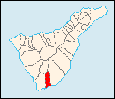 Municipal location in Tenerife | |
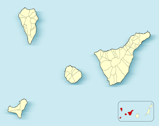 San Miguel de Abona Location in Province of Santa Cruz de Tenerife | |
| Coordinates: 28°6′N 16°37′W / 28.100°N 16.617°WCoordinates: 28°6′N 16°37′W / 28.100°N 16.617°W | |
| Sovereign state |
|
| Autonomous community |
|
| Province |
|
| Island |
|
| Area[1] | |
| • Total | 42.04 km2 (16.23 sq mi) |
| Population (2013)[2] | |
| • Total | 16,099 |
| • Density | 380/km2 (990/sq mi) |
| Time zone | GMT (UTC+0) |
| Climate | Csb |
| Website |
www |
San Miguel de Abona is a town and a municipality in the southern part of the island of Tenerife, one of the Canary Islands, and part of the province of Santa Cruz de Tenerife, Spain. The TF-1 motorway passes through the southern part of the municipality.
The population is 16,099 (2013[2]), its area is 42.04 km².[1]
In the south of the municipality, on the coastline, lies the golf course and holiday/residential village of Golf del Sur.
Historical population
| Year | Population |
|---|---|
| 1991 | |
| 1996 | 5,776 |
| 2001 | 8,398 |
| 2002 | 9,174 |
| 2003 | 9,988 |
| 2004 | 10,802 |
| 2013 | 16,099 |
References
- 1 2 Instituto Canario de Estadística, area
- 1 2 Instituto Canario de Estadística, population
External links
| Wikimedia Commons has media related to San Miguel de Abona. |
 |
Vilaflor | | ||
| Arona | |
Granadilla de Abona | ||
| ||||
| | ||||
| Atlantic Ocean |
This article is issued from Wikipedia - version of the 6/23/2016. The text is available under the Creative Commons Attribution/Share Alike but additional terms may apply for the media files.