San Mauro Pascoli
| San Mauro Pascoli | |
|---|---|
| Comune | |
| Comune di San Mauro Pascoli | |
|
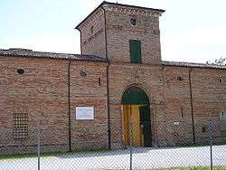
Villa Torlonia. | |
 San Mauro Pascoli Location of San Mauro Pascoli in Italy | |
| Coordinates: 44°6′N 12°25′E / 44.100°N 12.417°ECoordinates: 44°6′N 12°25′E / 44.100°N 12.417°E | |
| Country | Italy |
| Region | Emilia-Romagna |
| Province / Metropolitan city | Province of Forlì-Cesena (FC) |
| Frazioni | Alberazzo, La Torre, San Mauro Mare |
| Government | |
| • Mayor | Gianfranco Gori |
| Area | |
| • Total | 17.35 km2 (6.70 sq mi) |
| Elevation | 27 m (89 ft) |
| Population (31 December 2008)[1] | |
| • Total | 10,714 |
| • Density | 620/km2 (1,600/sq mi) |
| Demonym(s) | Sammauresi |
| Time zone | CET (UTC+1) |
| • Summer (DST) | CEST (UTC+2) |
| Postal code | 47030 |
| Dialing code | 0541 |
| Patron saint | St. Crispin |
| Saint day | 25 October |
| Website | Official website |
San Mauro Pascoli is a comune (municipality) in the Province of Forlì-Cesena in the Italian region Emilia-Romagna, located about 100 kilometres (62 mi) southeast of Bologna and about 35 kilometres (22 mi) southeast of Forlì. It is at some 7.5 kilometres (4.7 mi) from the sea, the frazione of San Mauro Mare facing it.
The comune was called San Mauro di Romagna until 1932, when its name was changed in honor of the poet Giovanni Pascoli, who was born here. Famous Italian shoe designer Giuseppe Zanotti was also born there.
Main sights
- Torlonia tower
- Roman furnaces
- Giovanni Pascoli House
Twin towns
 Moena, Italy
- Teggiano, Italy, since 1971
 Cluj-Napoca, Romania, since 1996
  Naumburg, Germany, since 2001
 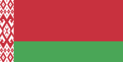 Pinsk, Belarus, since 2002
References
External links
This article is issued from Wikipedia - version of the 1/31/2015. The text is available under the Creative Commons Attribution/Share Alike but additional terms may apply for the media files.