San Luis Potosí
| San Luis Potosí Estado Libre y Soberano de San Luis Potosí | |||
|---|---|---|---|
| State | |||
| Free and Sovereign State of San Luis Potosí | |||
| |||
.svg.png) State of San Luis Potosí within Mexico | |||
| Coordinates: 22°36′N 100°26′W / 22.600°N 100.433°WCoordinates: 22°36′N 100°26′W / 22.600°N 100.433°W | |||
| Country | Mexico | ||
| Capital | San Luis Potosí | ||
| Largest City | San Luis Potosí | ||
| Municipalities | 58 | ||
| Admission | December 22, 1823[1] | ||
| Order | 6th | ||
| Government | |||
| • Governor |
Juan Manuel Carreras López | ||
| Area[2] | |||
| • Total | 61,137 km2 (23,605 sq mi) | ||
| Ranked 15th | |||
| Highest elevation[3] | 3,180 m (10,430 ft) | ||
| Population (2015)[4] | |||
| • Total | 2,717,820 | ||
| • Rank | 19th | ||
| • Density | 44/km2 (120/sq mi) | ||
| • Density rank | 20th | ||
| Demonym(s) | Potosino (a) | ||
| Time zone | CST (UTC−6) | ||
| • Summer (DST) | CDT (UTC−5) | ||
| Postal code | 78-79 | ||
| Area code | |||
| ISO 3166 code | MX-SLP | ||
| HDI |
| ||
| GDP | US$ 22,825,212.99 th[a] | ||
| Website | Official Web Site | ||
| ^ a. The state's GDP was $281,040,000 thousand of pesos in 2012,[5] amount corresponding to $22,825,212.99 thousand of dollars, being a dollar worth 12.32 pesos (value of May 21, 2012).[6] | |||


San Luis Potosí (![]() san ˈlwis potoˈsi ), officially the Free and Sovereign State of San Luis Potosí (Spanish: Estado Libre y Soberano de San Luis Potosí), is one of the 31 states which, with the Federal District, comprise the 32 Federal Entities of Mexico. It is divided in 58 municipalities and its capital city is San Luis Potosí City.
san ˈlwis potoˈsi ), officially the Free and Sovereign State of San Luis Potosí (Spanish: Estado Libre y Soberano de San Luis Potosí), is one of the 31 states which, with the Federal District, comprise the 32 Federal Entities of Mexico. It is divided in 58 municipalities and its capital city is San Luis Potosí City.
It is located in North-Central Mexico. It is bordered by 9 other Mexican states, making it the state with the most borders with other neighboring states. The northern borders are with Nuevo León and Coahuila; the northeastern ones with Tamaulipas; the eastern ones with Veracruz; the southern ones with Hidalgo, Querétaro, Jalisco, and Guanajuato; and the northwestern ones with Zacatecas.
In addition to the capital city, the state's largest cities include Ciudad Valles, Matehuala, Rioverde, and Tamazunchale.
History
In pre-Columbian times the territory now occupied by the state of San Luis Potosí contained the cultural areas of Mesoamerica and Aridoamerica. Its northern and western-central areas were inhabited by the Otomi and Chichimeca tribes. These indigenous groups were nomadic hunter-gatherers. Although most natives died during the Spanish settlements, huasteco groups still live, along with pame and náhuatl although their numbers are significantly small.

In 1592, gold and silver deposits were discovered which triggered the establishment of the state. Spanish miners established the first town known as “San Luis de Mezquitique”, modern location of the capital San Luis Potosí. This led to the first mayor being appointed, Juan de Oñate.
The State was given the name "San Luis Rey", King Saint Louis, in honor of Louis IX of France, and "Potosi" because the wealth of the state compared to the rich silver mines in Potosí, Bolivia. Settlers hoped of rivaling the Bolivian mine wealth, but this was never truly accomplished. In the 17th and 18th centuries, Franciscans, Augustinians, and Jesuits arrived to the area and settled, then began to build churches and buildings, many of which are still standing and have been turned into museums and universities.
In mid-1821, after the Independence of Mexico, General Jose Antonio Echavarri intimidated and threatened the Mayor and the City Council to surrender the city of San Luis to the Army of the Three Guarantees of Iturbide (Ejercito de las Tres Garantias de Iturbide), who at the time, was emperor of Mexico. They submitted to his demand, as there was no way to resist, and thus proclamation of Independence of San Luis Potosí was declared. The first Constitution of San Luis Potosí was then written on October 16, 1826, and this was in effect until 1835 when Congress proclaimed it centralist. At this point, local legislatures disappeared and state governors were appointed by the central government. This situation lasted until the promulgation of the 1857 Constitution.
The state participation in the Mexican–American War in the years of 1846-1847 gave it the name "San Luis de la Patria", Saint Louis of the Motherland, for haven contributed important leaders and ideas during the struggle with the United States. During the Reform War, state involvement was very prominent, and during the French Intervention in 1863, the city of San Luis Potosí became the capital of the country under the order of President Benito Juárez.
During the regime of Maximilian, San Luis became an important location. The city was held by the Imperialists until late 1866. In that year the telegraph line was opened between San Luis Potosí and Mexico City, which opened up communication lines and helped begin the industrialization of the state.
Geography
The state lies mostly on the Mexican Plateau, with the exception of the eastern part of the state, where the tableland breaks down into the tropical valley of the Tampaon River (which continues flowing northwestward until it becomes the Pánuco River, which divides San luis Potosí from the north-eastern state of Tamaulipas). The surface of the plateau is comparatively level, with some low mountainous wooded ridges. The Sierra Madre Oriental runs north and south through the state, and separates the Mexican Plateau from the Gulf Coastal Plain to the east. The Sierra Madre Oriental is home to the Sierra Madre Oriental pine-oak forests. The easternmost portion of the state lies on the Gulf Coastal Plain, and covered by the Veracruz moist forests. The eastern part is included in the region commonly referred to as "La Huasteca".
The Tampaón river and its tributaries drain the southern and southeastern portion of the state. The northern and central portion of the state, including the capital, lie on an interior drainage basin which does not drain to the sea.
The mean elevation is about 6,000 ft ensuring a temperate climate for the most part. The state lies partly within the arid zone of the north, while the southern half receiving a more liberal rainfall through the influence of the Nortes, which deliver significant amounts of rain. The rainfall, however, is uncertain at the western and northern regions, and much of the state does not have major rivers. The soil is fertile and in favorable seasons large crops of wheat, maize, beans and cotton are grown on the uplands. In the low tropical valleys, sugar, coffee, tobacco, peppers and fruit are staple products. Stockraising is an important industry and hides, tallow and wool are exported. Fine cabinet and construction woods are also made and exported to a limited extent.
Potosí (in Bolivia) was ´believed´ to have enough gold to build a bridge between Potosi and Spain. San Luis Potosí was compared to it upon the discovery of the mines and therefore named after it.
At one time San Luis Potosí ranked among the leading mining provinces of Mexico, but the revolts following independence resulted in a great decline in that industry. The area around Real de Catorce has some of the richest silver mines in the country. Other well-known silver mining districts are Peñón Blanco, Ramos and Guadalcázar. The development of Guadalcazar dates from 1620 and its ores yield gold, copper, zinc and bismuth, as well as silver. In the Ramos district, the Cocinera lode was said to have had a total yield of over $60,000,000 in the first decade of the 20th century.

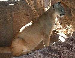


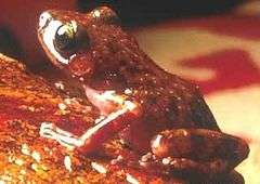
.jpg)

.jpg)


Municipalities
The State of San Luis Potosí is divided into 58 municipalities (Spanish: municipios), each headed by a municipal president (mayor). These are similar in function to counties. Is it so divided into four zones municipalities Altiplano (Highlands), Centro (centre), Media and Huasteca zone
Major cities
- San Luis Potosí, San Luis Potosí (state capital).
- Soledad de Graciano Sánchez
- Ciudad Valles
- Matehuala
- Rioverde
- Tamazunchale
- Villa De Pozos
- Taquian de Escobedo
Environmental issues
Mining
Currently one of the mountains, Wirikuta, within the state's declared National Sacred Site is being purchased for silver mining by a Canadian company, “First Majestic Silver Corp”.[7] The mountain is an important site for the Huichol ceremonial migration, Peyote hunt, and deer dance. On October 27, 2000 United Nations Education, Scientific and Cultural Organization (UNESCO) claimed this site as a protected area for its importance as a cultural route and endemic flora and fauna species. Later on June 9, 2001 it was declared as a National Sacred Site under the State of San Luis Potosí's Natural Protection act. Canada's First Majestic Silver Corp still decided to purchase mineral rights on November 13, 2009 with 80% of their interest within the protected land. The company's current methods includes open pit mining and lixivation through cyanide, using two kilograms of NaCN per tonne of ore. While open pit mining itself removes entire habitats and landscapes, the addition of sodium cyanide, NaCN, is a lethal method requiring only 0.2 grams to kill a person.[7] In April, 2010 the company also opened a new cyanidation plant in Coahila, Mexico where it has started producing 3500 tons of cyanide a day to help them expand their mining efforts.[8] Currently the Huicholes are trying to find outside groups to help them in the conservation of their land and culture by protecting this mountain.
Governors
The current governor is Juan Manuel Carreras López (2015–2021) of the PRI party (Partido Revolucionario Institucional)
Economy
The State has a unique position within the country, since it is located in between three major cities; Mexico City, Monterrey, and Guadalajara, and near four major ports; Tampico, Altamira, Manzanillo, and Mazatlán. Its varied climate patterns and territory along with extensive communications networks enabled it to maintain attractive business environments.
Traditionally, the Real de Minas potosino has driven the industrial engines in the state of San Luis Potosí, and as such, nowadays basic metallurgy still has the largest contribution within the Gross Domestic Product of the entity. The main metals and products extracted across mines are zinc, copper, lead, gold, silver, mercury, manganese, and arsenic. Other major industries following the mining lead are in the sectors of chemicals, foods, beverages, tobacco, and textiles.
The services sector, also known as tertiary, is second regarding contribution to the state's income with a 21%, followed by commerce, hotels and restaurants with 18%. These combined activities employ 51% of the economically active population or EAP.
Agriculture has been a traditional activity, sometimes still practiced in the Huasteca region. Currently, even if it contributes very little to the state GDP, it nevertheless employs as much as 20% of the EAP of the entity. The main agricultural products grown on Potosí soil are maize, beans, barley, sugar cane, oranges, coffee, sour lemon, prickly pear, and mango. Livestock activities are focused on raising sheep, cattle, and pigs.
The state is also a contributor to the large automotive industry of Mexico. General Motors now has a plant under construction, San Luis Potosí Assembly, to employ up to 1800 which will have the capacity to produce up to 160,000 vehicles per year, or about 440 cars per day.[9]
Cummins Inc. has also had a manufacturing presence in San Luis Potosí since 1980 and employs nearly 2000 people there.
ABB Group multinational in Mexico moved its headquarters from Mexico City to San Luis Potosí in 2007.
Throughout the state, major industrial parks can be seen, especially in highly urbanized areas such as the capital, San Luis Potosí, and other major cities.
The minimum wage in the state is 66.45 pesos per day as of 2015[10] In July 2014 BMW announced it was establishing a $1 billion plant in San Luis Potosí which will employ 1,500 people, and produce 150,000 cars annually, commencing in 2019.[11]
Demographics
| Historical population | ||
|---|---|---|
| Year | Pop. | ±% |
| 1895[12] | 571,420 | — |
| 1900 | 575,432 | +0.7% |
| 1910 | 627,800 | +9.1% |
| 1921 | 445,681 | −29.0% |
| 1930 | 579,831 | +30.1% |
| 1940 | 678,779 | +17.1% |
| 1950 | 856,066 | +26.1% |
| 1960 | 1,048,297 | +22.5% |
| 1970 | 1,281,996 | +22.3% |
| 1980 | 1,673,893 | +30.6% |
| 1990 | 2,003,187 | +19.7% |
| 1995 | 2,200,763 | +9.9% |
| 2000 | 2,299,360 | +4.5% |
| 2005 | 2,410,414 | +4.8% |
| 2010 | 2,585,518 | +7.3% |
| 2015[13] | 2,717,820 | +5.1% |
The state of San Luis Potosí reports a population of about 2,678,231 people, according to the latest projection which took place in the year 2013. Population growth rate from 2010, the last official census, to 2013 was about 3.6%.
The state's population is relatively young, 60% of its residents being under 30 years of age. The state reports a life expectancy rate similar to the national average, that is, 72 years for men, and 77 years of age for women.
Regarding cultural and ethnic diversity, 11% of the state population is indigenous, and the most representative language is that of the Nahuatl, followed by the Huasteco. The native people of the state are among the tallest in Mexico and include the Huastecs and Pame people.
Concerning immigrants and people of European ancestry, 89% of the population has some form of European roots, mostly from Spain. During the colonization and establishment of Mexico, there was a constant flow of Spanish immigrants. There have also been large influxes during instabilities in Spain, such as during the Spanish Civil War. Besides Spanish people, there is also a significant population of descendants of Italian immigrants, especially in cities such as Rio Verde and Cerritos. Most of the European peoples have arrived through the state of Veracruz to the East.
Nonetheless, due to its relative isolation, the state is one of the nine states in Mexico which report high rates of migration into the United States.
Education
The average schooling rate for those over 15 years of age lies at 7.7 years of education, considerably lower than the 8.1 found nationally. The same portion of those older than the age of 15 yield a 28% dropout rate of primary school. Children under the age of 14 years have a 4% dropout rate of school. The literacy rate is about 90.8%, most of the illiterate being the older generation. There is only one major university in the state, despite there being other minor schools throughout. This institution of higher education is the following:
Other higher education institutions include:
- Instituto Tecnológico de San Luis Potosí (ITSLP).
- Instituto Tecnológico y de Estudios Superiores de Monterrey, Campus San Luis Potosí (ITESM).
- Universidad del Valle de México, Campus San Luis Potosí (UVM).
- Universidad Cuauhtémoc, Campus San Luis Potosí (UCSLP).
- Universidad Tecnológica de San Luis Potosí (UTSLP).
- Universidad Politécnica de San Luis Potosí (UPSLP).
- College of San Luis Potosí (COLSAN).
- Universidad del Centro de México (UCEM).
Transportation
Ponciano Arriaga International Airport serves the capital of San Luis Potosí (named the same) with a variety of domestic and international daily flights. Other cities such as Matehuala, Tamuin and Rio Verde also have airports but they but are only domestic flights only. Besides airports, the state has an extensive road network, like the rest of the country. Most of the roads are paved in urban areas and highways. Some small towns, however, have cobblestone streets.
Notable people and residents
Arts and sciences
- Ana Bárbara - Singer-songwriter
- Julián Carrillo Trujillo - Discovered the Thirteenth Sound
- Francisco González Bocanegra - Author of the Mexican National Anthem
- Manuel José Othón - Poet
Politics
- Ponciano Arriaga
- Miguel Barragán - President of Mexico
- Carlos Jonguitud Barrios
- Luis Ernesto Derbez
- Alfonso Lastras Ramírez
- Salvador Nava Martínez
- Francisco Javier Salazar Sáenz
- Enrique Márquez Jaramillo
Sports
- Ivan Becerra, former professional soccer player
- Jorge Goeters, NASCAR driver
- Nery Castillo, professional football (soccer) player, was born in San Luis Potosí but moved away when he was 3 months old.
- Mil Máscaras (Thousand Masks), professional wrestler
- Alberto Del Rio, WWE wrestler
Journalism
- Jesús Blancornelas, a prize-winning journalist
See also
| Wikimedia Commons has media related to San Luis Potosí. |
References
- ↑ "Las Diputaciones Provinciales" (PDF) (in Spanish). p. 15.
- ↑ "Resumen". Cuentame INEGI. Retrieved February 12, 2013.
- ↑ "Relieve". Cuentame INEGI. Retrieved April 6, 2011.
- ↑ "Encuesta Intercensal 2015" (PDF). Retrieved December 8, 2015.
- ↑ "Panorama Economico del Estado de San Luis Potosi" (PDF). Gobierno de San Luis Potosi. Retrieved May 21, 2013.
- ↑ "1 Dollar to 1 Peso, May 2013". www.google.com. Retrieved May 21, 2013.
- 1 2 Salvemos Wirikuta -Tamatzimahuaha: Frente en Defensa de la Zona Wirikuta. http://salvemoswirikuta.blogspot.com/2010/08/huichol-route-through-sacred-sites-to.html
- ↑ Liezel Hill 8th April 2010, TORONTO. First Majestic reports commercial production at new cyanidation plant. Mining Weekly. http://www.miningweekly.com/article/first-majestic-reports-commercial-production-at-new-cyanidation-plant-2010-04-08.
- ↑ "GM to produce Aveo at new Mexican plant, Stephen Downer, Automotive News".
- ↑ http://www.conasami.gob.mx/t_sal_mini_prof.html. Missing or empty
|title=(help) - ↑ "Joining rivals, BMW to set up $1bn plant in Mexico". Mexico Star. Retrieved 28 June 2014.
- ↑ "Mexico: extended population list". GeoHive. Retrieved 2011-07-29.
- ↑ "Encuesta Intercensal 2015" (PDF). INEGI. Retrieved 2015-12-09.
- Ricketts, Taylor H., Eric Dinerstein, David M. Olson, Colby J. Loucks, et al. (1999). Terrestrial Ecoregions of North America: a Conservation Assessment. Island Press, Washington, D.C..
![]() This article incorporates text from a publication now in the public domain: Chisholm, Hugh, ed. (1911). "article name needed". Encyclopædia Britannica (11th ed.). Cambridge University Press.
This article incorporates text from a publication now in the public domain: Chisholm, Hugh, ed. (1911). "article name needed". Encyclopædia Britannica (11th ed.). Cambridge University Press.
External links
| Wikivoyage has a travel guide for San Luis Potosi (state). |
| Wikisource has the text of The New Student's Reference Work article San Luis Potosi. |
 Geographic data related to San Luis Potosí at OpenStreetMap
- (Spanish) San Luis Potosí state government
- Events and entertainment in San Luis Potosí
- Churches of San Luis Potosí
- Tourism in San Luis Potosí
- Administration of Justice
- Art and Culture in San Luis Potosí
- Interactive map of San Luis Potosí with the tourist points of interest
