San Lorenzo River

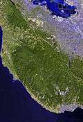
The San Lorenzo River drains a large watershed in Santa Cruz County, California. The headwaters originate in the Santa Cruz Mountains (in Castle Rock State Park) at an elevation of 2,500 feet (760 m), and the river flows 29.3 miles (47.2 km)[1] through the San Lorenzo Valley before emptying into the Pacific Ocean at Monterey Bay. The San Lorenzo River was once one of the most popular steelhead and coho salmon rivers on the Central Coast of California. In 1960, it was estimated that there were more than 30,000 fish living in this river, but a decade later the population had been reduced to 1000. The Branciforte Creek watershed is a major sub-basin of the San Lorenzo catchment-basin. Fishing regulations were changed in 1998 in order to protect wild stocks vs. hatchery stocks. The changes in the regulations have not proved effective and additional conservation/preservation efforts are still needed. As of 2013, continued growth has raised demand for water from the entire watershed system bringing attention to the need for further preservation of stream flows in order to protect young salmon, steelhead, and lamprey.
Geology
Underlying rock strata in the San Lorenzo River basin include Lompico Sandstone and Vaqueros Sandstone.
History
The first European land exploration of Alta California, the Spanish Portolà expedition, gave the river its name when it passed through the area on its way north, camping near the west bank on October 17, 1769. Franciscan missionary Juan Crespi, traveling with the expedition, noted in his diary that, "Not far from the sea we came to a large river...It is one of the largest that we have met with on the journey...This river was named San Lorenzo."[2] "Not far from the sea" indicates that the party probably crossed the river at one of what later became the commonly used fords. The fords, in turn, became the locations for the first two bridges across the river - at today's Water Street and Soquel Avenue.
In 1863, the California Powder Works was built adjacent to the river three miles upstream from Santa Cruz. The powder works made gunpowder for California mining after normal supplies had been interrupted by the American Civil War. Upstream from the works, a dam was constructed (in what is now Henry Cowell Redwoods State Park) to raise the water level enough to flow into a 1200-foot-long tunnel, dug through a granite ridge to convey water to a raised flume that, with a 60-foot drop, provided water power for the powder mill machinery. During dry summer weather when the river was low, the total river flow might be diverted into the flume from below the dam. The powder mill was closed in 1914 and the dam demolished.[3]
Flooding and water pollution
Following devastating floods in December 1955, the Army Corps of Engineers built flood control measures along the San Lorenzo River and Branciforte Creek through downtown Santa Cruz. No flooding from the San Lorenzo River was reported when a flow event of nearly equal magnitude occurred in January 1982, but the water levels were much higher than one would expect, based on the original design. That was because a large amount of sediment had re-deposited in the channel after it was built. The original project design (1956) required periodic dredging of the bed sediment, which is both expensive and destructive to aquatic and riparian habitat. The flood control channel was not maintained regularly, presumably for those reasons. The levees and floodwalls were rebuilt in 2004, but the design for those changes still assumed that the channel bed would be maintained by dredging. Although the latest project calls for less dredging the original project, any dredging at all is economically and environmentally unfeasible for the City of Santa Cruz, the local sponsor of the federal project. The current and likely future levels of flood protection provided by the project, without dredging, was being studying by the Army Corps of Engineers as of August 2011.
A habitat restoration project has been underway since 1985. Recent counts of fish show the population is slowly rising to approximately 3000. Tidal influence wanes between the Broadway and Soquel Avenue bridges in the city of Santa Cruz, where some sand bars are visible.
As early as the 1970s Santa Cruz County began to create a hydrology transport model of the San Lorenzo River, retaining a group of scientists and engineers from Earth Metrics Inc., who were to create the first mathematical model of the river, with the objective of analyzing bedload transport and downstream sedimentation. The model was also used to predict transport of nitrates and other water pollution, and would be eventually used to study a variety of different land management and flood control strategies.
Another problem for the river and its habitat is the water pollution from the city of Santa Cruz and the upstream communities of Felton, Ben Lomond, Brookdale, and Boulder Creek. The San Lorenzo River Watershed has the highest septic system density of any comparable area in the state of California. Bacteria levels were dangerously high in the 1980s but have improved over the last few years. Still the bacteria levels in many areas barely meet the standards for safe swimming, and the nitrate levels are extremely high and are a threat to the drinking water supply for much of the county.
Scenic and historic elements
Much of the upper reaches of this watershed are quite beautiful in their natural forest setting, while the lower reach is accessible to the large population of Santa Cruz. In 1987 the city of Santa Cruz retained ROMA, a San Francisco design firm, to develop a design concept plan for incorporating the natural elements of the river into the urban design fabric of the city. The plan led to creation of pedestrian walkways, picnic areas and view opportunities along the lower populated stretch of the river. The plan called for creation of a continuous forest to be established on the upper banks of Valley Oak, Buckeye, Willow and other trees with seasonal foliage.
One notably scenic reach between the Riverside Avenue and Broadway bridges may be the most visually prominent and attractive parts of the river. Here the river bends skirting the base of Beach Hill, a historic neighborhood and noteworthy topographic element of the city of Santa Cruz. This reach is visible from many parts of the city and gives a sense of steepness and enclosure within the channel. The west bank had been the site of a wooden boardwalk, now washed away by erosion.
References
- ↑ U.S. Geological Survey. National Hydrography Dataset high-resolution flowline data. The National Map, accessed March 15, 2011
- ↑ Bolton, Herbert E. (1927). Fray Juan Crespi: Missionary Explorer on the Pacific Coast, 1769-1774. HathiTrust Digital Library. p. 214. Retrieved April 2014. Check date values in:
|access-date=(help) - ↑ "The California Powder Works". Santa Cruz Public Library Local History Articles. Retrieved 2011-11-21.
Bibliography
- C. Michael hogan, David Crimp, Leda Patmore, et al., Bedload Transport Computer Model for the San Lorenzo River, prepared for Santa Cruz County by Earth Metrics Inc., Palo Alto, Ca. (1977)
- ROMA, San Lorenzo River Design Concept Plan, prepared for the city of Santa Cruz, June, 1987
See also
| Wikimedia Commons has media related to San Lorenzo River. |
Coordinates: 36°57′51″N 122°00′45″W / 36.96417°N 122.01250°W