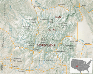
San Juan Mountains
| San Juan Mountains | |
|---|---|
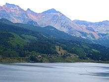
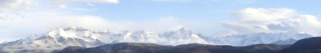
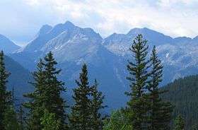 San Juan Mountains seen from the San Juan Skyway. | |
| Highest point | |
| Peak | Uncompahgre Peak |
| Elevation | 14,309 ft (4,361 m) |
| Coordinates | 38°04′18″N 107°27′14″W / 38.07167°N 107.45389°WCoordinates: 38°04′18″N 107°27′14″W / 38.07167°N 107.45389°W |
| Geography | |
| Country | United States |
| State | Colorado |
| Parent range | Rocky Mountains |
The San Juan Mountains are a high and rugged mountain range in the Rocky Mountains in southwestern Colorado, and is the largest mountain range in Colorado by area. The area is highly mineralized (the Colorado Mineral Belt) and figured in the gold and silver mining industry of early Colorado. Major towns, all old mining camps, include Creede, Lake City, Silverton, Ouray, and Telluride. Large scale mining has ended in the region, although independent prospectors still work claims throughout the range. The last large scale mines were the Sunnyside Mine near Silverton, which operated until late in the 20th century and the Idarado Mine on Red Mountain Pass that closed down in the 1970s. Famous old San Juan mines include the Camp Bird and Smuggler Union mines, both located between Telluride and Ouray.
The Summitville mine was the scene of a major environmental disaster in the 1990s when the liner of a cyanide-laced tailing pond began leaking heavily. Summitville is in the Summitville caldera, one of many extinct volcanoes making up the San Juan volcanic field. One, La Garita Caldera, is 35 miles (56 km) in diameter. Large beds of lava, some extending under the floor of the San Luis Valley, are characteristic of the eastern slope of the San Juans.
Tourism is now a major part of the regional economy, with the narrow gauge railway between Durango and Silverton being an attraction in the summer. Jeeping is popular on the old trails which linked the historic mining camps, including the notorious Black Bear Road. Visiting old ghost towns is popular, as is wilderness trekking and mountain climbing. Many of the old mining camps are now popular sites of summer homes. Though the San Juans are extremely steep and receive a lot of snow, so far only Telluride has made the transition to a major ski resort. Purgatory Resort, once known as Durango Mountain Resort, is a small ski area 26 miles north of Durango.[1] There is also skiing on Wolf Creek Pass at the Wolf Creek ski area. Recently Silverton Mountain ski area has begun operation near Silverton.
The Rio Grande drains the east side of the range. The other side of the San Juans, the western slope of the continental divide, is drained by tributaries of the San Juan, Dolores and Gunnison rivers, which all flow into the Colorado River.
The San Juan and Uncompahgre National Forests cover a large portion of the San Juan Mountains.
The San Juan Mountains also have the distinction of being the location of the highest airport with scheduled airline service in the U.S., being Telluride Airport at an elevation of 9,070 feet.[2]
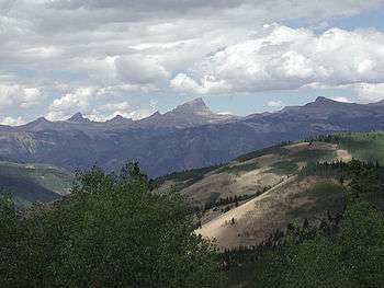
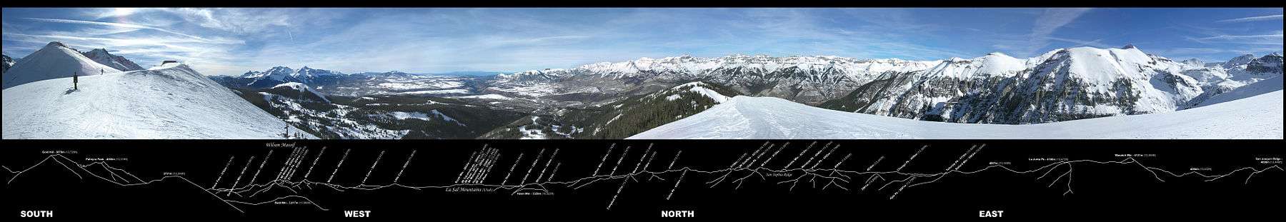
Prominent peaks
.jpg)
- Note: This is only a partial list of important peaks in the San Juans, listing peaks by prominence only. There are dozens more summits over 12,000 feet.
| Rank | Mountain Peak | Elevation | Prominence | Isolation |
|---|---|---|---|---|
| 1 | Uncompahgre Peak NGS | 4365 m 14,321 ft | 1304 m 4,277 ft | 136.9 km 85.1 mi |
| 2 | Mount Wilson[3] | 4344 m 14,252 ft | 1227 m 4,024 ft | 53.2 km 33.1 mi |
| 3 | Mount Sneffels NGS | 4315 m 14,158 ft | 930 m 3,050 ft | 25.3 km 15.73 mi |
| 4 | Mount Eolus[3] | 4294 m 14,089 ft | 665 m 2,183 ft | 40.5 km 25.2 mi |
| 5 | Handies Peak NGS | 4285 m 14,058 ft | 575 m 1,888 ft | 18.00 km 11.18 mi |
| 6 | San Luis Peak NGS | 4274 m 14,022 ft | 949 m 3,113 ft | 43.4 km 27.0 mi |
| 7 | Vermilion Peak[3] PB | 4237 m 13,900 ft | 642 m 2,105 ft | 14.60 km 9.07 mi |
| 8 | Rio Grande Pyramid NGS PB | 4214 m 13,827 ft | 567 m 1,861 ft | 17.31 km 10.76 mi |
| 9 | Mount Oso[3] | 4173 m 13,690 ft | 507 m 1,664 ft | 8.81 km 5.47 mi |
| 10 | Tower Mountain[3] PB | 4132 m 13,558 ft | 504 m 1,652 ft | 8.62 km 5.36 mi |
| 11 | Sultan Mountain[3] PB | 4076 m 13,373 ft | 569 m 1,868 ft | 7.39 km 4.59 mi |
| 12 | Summit Peak NGS PB | 4056 m 13,307 ft | 841 m 2,760 ft | 64.2 km 39.9 mi |
| 13 | Dolores Peak[3] PB | 4053 m 13,296 ft | 594 m 1,950 ft | 8.02 km 4.98 mi |
| 14 | Lavender Peak[3] PB | 4037 m 13,245 ft | 872 m 2,860 ft | 39.9 km 24.8 mi |
| 15 | Bennett Peak[3] PB | 4026 m 13,209 ft | 531 m 1,743 ft | 27.5 km 17.10 mi |
| 16 | Conejos Peak NGS PB | 4017 m 13,179 ft | 583 m 1,912 ft | 13.12 km 8.15 mi |
| 17 | Twilight Peak[3] | 4012 m 13,163 ft | 713 m 2,338 ft | 7.86 km 4.88 mi |
| 18 | South River Peak[3] PB | 4009 m 13,154 ft | 746 m 2,448 ft | 35.3 km 22.0 mi |
| 19 | Peak 13,010[3] PB | 3967 m 13,016 ft | 546 m 1,790 ft | 15.39 km 9.56 mi |
| 20 | Lone Cone[3] PB | 3846 m 12,618 ft | 693 m 2,273 ft | 14.97 km 9.30 mi |
| 21 | Graham Peak NGS PB | 3821 m 12,536 ft | 778 m 2,551 ft | 16.78 km 10.43 mi |
| 22 | Elliott Mountain[3] PB | 3763 m 12,346 ft | 683 m 2,240 ft | 8.26 km 5.13 mi |
| 23 | Cornwall Mountain[3] PB | 3746 m 12,291 ft | 532 m 1,744 ft | 8.37 km 5.20 mi |
| 24 | Sawtooth Mountain NGS PB | 3704 m 12,153 ft | 587 m 1,927 ft | 28.3 km 17.57 mi |
| 25 | Chalk Benchmark NGS PB | 3669 m 12,038 ft | 601 m 1,971 ft | 11.68 km 7.26 mi |
| 26 | Little Cone NGS PB | 3654 m 11,988 ft | 561 m 1,841 ft | 9.70 km 6.03 mi |
| 27 | Cochetopa Dome | 3395 m 11,138 ft | 537 m 1,762 ft | 9.90 km 6.15 mi |
| 28 | Horse Mountain[3] PB | 3033 m 9,952 ft | 575 m 1,887 ft | 22.5 km 13.96 mi |
History of the area

Mining operators in the San Juan mountain area formed the San Juan District Mining Association (SJDMA) in 1903, as a direct result of a Western Federation of Miners proposal to the Telluride Mining Association for the eight-hour day, which had been approved in a referendum by 72 percent of Colorado voters.[4] The new association consolidated the power of thirty-six mining properties in San Miguel, Ouray, and San Juan counties.[5] The SJDMA refused to consider any reduction in hours or increase in wages, helping to provoke a bitter strike.
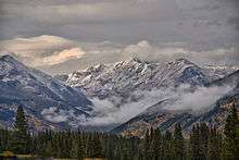
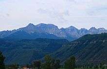
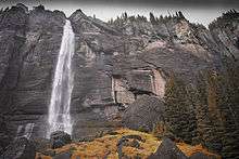
Gallery
Acceleration of snowmelt by dust
Dust blown in from adjoining deserts sometimes accelerates snowmelt in the San Juans.[6]
- Dust Accelerates Snowmelt in the San Juan Mountains
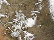 2005 (Less dust)
 2006 (More dust)
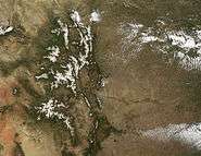 2008 (Less dust)
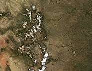 2009 (More dust)
See also
- Southern Rocky Mountains
- Sneffels Range
- Cimmaron Range
- Needle Mountains
- La Garita Mountains
- Cochetopa Hills
- La Plata Mountains
- Mountain ranges of Colorado
References
- ↑ Slothower, Chuck (25 Feb 2015). "It is 'DMR' No Longer". Durango Herald (26 Feb 2015). Retrieved 17 May 2016.
- ↑ http://www.tellurideairport.com
- 1 2 3 4 5 6 7 8 9 10 11 12 13 14 15 16 The elevation of this summit has been converted from the National Geodetic Vertical Datum of 1929 (NGVD 29) to the North American Vertical Datum of 1988 (NAVD 88). National Geodetic Survey
- ↑ Roughneck—The Life and Times of Big Bill Haywood, Peter Carlson, 1983, page 65.
- ↑ The Corpse On Boomerang Road, Telluride's War On Labor 1899-1908, MaryJoy Martin, 2004, page 201.
- ↑ "Dust Accelerates Snow Melt in San Juan Mountains". Earth Observatory NASA. July 4, 2009. Retrieved June 4, 2012.
Further reading
- Bove, D. et al. (2001). Geochronology and geology of Late Oligocene through Miocene volcanism and mineralization in the western San Juan Mountains, Colorado [U.S. Geological Survey Professional Paper 1642]. Washington, D.C.: U.S. Department of the Interior, U.S. Geological Survey.
- Lippman, P.W. (2006). Geologic map of the central San Juan Caldera Cluster, southwestern Colorado [Geologic Investigations Series I-2799]. Reston, VA: U.S. Department of the Interior, U.S. Geological Survey.
External links
| Wikimedia Commons has media related to San Juan Mountains. |
