Bánica
| Bánica | |
|---|---|
| San Francisco de Bánica | |
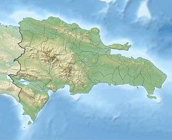 Bánica Location of Bánica in the Dominican Republic | |
| Coordinates: 19°05′N 71°41′W / 19.083°N 71.683°WCoordinates: 19°05′N 71°41′W / 19.083°N 71.683°W | |
| Country | Dominican Republic |
| Province | Elías Piña |
| Founded | 1504 |
| Municipality since | 1844 |
| Area[1] | |
| • Total | 265.98 km2 (102.70 sq mi) |
| Elevation[2] | 287 m (942 ft) |
| Population (2012)[3] | |
| • Total | 7,856 |
| • Density | 30/km2 (76/sq mi) |
| • Demonym | Baniquero(a) |
| Distance to – Santo Domingo |
266 km |
| Municipalities | 2 |
San Francisco de Bánica, or simply Bánica, is a municipality of the Elías Piña province, on the border with Haiti and near the Artibonite river. The name Bánica comes from the Taíno name of the region, Banique ("land of ebony").
History
The town was founded in 1504 by Diego Velázquez, who later went to conquest the island of Cuba, on the left side of the River Artibonite. It was an important town in those years but later it lost its importance. In the 18th century, the Spanish government moved the city to its present place, away from the river, and brought families from the Canary Islands to live there.
During the Haitian Revolution, many people fled to other places. When the Haitians occupied the eastern part of the island (the present Dominican Republic), they administered the town as part of the Department of Artibonite.[4]
After the Independence in 1844, the town was elevated by the Dominican government to the category of municipality of the Azua province.[4] But again the town was abandoned by its inhabitants. After the "Restoration War" (1863–1865), some families from other towns close to the Haitian border came to live in Bánica.
Bánica was made a municipality of the San Juan province in 1938 and then, in 1942, of the new province of Elías Piña.[4]
Economy
The main economic activity of the municipality is agriculture. Commerce with Haiti is also an important economic activity in the city.
Places of interest
- Iglesia de San Francisco de Asís (Saint Francis of Assisi Church). It is a very interesting colonial Catholic church. It is not known when it was built but in 1740 the Bishop Domingo Pantaleón Álvarez Abréu wrote that in Bánica "there is a new church".
- Reloj de sol (Sundial). In one of his faces there is date, 1795, that could be the date when it was built. There were only two sundials in the old Spanish colony: one in Santo Domingo and another in Bánica.
- Cerro de San Francisco (Saint Francis Hill). It is a rocky hill at 1.5 km from the city. Here there is a cave visited by many people to pray to Saint Francis; they get wet with water that falls from the top of the cave and they put limestone dust in their faces so when they get back to town they are identified by their white faces. The hill is protected by law because here there is the only wild population of Pereskia marcanoi, a cactus with leaves and beautiful small purple flowers; its common name is Rosa de Bánica ("Bánica Rose").
References
- ↑ Superficies a nivel de municipios, Oficina Nacional de Estadistica Archived April 17, 2009, at the Wayback Machine.
- ↑ De la Fuente, Santiago (1976). Geografía Dominicana (in Spanish). Santo Domingo, Dominican Republic: Editora Colegial Quisqueyana.
- ↑ Censo 2012 de Población y Vivienda,Oficina Nacional de Estadistica
- 1 2 3 Tolentino Rojas, Vicente (1944). Historia de la División Territorial Dominicana, 1494-1943 (in Spanish). Ciudad Trujillo, República Dominicana: Colección Trujillo.
| |||||||||||||||||||||||||||||||||||||||||||||||||||||||||||||||