San Diego–Coronado Bridge
| San Diego–Coronado Bridge | |
|---|---|
 | |
| Coordinates | 32°41′11″N 117°09′30″W / 32.6865°N 117.1583°WCoordinates: 32°41′11″N 117°09′30″W / 32.6865°N 117.1583°W |
| Carries |
5 lanes of |
| Crosses | San Diego Bay |
| Locale | San Diego and Coronado, California |
| Maintained by | Caltrans |
| ID number | 57 0857 |
| Characteristics | |
| Design | Orthotropic deck on box girder |
| Material | Prestressed concrete and steel |
| Total length | 11,179 feet (3,407 m) or 2.1 miles (3.4 km) (including approaches) |
| Width | 63 feet (19 m) between curbs |
| Longest span | 660 feet (200 m) |
| Number of spans | 32 |
| Piers in water | 21[1] |
| Clearance below | 200 feet (61 m) |
| History | |
| Successful competition design | 1978 World Bridge Beauty Contest |
| Constructed by | Murphy-Pacific |
| Fabrication by | Murphy-Pacific[2] |
| Construction begin | February 1967[3] |
| Construction cost | US$48 (equivalent to $310 in 2015) million[4] |
| Opened | August 3, 1969[5] |
| Replaces | San Diego and Coronado Ferry |
| Statistics | |
| Daily traffic | 75,000 (2009)[5] |
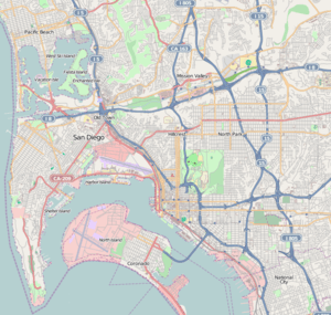 San Diego–Coronado Bridge Location in San Diego | |
The San Diego–Coronado Bridge, locally referred to as the Coronado Bridge, is a prestressed concrete/steel girder bridge, crossing over San Diego Bay in the United States, linking San Diego with Coronado, California.[6] The bridge is signed as part of State Route 75.
Description
Construction
In 1926, John D. Spreckels recommended that a bridge be built between San Diego and Coronado, but voters dismissed the plan.[7] The U.S. Navy initially did not support a bridge that would span San Diego Bay to connect San Diego to Coronado. They feared a bridge could be collapsed by attack or an earthquake and trap the ships stationed at Naval Base San Diego.[4] In 1935, an officer at the naval air station at North Island argued that if a bridge was built to cross the bay then the Navy would leave San Diego.[4]
In 1951–52, the Coronado City Council initiated plans for bridge feasibility studies.[4][8] By 1964 the Navy supported a bridge if there was at least 200 feet (61 m) of clearance for ships which operate out of the nearby Naval Base San Diego to pass underneath it.[4] To achieve this clearance with a reasonable grade, the bridge length was increased by taking a curved path, rather than a more direct path to Coronado. The clearance would allow an empty oil-fired aircraft carrier to pass beneath it – it is not sufficient for Nimitz-class nuclear aircraft carriers in light load condition.[9]
.jpg)
The principal architect was Robert Mosher. Construction on the San Diego–Coronado Bay Bridge started in February 1967. The bridge required 20,000 tons of steel (13,000 tons in structural steel and 7,000 in reinforcing steel) and 94,000 cubic yards of concrete. To add the concrete girders, 900,000 cubic yards of fill was dredged and the caissons for the towers were drilled and blasted 100 feet into the bed of the bay.
The bridge opened to traffic on August 3, 1969, during the celebration of the 200th anniversary of the founding of San Diego.[8][10] The 11,179-foot-long (3,407 m or 2.1 mi) bridge ascends from Coronado at a 4.67 percent grade before curving 80 degrees toward San Diego. It is supported by 27 concrete girders, the longest ever made at the time of construction.[4]

In 1970, it won an award of merit for long span bridge from the American Institute of Steel Construction.[11] The five-lane bridge featured the longest continuous box girder in the world[10] until it was surpassed by the Shibanpo Yangtze River Bridge in Chongqing, China in 2008.[12] The bridge is the third largest orthogonal box in the country – the box is the center part of the bridge, between piers 18 and 21 over the main shipping channel.
Tolls and tollbooths
Originally, the toll was $0.60 in each direction. Several years later, this was changed to a $1.00 toll collected for traffic going westbound to Coronado only. Although the bridge was supposed to become "toll-free" once the original bridge bond was paid (which occurred in 1986), the tolls continued for sixteen additional years. On June 27, 2002, it became the last toll bridge in Southern California to discontinue tolls, despite objections from some residents that traffic to the island would increase.[13][14] The islands upon which the toll booths sat, as well as the canopy over the toll plaza area, are still intact, located at the western end of the bridge in the westbound lanes. Though tolls are no longer collected, beginning February 19, 2009 there was talk of resuming westbound toll collection to fund major traffic solutions and a tunnel.[15] However nothing came of the discussions, and more recently there have been discussions of removing the unused toll plaza completely.[16]
Lanes and traffic
The bridge contains five lanes: two eastbound, two westbound, and a reversible middle lane with a moveable barrier system installed in 1993 which can be used to create a third lane in either direction in response to traffic volume.[10] The eastern end of the bridge connects directly to a T interchange with Interstate 5, just southeast of downtown San Diego. It is designated and signed as part of California State Highway 75. The bridge was designed entirely and exclusively for motor vehicle traffic; there are no pedestrian walkways, bike paths, or shoulders ("breakdown lanes"). Once a year beginning in 1986, a lane is opened to pedestrians for the Navy Bay Bridge Run/Walk, a fundraiser sponsored by and benefiting the Navy Morale, Welfare, and Recreation program.[17] Beginning in 2008, cyclists have the once-a-year opportunity to ride over the bridge in the Bike the Bay "fun ride".[18]
Artwork
The pillars supporting the bridge on the eastern end are painted with huge murals as part of Chicano Park, the largest collection of Chicano art murals in the world.[19] This neighborhood park and mural display were created in response to a community uprising in 1970, which protested the negative effects of the bridge and Interstate 5 on the Barrio Logan community. Local artist Salvador Torres proposed using the bridge and freeway pillars as a giant canvas for Chicano art at a time when urban wall murals were rare in the United States, and he and many other artists created the murals when permission for the park was finally granted in 1973.
Suicide bridge
It is the third deadliest suicide bridge in the USA, trailing only the Golden Gate Bridge in San Francisco and the Aurora Bridge in Seattle.[20] Between 1972 and 2000, more than 200 suicides occurred on the bridge.[21] Signs have been placed on the bridge urging potential suicides to call a hotline. However call boxes are not provided. Community efforts to have suicide barriers or nets installed successfully pushed Coronado officials to fund feasibility studies and construction proposals, though no action has yet been taken.[22]
One "suicide" was later determined to be a murder. Authorities determined that Jewell P. Hutchings, 52, of Cerritos had been forced to jump at gunpoint; her husband, James Albert Hutchings, was subsequently charged with murdering her and pleaded guilty to involuntary manslaughter.[23]
The bridge's reputation as a suicide hotspot has also reached the realms of fiction. In the television series Veronica Mars, the mother of main character Logan Echolls is believed to have committed suicide by jumping (although a body is never found) in the episode "Clash of the Tritons".
Bridge lighting
In April 2008, the Port released an international call for artists seeking qualifications of artist-led teams interested in developing environmentally-friendly lighting concept proposals for the bridge.[24] In 2010, London-based design group led by Peter Fink was chosen.[25] The winning concept envisages illuminating the bridge with programmable LED lighting in an energy neutral manner using electricity generated by wind turbines.[26] In 2012, two long years after choosing Fink’s project, the Port finally cut a check for $75,000 to initiate fundraising in concert with the San Diego Foundation.[27] The Port of San Diego says no taxpayer dollars will be used. Instead, they are relying on grants and private donations to fund this lighting project, which will ideally be complete by 2019 to coincide with the bridge's 50th anniversary.[25] As of March 2014, the working target date is 2019.[27]
Urban legend
A decades-old local urban legend claims the center span of the bridge was engineered to float in the event of collapse, allowing Naval ships to push the debris and clear the bay. The myth may have developed as a result of the hollow box design of the 1,880-foot center span, combined with the low-profile barges that made it appear to float on its own during construction. However, Caltrans and the bridge's principal architect, Robert Mosher, maintain that the legend is false.[28]
Selected photos


References
- ↑ Payton, Mari; Krueger, Paul (May 8, 2013). "EXCLUSIVE: Divers Inspect Coronado Bridge". NBC San Diego. Retrieved February 17, 2015.
- ↑ Kozy, Brian; Duan, Lian (2014). "2.4: Steel Girder Bridges". In Chen, Wai-Fah; Duan, Lian. Handbook of International Bridge Engineering. Boca Raton: CRC Press. p. 74. ISBN 978-1-4398-1029-3. Retrieved February 17, 2015.
- ↑ "San Diego – Coronado Bridge Seismic Retrofit Project". Caltrans. March 1999. Retrieved February 17, 2015.
- 1 2 3 4 5 6 Linder, Bruce (2001). San Diego's Navy. Annapolis, Maryland: Naval Institute Press. pp. 156–157. ISBN 1-55750-531-4.
- 1 2 "San Diego-Coronado Bridge Fact Sheet" (PDF). Caltrans. August 2009. Retrieved February 17, 2015.
- ↑ "2013 Named Freeways, Highways, Structures and Other Appurtenances In California" (PDF). Caltrans. January 2014. Archived (PDF) from the original on January 17, 2009. Retrieved February 17, 2015.
- ↑ Brandes, Ray (1981). San Diego: An Illustrated History. Los Angeles: Rosebud Books. p. 150. ISBN 0-86558-006-5.
- 1 2 Engstrand, Iris (2005). San Diego: California's Cornerstone. Sunbelt Publications. p. 186. ISBN 978-0-932653-72-7.
- ↑ Bolton, P.N. (November 3, 1998). "Interim Technical Guidance (ITG) — Facilities Homeporting Criteria for Nimitz Class Aircraft Carriers" (PDF). Whole Building Design Guide. Naval Facilities Engineering Command (NAVFAC). Retrieved February 17, 2015.
2-2. Entrances and Harbors – site specific criteria
e. Vertical Bridge Clearances – 250 ft. Mean Higher High Water (MHHW) when ship is in light condition. Light condition occurs when ship has no aircraft, airwing, ammunition, and has 55% of JP-5, 10% of provisions and stores, 10% of potable water, aircraft handling vehicles, and 25% onboard discharge tank water. This height is based on the older CVs. If the facility is designed explicitly for Nimitz class, use 230 ft. MHHW. - 1 2 3 Bermudez, Yader A. (February 26, 1999). "San Diego–Coronado Bridge". Caltrans. California Department of Transportation. Retrieved April 23, 2011.
- ↑ "Prize Bridge : 1970's Winners". National Steel Bridge Alliance. 2015. Retrieved February 17, 2015.
- ↑ "Shibanpo Bridge Breaks World Record for Longest Box Girder Bridge Span". Segments. American Segmental Bridge Institute. 48. Fall 2006. Retrieved February 17, 2015.
- ↑ "Frequent Questions". Coronado Visitor Center. Archived from the original on May 19, 2009. Retrieved December 18, 2009.
- ↑ "Coronado Bridge Turns 40". ABC 10News. August 3, 2009. Retrieved February 17, 2015.
- ↑ Zúñiga, Janine (February 19, 2009). "Panel to discuss return of Coronado bridge tolls". San Diego Union Tribune. Retrieved August 21, 2011.
- ↑ "Removal Of Coronado Bridge Toll Booths Proposed". ABC 10News. October 27, 2011. Retrieved September 10, 2015.
- ↑ "About – Navy's 30th Bay Bridge Run/Walk". Navy's Bay Bridge Run/Walk. Retrieved 2016-01-24.
- ↑ "Bike the Bay". Bike the Bay. 2015. Retrieved February 17, 2015.
- ↑ Delgado, Kevin (Winter 1998). "A Turning Point: The Conception and Realization of Chicano Park". Journal of San Diego History. Retrieved April 23, 2011.
- ↑ Gibson, Linda (July 17, 1999). "Bridge phones offer a new lifeline; Solar-powered phones have been installed on the Skyway to offer direct help for those contemplating suicide". St. Petersburg Times. Sptimes.com. Retrieved August 21, 2011.
- ↑ Hagstrom, Suzy (October 12, 2000). "Through the Air into Darkness". San Diego Reader.
- ↑ "Coronado to Study Bridge Barrier". NBC 7 San Diego. Retrieved 2016-01-24.
- ↑ Hagstrom, Suzy (October 5, 2000). "A Big Message". San Diego Reader. Retrieved September 21, 2012.
- ↑ "San Diego-Coronado Bay Bridge Lighting Project (Background)". Port of San Diego. Retrieved July 13, 2014.
- 1 2 "Winning lighting design chosen for Coronado Bridge". CBS8. August 6, 2010. Retrieved February 17, 2015.
- ↑ "Peter FINK, San Diego Coronado Bridge (USA)". Public Art directory. Retrieved February 17, 2015.
- 1 2 Jenkins, Logan (March 11, 2014). "San Francisco stole our lights and our thunder". San Diego Union-Tribune. Retrieved February 17, 2015.
- ↑ Kyle, Keegan (January 6, 2011). "Fact Check: A Bomb Resistant, Floating Coronado Bridge?". Voice of San Diego. Retrieved March 22, 2013.
External links
| Wikimedia Commons has media related to San Diego-Coronado Bridge. |
- Caltrans – Bridge History and Facts
- Caltrans – Bridge Contracts
- California Department of Transportation – The San Diego-Coronado Bridge
- City of Coronado – Transportation Management Association Bridge