San Cristóbal Volcano
| San Cristóbal | |
|---|---|
 San Cristóbal from the Ingenio San Antonio sugar mill in Chichigalpa, Nicaragua | |
| Highest point | |
| Elevation | 1,745 m (5,725 ft) [1] |
| Coordinates | 12°42′07″N 87°00′14″W / 12.702°N 87.004°WCoordinates: 12°42′07″N 87°00′14″W / 12.702°N 87.004°W [1] |
| Geography | |
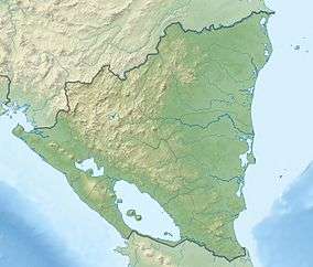 San Cristóbal Nicaragua | |
| Location | Chinandega Department, Nicaragua |
| Parent range | Cordillera Los Maribios |
| Geology | |
| Mountain type | Stratovolcano |
| Last eruption | June 2015 (ongoing) |
Volcán San Cristóbal is the highest volcano in Nicaragua at 1,745 m (5,725 ft). Located near to the northwest corner of the country, it forms a majestic backdrop to the city of Chichigalpa, Chinandega. It is also among the most active volcanos in Nicaragua, erupting frequently (if gently).
San Cristóbal is part of a 5-member volcanic complex that bears the same name. Chonco lies 4 km to the west, and Moyotepe 4 km to the north east. Joined to the volcano's eastern flank is Volcán Casitas, which buried a village with a catastrophic landslide in 1998. The scars from said landslide are still visible today. Finally, La Pelona is located on the eastern end of the complex.[1]
Physical features
San Cristóbal is the youngest volcano in its complex. It is a nearly symmetrical stratovolcano, rising in a distinctive cone shape. The SW slope is the longest, and the crater rim on that side rises 140 m above the NE end due to prevailing trade winds that distribute tephra to the SW.[1]
The crater is 500 × 600 m in size. While the volcano was at one point covered in tropical forests, the large quantities of gas and smoke that it emits constantly have killed off much of the vegetation.[2]
Eruptive history
- 1685: Erupted strongly enough to merit preservation in historical accounts.
- August 1919: Produced loud noises and light tremors that were felt in surrounding areas.
- May 1971: Produced bangs and explosions.
- March 1976: Produced a high, continuous column of smoke, several light tremors, and explosions that occurred every three minutes.
- c. December 1986: Marked expulsion of gases
- c. January 1987: Expelled large quantities of gas.
- May 1997: Entered into a new eruptive period, expelling gases, ash, and sand, and also producing light tremors.
- December 1999: Expelled gas, ash, and sand.
- May, August 2001: Reactivated.
- April 2006: Moderate phreatic eruption.
- July 2008: Rumbled with a series of small explosions, and expelled gas.
- September 2009: Explosion and moderate ash expulsion.
- September 2012: Three big explosions, expelled gas, ash and sand to 5,000 metres, following the 2012 Costa Rica earthquake.[3]
- December 25, 2012 and continuing into 2013: elevated seismic activity and multiple eruptions over the next few days.[4][5]
- April 11, 2014: Gas plume that may contain ash drifted West about 20 km.
- July 20, 2014: Two explosions that occurred at 1:30 P.M. and 2:13 P.M. local time produced small plumes of ash that rose 100 meters.
Current activity
San Cristóbal remains quite active, continuously expelling copious amounts of gas and smoke. As recent as September 2009, it was reported that ash was falling in nearby towns.[6] In September 2012 it erupted again, spewing ash up to four kilometres (2.5 miles) into the atmosphere, resulting in the evacuation of around 3000 people in the surrounding area.[7]
A further eruption took place, starting on the 25th of December 2012 and continuing into 2013, causing the evacuation of hundreds of locals.[8]
See also
References
- 1 2 3 4 "San Cristóbal". Global Volcanism Program. Smithsonian Institution. Retrieved 2011-05-03.
- ↑ INETER San Cristobal description http://www.ineter.gob.ni/geofisica/vol/cristobal/descr.html
- ↑ Nicaragua’s San Cristóbal volcano erupts The Tico Times, 2012-09-08.
- ↑ San Cristobal volcano (Nicaragua) eruption update: near continuous ash eruptions, evacuations Volcano Discovery, 2012-12-27.
- ↑ Volcano activity of December 27, 2012 – San Cristobal volcano, Nicaragua erupting (video) Earthquake Report.com,2012-12-27.
- ↑ "Eruption underway at Nicaragua's San Cristobal volcano". BNO News. September 2009. Retrieved 2011-05-03.
- ↑ "Thousands evacuate as Nicaragua volcano spews ash". ABC News. 9 September 2012. Retrieved 2012-09-09.
- ↑ "Nicaragua San Cristobal volcano: Hundreds told to leave". BBC News. 27 December 2012. Retrieved 2012-12-27.
| Guatemala | 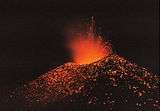 | |
|---|---|---|
| El Salvador | ||
| Nicaragua | ||
| Costa Rica |
| |
| Panama | ||
Note: volcanoes are ordered from north-west to south-east. | ||