San Antonito, Bernalillo County, New Mexico
| San Antonito, New Mexico | |
|---|---|
| Census-designated place | |
 San Antonito | |
| Coordinates: 35°09′47″N 106°20′51″W / 35.16306°N 106.34750°WCoordinates: 35°09′47″N 106°20′51″W / 35.16306°N 106.34750°W | |
| Country | United States |
| State | New Mexico |
| County | Bernalillo |
| Area[1] | |
| • Total | 2.445 sq mi (6.33 km2) |
| • Land | 2.445 sq mi (6.33 km2) |
| • Water | 0 sq mi (0 km2) |
| Elevation | 6,873 ft (2,095 m) |
| Population (2010)[2] | |
| • Total | 985 |
| • Density | 400/sq mi (160/km2) |
| Time zone | Mountain (MST) (UTC-7) |
| • Summer (DST) | MDT (UTC-6) |
| ZIP code | 87047[3] |
| Area code(s) | 505 |
| GNIS feature ID | 910608[4] |
San Antonito is a census-designated place in Bernalillo County, New Mexico, United States. Its population was 985 as of the 2010 census.
San Antonito Church and Cemetery, which is listed on the National Register of Historic Places, is located in San Antonito.[5]
References
- ↑ "US Gazetteer files: 2010, 2000, and 1990". United States Census Bureau. 2011-02-12. Retrieved 2011-04-23.
- ↑ "American FactFinder". United States Census Bureau. Retrieved 2011-05-14.
- ↑ United States Postal Service (2012). "USPS - Look Up a ZIP Code". Retrieved 2012-02-15.
- ↑ "San Antonito". Geographic Names Information System. United States Geological Survey.
- ↑ National Park Service (2010-07-09). "National Register Information System". National Register of Historic Places. National Park Service.
Municipalities and communities of Bernalillo County, New Mexico, United States | ||
|---|---|---|
| Cities | 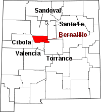 | |
| Town | ||
| Villages | ||
| CDPs | ||
| Other unincorporated communities | ||
| Indian reservations |
| |
| Footnotes | ‡This populated place also has portions in an adjacent county or counties | |
This article is issued from Wikipedia - version of the 7/31/2014. The text is available under the Creative Commons Attribution/Share Alike but additional terms may apply for the media files.