Samnaun Alps
| Samnaun Alps | |
|---|---|
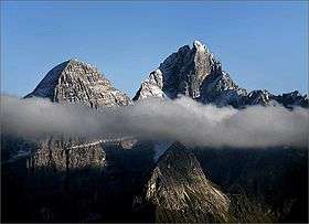
 Muttler (left) and Piz Tschütta (right) | |
| Highest point | |
| Peak | Muttler |
| Elevation | 3,293 m (10,804 ft) |
| Coordinates | 46°54′1″N 10°22′42″E / 46.90028°N 10.37833°ECoordinates: 46°54′1″N 10°22′42″E / 46.90028°N 10.37833°E |
| Geography | |
| Countries | Austria and Switzerland |
| States | Tyrol and Graubünden |
| Parent range | Central Eastern Alps |
| Borders on | Verwall Alps, Silvretta, Sesvenna Range and Ötztal Alps |
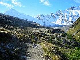
The Samnaun Alps are a mountain range of the Central Eastern Alps, named after the Swiss municipality of Samnaun. They are located at the border of the Austrian state of Tyrol and the Graubünden canton of Switzerland.
The range includes the following peaks:
| Peak | Elevation (m/ft) | |
|---|---|---|
| Muttler | 3293 | 10,804 |
| Piz Tschütta | 3258 | 10,689 |
| Piz Mundin | 3146 | 10,322 |
| Vesilspitze | 3115 | 10,220 |
| Piz Rots | 3097 | 10,161 |
| Vesulspitze | 3092 | 10,145 |
| Hexenkopf | 3038 | 9,968 |
| Bürkelkopf | 3033 | 9,951 |
| Gemspleiskopf | 3017 | 9,899 |
| Rothbleiskopf | 2938 | 9,640 |
| Flimspitz | 2929 | 9610 |
For a list of passes, see Passes of the Silvretta and Rätikon Ranges.
 Muttler from north
.jpg) Fimbatal border crossing Switzerland and Austria
Fimbatal border crossing Switzerland and Austria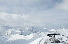 Piz Rots in the skiarea Silvretta Arena
 Piz Mundin and Muttler from east (Nauders)
See also
This article is issued from Wikipedia - version of the 11/28/2016. The text is available under the Creative Commons Attribution/Share Alike but additional terms may apply for the media files.