Samarskaya Luka National Park
| Samarskaya Luka National Park | |
|---|---|
|
Russian: Самарская Лука (Also: Samara Bend) | |
|
IUCN category II (national park) | |
|
Deviat Mound, Samara Bend | |
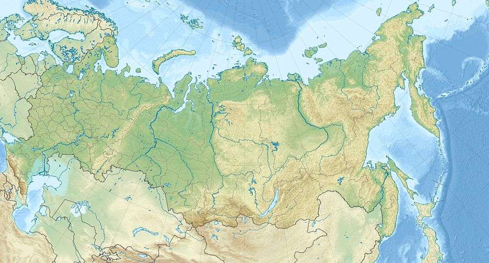 Location of Park | |
| Location | Samara Oblast |
| Nearest city | Zhigulyovsk |
| Coordinates | 53°18′N 49°50′E / 53.300°N 49.833°ECoordinates: 53°18′N 49°50′E / 53.300°N 49.833°E |
| Area | 134,000 hectares (330,000 acres) |
| Established | 1984 |
| Governing body | Ministry of Natural Resources and Environment (Russia) |
| Website | http://www.npsamluka.ru/ |

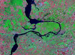
Samarskaya Luka National Park (Russian: Самарская Лука национальный парк) (in English, "Samara Bend") covers most of the peninsula formed by the 180-degree bend of the Volga River as it flows around the Zhiguli Mountains, near the cities of Samara and Zhigulyovsk in the Stavropolsky District, Samara Oblast. The north shore of the bend is on the Kuybyshev Reservoir, the south side is on the Saratov Reservoir, and on the north it has a border with Zhiguli Nature Reserve. The park is culturally important because of its centrality to a range of peoples back to ancient times, and to its scientific value resulting from the biodiversity of its closely placed variety of habitats. The territory is part of the Middle Volga Complex Biosphere.[1]
Topography
The Samara Bend is located at the meeting zone of two geological regions: the Volga Uplands, and the Lower Volga Lowlands. In the Volga Uplands, a region of hills on the East European Plain, the park is found on the northeast edge. Across the Volga on the left bank are the Volga Lowlands, a tectonic trough of clay and sand remaining from the ancient Caspian Sea. The Kuybyshev and Saratov reservoirs of the Volga form the north and south borders of the park.
The Volga's detour around the Zhiguli mountains is almost 200 km in length. The Zhiguli, and most of the bedrock in the park, is a karst (limestone) formation, averaging about 300 meters in height. About 18% of the Samara Bend National Park is in the mountainous Zhiguli on the north, 8% is on Volga floodplains to the south, and the remainder is forest and forest-steppe. In the eastern part of the park, the weathering of the limestone has left more than 500 craters over 1 meter to 100 meters in width, and 1 meter to 20 meters in depth. [2]
Ecoregion and Climate
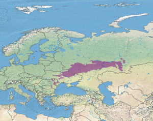
Samarskaya Luka lies in the "East European forest steppe" ecoregion (WWF ID#419), a transition zone between the broadleaf forests of the north and the grasslands to the south, cutting across the middle of Eastern Europe from Bulgaria through Russia. This forest steppe ecoregion is characterized by a mosaic of forests, steppe, and riverene wetlands.[3]
The climate in Samarskaya Luka is Humid continental climate, cool summer, (Köppen climate classification (Dfb)), characterized by large swings in temperature, both diurnially and seasonally, with mild summers and cold, snowy winters. The coldest month is January (-10 C on average); the warmest month is July (+20 C). Average precipitation is 556 mm. The frost-free period is 156 days. The predominant winds are from the southwest.[2]
| Samara Bend, Samara Oblast, Russia | ||||||||||||||||||||||||||||||||||||||||||||||||||||||||||||
|---|---|---|---|---|---|---|---|---|---|---|---|---|---|---|---|---|---|---|---|---|---|---|---|---|---|---|---|---|---|---|---|---|---|---|---|---|---|---|---|---|---|---|---|---|---|---|---|---|---|---|---|---|---|---|---|---|---|---|---|---|
| Climate chart (explanation) | ||||||||||||||||||||||||||||||||||||||||||||||||||||||||||||
| ||||||||||||||||||||||||||||||||||||||||||||||||||||||||||||
| ||||||||||||||||||||||||||||||||||||||||||||||||||||||||||||
Flora
Because of the complexity and centrality of the habitats, biodiversity is high. Plant communities include Eastern European steppe, steppe pine forests, Eastern European deciduous forests, grasslands, and floodplains. Over 1,500 species of vascular plants have been recorded in the park's borders. The trees are almost all deciduous - 97%, with linden, oak and birch the most common. The 3% conifers are in small stands of sparse Scots pine found on the higher slopes and on limestone. [4] [2]
 Zhiguli hills, northeast sector of Samaraskaya Luka
 Molodetsky Kurgan ("Valiant Barrow"), on the northwest of Samara Bend, looking east
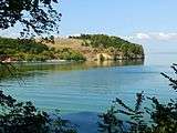 Usinsk Mound, far northwest point of the park
Fauna
A noteworthy feature of the vertebrates in the park is that 30% of the species are living at the edge of their historical ranges. The result is that norther taiga species, such as the Ural owl, can be found in close proximity to southern steppe species such as the European bee-eater. [1] [4]
Tourism
The park is popular with tourists for hiking and recreation. Tickets can be purchased at travel agencies in the area; the park's website provides a list. Group tickets and guided tours must be arranged through the office in Samara. Camping and fires are not permitted along the trails and protected zones of the park. [1]
Popular trails and landmarks include:
- Molodetsky Kurgan. A 200-meter high ridge that runs along the Volga on the northwest border of the park.
- Deviat Hill. A limestone promontory off the west end of the Molodetsky Ridge.
- Usinsk Mound. ("Cake Hill"). Opposite Deviat Hill on a small bay.
- Stone Bowl Tract. Area of limestone depressions and mineral springs, with a small chapel of St. Nicholas (included on the pilgrimage route of holy sites in Samara).[5]
- Museum Tour. There are six museums on the site of the park, dedicated to cultural and natural features of the Samara Bend and its history.
- Witch Lake Trail. 2 km ecological trail, appropriate for children, with interpretive signs about the natural setting and the ancient myths of the region.
- Stephan Razan Caves. Limestone caves with history and legend.
See also
References
- 1 2 3 "Samarskaya Luka National Park (Official Park Site)". FGBU Samarskaya Luka NP. Retrieved January 24, 2016.
- 1 2 3 "Samarskaya Luka National Park" (in Russian). Retrieved January 24, 2016.
- ↑ "East European forest steppe". Encyclopedia of Earth. Retrieved January 24, 2016.
- 1 2 "Samarskaya Luka National Park - Flora and Fauna" (in Russian). Retrieved January 27, 2016.
- ↑ "Stone Bowl" (in Russian). Blagovest Orthodox Newspaper. Retrieved January 26, 2016.
External links
- Samarskaya Luka map at ProtectedPlanet.net
- Samarskaya Luka map at OpenStreetMap.org
- Official Park Site - Map of Samarskaya Luka