Samalkota
| Samalkota సామర్లకోట Samarlakota | |
|---|---|
| Town | |
 | |
 Samalkota Location in Andhra Pradesh, India | |
| Coordinates: 17°03′11″N 82°10′10″E / 17.0531°N 82.1695°ECoordinates: 17°03′11″N 82°10′10″E / 17.0531°N 82.1695°E | |
| Country | India |
| State | Andhra Pradesh |
| District | East Godavari |
| Area[1] | |
| • Total | 14.88 km2 (5.75 sq mi) |
| Elevation | 9 m (30 ft) |
| Population (2011) | |
| • Total | 56,864 |
| • Density | 3,800/km2 (9,900/sq mi) |
| Languages | |
| • Official | Telugu |
| Time zone | IST (UTC+5:30) |
| PIN | 533 440 |
| Telephone code | +91-884 |
| Vehicle registration | AP 05 |
Samalkota is a town in East Godavari district of the Indian state of Andhra Pradesh.
Geography
Samarlakota is located at 17°03′00″N 82°11′00″E / 17.0500°N 82.1833°E.[2] It has an average elevation of 9 meters (32 feet).
Samalkot is fourth largest population city after Rajahmundry, Kakinada and Amalapuram in the East Godavari district.
Samalkot-Peddapuram towns are Twin towns in the East godavari district.( total area 56.01 km2 (21.62 sq mi) and 1,06,500 populations(2011 Census) and distance between just 1 KM by Peddapuram-samalkot main road
Transport
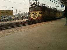
The Andhra Pradesh State Road Transport Corporation operates bus services from Samalkota bus station.[3] Samarlakota railway station is an important railway junction on the Visakhapatnam-Vijayawada section of Howrah-Chennai main line. The railway line to Kakinada branches at this railway junction.
Roads: Samalakota-Peddapuram road( Main Road), Samarlkot-Peddapuram ADB road, Pitapuram road, Prathipadu road, kakinada-Rajahmundry Canel road
Nearest cities and towns: kakinada (14 KM), Rajahmundry(55 KM),Eluru( 150KM),Bhimavaram( 122KM) Peddapuram(2KM), Pitapuram(14 KM), Mandapeta( 40KM), Ramachandrapuram( 40KM), Yanam (45 KM)
Distance from other important cities: Visakhapatnam( 150 KM),Vijayawada( 205 KM),Guntur( 235KM), Amaravati-Capital of A.P(240 KM), Warangal, Telangana (370 KM), Hyderabad, Telangana ( 480KM),Bhubaneswar, Odisha(580KM), Chennai, Tamilnadu(660 KM),Bengaluru( Karnataka( 860KM), Kolkata, West Bengal(1020KM),Mumbai, Maharashtra( 1200 KM), New Delhi( Capital of india) 1800 KM
Nearest Airports: Burugupudi airport, Rajahmudry( 60KM), Visakhapatnam international airport( 150 KM) and Gannavaram Airport( Vijayawada-200 KM)
Seaports: kakinada sea port( 20KM), Visakhapatnam seaport( 160 KM)
Beaches: NTR Beach, vakalapudi is nearest beach to samalkot( 15 KM)
Demographics
Samalkot is a Municipality city in district of East Godavari, Andhra Pradesh. The Samalkot city is divided into 18 wards for which elections are held every 5 years. The Samalkot Municipality has population of 56,864 of which 28,115 are males while 28,749 are females as per report released by Census India 2011.
Population of Children with age of 0-6 is 5793 which is 10.19 % of total population of Samalkot (M). In Samalkot Municipality, Female Sex Ratio is of 1023 against state average of 993. Moreover Child Sex Ratio in Samalkot is around 948 compared to Andhra Pradesh state average of 939. Literacy rate of Samalkot city is 74.58 % higher than state average of 67.02 %. In Samalkot, Male literacy is around 78.77 % while female literacy rate is 70.51 %.
Samalkot Municipality has total administration over 16,044 houses to which it supplies basic amenities like water and sewerage. It is also authorized to build roads within Municipality limits and impose taxes on properties coming under its jurisdiction.
Temples/Churches/mosque: Sri Chalukya Kumararama Sri Bhimeswaraswamy vari temple, prasanna anjaneya swamy temple,Peddapuram Road, Ganapathi Temple, Mehar complex, muthyalamma thalli temple, kakinada Road, Sai Baba Temple, station centre, are famous temples in Samalkot. centenary baptist church, augustana lutheran church,andhra baptist churches are famous churches in samalkot.
industries/ Factories :
Nava Bharav ventures limited ( Sugar factory), Reliance power plant, GVK power plant, Sudha Agro Oil & Chemical Industries Ltd, R.A.K. Ceramics India Pvt. Ltd, Ambati Subbanna & Co., Oil Firm, Vijaya Industries, Shree Papers Limited, Seven Hills Papers Pvt Ltd, Sri Venkateswara Fertilizers Private Limited, Sri Venkatarama Oil Industries Ltd, Curewell Pharmacy, Rishi Pharma, Vasavi Industries, R. K. Agro Products, Venkateswara Plastic, Sri Vasavi Industries,
Education
The primary and secondary school education is imparted by government, aided and private schools, under the School Education Department of the state.[4][5] The medium of instruction followed by different schools are English, Telugu.
References
- ↑ "Municipalities, Municipal Corporations & UDAs" (PDF). Directorate of Town and Country Planning. Government of Andhra Pradesh. Archived from the original (PDF) on 28 January 2016. Retrieved 28 January 2016.
- ↑ Falling Rain Genomics.Samarlakota
- ↑ "Bus Stations in Districts". Andhra Pradesh State Road Transport Corporation. Retrieved 9 March 2016.
- ↑ "School Eduvation Department" (PDF). School Education Department, Government of Andhra Pradesh. Retrieved 7 November 2016.
- ↑ "The Department of School Education - Official AP State Government Portal | AP State Portal". www.ap.gov.in. Retrieved 7 November 2016.