Salem Township, Delaware County, Indiana
| Salem Township | |
|---|---|
| Township | |
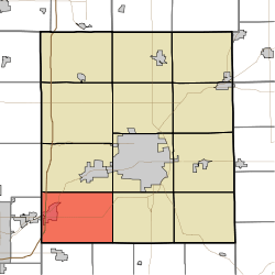 Location of Salem Township in Delaware County | |
| Coordinates: 40°07′01″N 85°30′33″W / 40.11694°N 85.50917°WCoordinates: 40°07′01″N 85°30′33″W / 40.11694°N 85.50917°W | |
| Country | United States |
| State | Indiana |
| County | Delaware |
| Government | |
| • Type | Indiana township |
| Area | |
| • Total | 35.21 sq mi (91.2 km2) |
| • Land | 35.08 sq mi (90.9 km2) |
| • Water | 0.14 sq mi (0.4 km2) |
| Elevation[1] | 938 ft (286 m) |
| Population (2010) | |
| • Total | 4,034 |
| • Density | 115/sq mi (44/km2) |
| FIPS code | 18-67356[2] |
| GNIS feature ID | 453823 |
Salem Township is one of twelve townships in Delaware County, Indiana. According to the 2010 census, its population was 4,034 and it contained 1,729 housing units.[3]
History
The Richwood Evangelical Lutheran Church was listed on the National Register of Historic Places in 2004.[4]
Geography
According to the 2010 census, the township has a total area of 35.21 square miles (91.2 km2), of which 35.08 square miles (90.9 km2) (or 99.63%) is land and 0.14 square miles (0.36 km2) (or 0.40%) is water.[3]
Cities and towns
- Chesterfield (east edge)
- Daleville
Unincorporated towns
Adjacent townships
- Mount Pleasant Township (north)
- Center Township (northeast)
- Monroe Township (east)
- Jefferson Township, Henry County (southeast)
- Fall Creek Township, Henry County (south)
- Union Township, Madison County (west)
- Richland Township, Madison County (northwest)
Major highways
Cemeteries
The township contains three cemeteries: Saunders, Sharp and Sunderland.
References
- ↑ "US Board on Geographic Names". United States Geological Survey. 2007-10-25. Retrieved 2008-01-31.
- ↑ "American FactFinder". United States Census Bureau. Retrieved 2008-01-31.
- 1 2 "Population, Housing Units, Area, and Density: 2010 - County -- County Subdivision and Place -- 2010 Census Summary File 1". United States Census. Retrieved 2013-05-10.
- ↑ National Park Service (2010-07-09). "National Register Information System". National Register of Historic Places. National Park Service.
External links
- Indiana Township Association
- United Township Association of Indiana
- Old Salem Township historic information
Municipalities and communities of Delaware County, Indiana, United States | ||
|---|---|---|
| City | ||
| Towns | ||
| Townships | ||
| Unincorporated communities | ||
| Footnotes | ‡This populated place also has portions in an adjacent county or counties | |
This article is issued from Wikipedia - version of the 12/2/2015. The text is available under the Creative Commons Attribution/Share Alike but additional terms may apply for the media files.