Salem, New Jersey
| Salem, New Jersey | |
|---|---|
| City | |
| City of Salem | |
|
Old Salem Courthouse | |
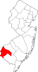
 The City of Salem highlighted in Salem County. Inset map: Salem County highlighted in the State of New Jersey. | |
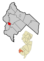
 Census Bureau map of Salem, New Jersey | |
| Coordinates: 39°34′06″N 75°28′21″W / 39.568236°N 75.472553°WCoordinates: 39°34′06″N 75°28′21″W / 39.568236°N 75.472553°W[1][2] | |
| Country |
|
| State |
|
| County | Salem |
| Formed | October 1675 |
| Incorporated | February 21, 1798 (as township) |
| Incorporated | February 25, 1858 (as city) |
| Government[3] | |
| • Type | City |
| • Body | City Council |
| • Mayor | Charles Washington Jr. (D, term ends December 31, 2018)[4][5] |
| • Clerk | Tierra M. Jennings[6] |
| Area[1] | |
| • Total | 2.815 sq mi (7.291 km2) |
| • Land | 2.343 sq mi (6.070 km2) |
| • Water | 0.472 sq mi (1.221 km2) 16.75% |
| Area rank |
350th of 566 in state 12th of 15 in county[1] |
| Elevation[7] | 10 ft (3 m) |
| Population (2010 Census)[8][9][10] | |
| • Total | 5,146 |
| • Estimate (2015)[11] | 4,894 |
| • Rank |
374th of 566 in state 5th of 15 in county[12] |
| • Density | 2,195.9/sq mi (847.8/km2) |
| • Density rank |
275th of 566 in state 3rd of 15 in county[12] |
| Time zone | Eastern (EST) (UTC-5) |
| • Summer (DST) | Eastern (EDT) (UTC-4) |
| ZIP code | 08079[13][14] |
| Area code(s) | 856 exchanges 339, 878, 935[15] |
| FIPS code | 3403365490[1][16][17] |
| GNIS feature ID | 0885385[1][18] |
| Website |
www |

Salem is a city in Salem County, in the U.S. state of New Jersey. As of the 2010 United States Census, the city's population was 5,146,[8][9][10] reflecting a decrease of 711 (-12.1%) from the 5,857 counted in the 2000 Census, which had in turn declined by 1,026 (-14.9%) from the 6,883 counted in the 1990 Census, an overall drop of more than 25% over the two decades.[19] It is the county seat of Salem County,[20] the state's most rural county.[21] The name "Salem", in both the city and county, is derived from the Hebrew word shalom, meaning "peace".[22][23]
The town and colony of Salem was laid out in 1675 by John Fenwick and the community was given permission to choose officers in October 1693. It was incorporated on February 21, 1798, as part of the initial group of 104 townships established by the New Jersey Legislature. On February 25, 1858, it was reincorporated as Salem City.[24]
History
Salem was founded by John Fenwick, a Quaker. Fenwick had been involved in a financial dispute with an Edward Billinge, another Quaker, who had received the undivided portion of New Jersey territory that James Stuart, Duke of York had granted to Lord John Berkeley in 1664. Berkeley had sold his share to Billinge in 1675 for 1,000 pounds, but Billinge had become bankrupt and so had the property turned over to Fenwick to hold for Billinge and his assigns in trust. Billinge and Fenwick came to disagree over the property.
William Penn was asked to adjudicate the matter and he awarded 90% of the claim to Billinge and the remaining 10% and a cash settlement to Fenwick for his share. Fenwick was dissatisfied with Penn's judgement and refused to abide by the decision; essentially Fenwick had no assurance that a previously bankrupt man would convey ten percent of the net proceeds of the future venture since he had not even paid the adjudicated cash settlement. So Fenwick organized a colony of settlers and sailed to the Delaware Bay where he settled as Patroon on the eastern shore near the abandoned Swedish settlement of Fort Nya Elfsborg and set himself up as the local governor of the fifth Tenth (approximately 20% of the original Billinge property), issuing land patents and enforcing his own laws in defiance of Billinge and Penn. Billinge countered by suing Fenwick, causing uncertainty in the chain of land title. The economic damages to those who controlled property within and near Salem caused many injured persons over the next decade to declare a long line of complaints and lawsuits in the colonial courts. To preserve Salem, its inhabitants and their property, Fenwick remained under arrest for months until copies of documents proving his claims were obtained from England. Fenwick ultimately proved the right of his claim in the court of Dominion Governor Andros, and returned to govern the Salem tenth by 1689.[25][26] Salem remained as a settlement and continued growing.[27]
In 1778, the British launched an assault against the local American militia in what became known as the Salem Raid. During that assault, Judge William Hancock of the King's Court who was presiding at the County Courthouse at the beginning of the American Revolutionary War, was accidentally killed by the British troops as part of the assault that became known as the Hancock House Massacre.[28] After the war concluded, treason trials were held at the county courthouse where suspected Loyalists were put on trial for having allegedly aided the British raid of Salem. Four men were convicted and sentenced to death for treason; however, they were pardoned by Governor William Livingston and exiled from New Jersey.[29]
The town was formally incorporated as a city by the New Jersey Legislature's Township Act of 1798 on February 21, 1798.
The Old County Courthouse was the site of the legend of Colonel Robert Gibbon Johnson proving the edibility of the tomato. According to legend, Colonel Johnson stood upon the courthouse steps in 1820 and ate tomatoes in front of a large amazed crowd assembled to watch him do so.[30] However, the legend did not appear in print until 1948 and modern scholars doubt the veracity of this story.[31][32]
Historical buildings
The Old Salem County Courthouse serves today as the administrative offices for Salem City. It is the oldest active courthouse in New Jersey and is the second-oldest courthouse in continuous use in the United States.[33] The Courthouse was erected in 1735 during the reign of King George II using locally manufactured bricks. The building was enlarged in 1817 and additionally enlarged and remodeled in 1908. Its distinctive bell tower is essentially unchanged and the original bell sits in the courtroom.[33]
Geography
Salem is located along the Salem River.[34] According to the United States Census Bureau, Salem city had a total area of 2.815 square miles (7.291 km2), including 2.343 square miles (6.070 km2) of land and 0.472 square mile (1.221 km2) of water (16.75%).[1][2]
The city borders the Salem County municipalities of Elsinboro Township, Lower Alloways Creek Township, Mannington Township, Pennsville Township and Quinton Township.
Climate
The climate in the area is characterized by hot, humid summers and generally mild to cool winters. According to the Köppen Climate Classification system, Salem has a humid subtropical climate, abbreviated "Cfa" on climate maps.[35]
Demographics
| Historical population | |||
|---|---|---|---|
| Census | Pop. | %± | |
| 1810 | 929 | — | |
| 1820 | 1,303 | 40.3% | |
| 1830 | 1,570 | 20.5% | |
| 1840 | 2,006 | 27.8% | |
| 1850 | 3,052 | 52.1% | |
| 1860 | 3,865 | 26.6% | |
| 1870 | 4,555 | 17.9% | |
| 1880 | 5,056 | 11.0% | |
| 1890 | 5,516 | 9.1% | |
| 1900 | 5,811 | 5.3% | |
| 1910 | 6,614 | 13.8% | |
| 1920 | 7,435 | 12.4% | |
| 1930 | 8,047 | 8.2% | |
| 1940 | 8,618 | 7.1% | |
| 1950 | 9,050 | 5.0% | |
| 1960 | 8,941 | −1.2% | |
| 1970 | 7,648 | −14.5% | |
| 1980 | 6,959 | −9.0% | |
| 1990 | 6,883 | −1.1% | |
| 2000 | 5,857 | −14.9% | |
| 2010 | 5,146 | −12.1% | |
| Est. 2015 | 4,894 | [11][36] | −4.9% |
| Population sources: 1810–2000[37] 1810-1920[38] 1840[39] 1830–1870[40] 1850[41] 1870[42] 1880–1890[43] 1890-1910[44] 1910–1930[45] 1930-1990[46] 2000[47][48] 2010[8][9][10] | |||
Census 2010
The 2010 United States Census counted 5,146 people, 2,157 households, and 1,264 families residing in the city. The population density was 2,195.9 per square mile (847.8/km2). The city contained 2,633 housing units at an average density of 1,123.6 per square mile (433.8/km2). The racial makeup of the city was 31.21% (1,606) White, 62.13% (3,197) Black or African American, 0.41% (21) Native American, 0.39% (20) Asian, 0.00% (0) Pacific Islander, 1.85% (95) from other races, and 4.02% (207) from two or more races. Hispanics or Latinos of any race were 6.68% (344) of the population.[8]
Out of a total of 2,157 households, 28.9% had children under the age of 18 living with them, 22.8% were married couples living together, 30.7% had a female householder with no husband present, and 41.4% were non-families. 35.5% of all households were made up of individuals, and 12.7% had someone living alone who was 65 years of age or older. The average household size was 2.36 and the average family size was 3.05.[8]
In the city, 28.2% of the population were under the age of 18, 9.7% from 18 to 24, 22.4% from 25 to 44, 27.1% from 45 to 64, and 12.5% who were 65 years of age or older. The median age was 34.4 years. For every 100 females the census counted 80.8 males, but for 100 females at least 18 years old, it was 73.5 males.[8]
The Census Bureau's 2006–2010 American Community Survey showed that (in 2010 inflation-adjusted dollars) median household income was $25,682 (with a margin of error of +/- $5,287) and the median family income was $38,286 (+/- $5,682). Males had a median income of $47,708 (+/- $9,641) versus $32,236 (+/- $5,778) for females. The per capita income for the borough was $17,733 (+/- $2,366). About 26.5% of families and 28.4% of the population were below the poverty line, including 43.4% of those under age 18 and 10.9% of those age 65 or over.[49]
Census 2000
As of the 2000 United States Census[16] there were 5,857 people, 2,383 households, and 1,463 families residing in the city. The population density was 2,244.3 people per square mile (866.4/km2). There were 2,863 housing units at an average density of 1,097.0 per square mile (423.5/km2). The racial makeup of the city was 37.46% White, 56.77% African American, 0.60% Native American, 0.24% Asian, 1.38% from other races, and 3.55% from two or more races. Hispanic or Latino of any race were 4.88% of the population.[47][48]
There were 2,383 households out of which 32.9% had children under the age of 18 living with them, 27.7% were married couples living together, 29.0% had a female householder with no husband present, and 38.6% were non-families. 34.1% of all households were made up of individuals and 14.2% had someone living alone who was 65 years of age or older. The average household size was 2.43 and the average family size was 3.10.[47][48]
In the city the population was spread out with 31.0% under the age of 18, 9.1% from 18 to 24, 25.4% from 25 to 44, 20.6% from 45 to 64, and 14.0% who were 65 years of age or older. The median age was 34 years. For every 100 females there were 80.7 males. For every 100 females age 18 and over, there were 73.6 males.[47][48]
The median income for a household in the city was $25,846, and the median income for a family was $29,699. Males had a median income of $35,389 versus $24,354 for females. The per capita income for the city was $13,559. About 24.7% of families and 26.6% of the population were below the poverty line, including 35.3% of those under age 18 and 12.1% of those age 65 or over.[47][48]
Government
Local government
Salem is governed under the City form of New Jersey municipal government. The government consists of a Mayor, who is elected at-large to a three-year term of office. The City Council is made up of eight members, with four members representing each of two wards, East and West. Council members are elected on a staggered basis to four-year terms of office, with one seat from each ward up for election each year. All members of the governing body are chosen on a partisan basis as part of the November general election.[3][50]
As of 2016, the Mayor of Salem is Democrat Charles Washington Jr., whose term of office ends December 31, 2015.[51] Members of the City Council are Council President Karen Roots (West; D, 2019), President Pro Tempore Charles V. Hassler (West; D, 2017), Ruth Ann Carter (East; D, 2016, elected to serve an unexpired term), Earl R. Gage (West; D, 2018), Vaughn Groce (East; D, 2017), Horace Johnson (East; D, 2018), Sharon K. Kellum (West; D, 2016 - appointed to serve an unexpired term) and Lydia Y. Thompson (East; D, 2019).[4][52][53][54][55][56][57][58]
Ruth Carter was named in October 2013 to fill the seat vacated in the previous month by Bob Johnson, who resigned due to family obligations.[59] Carter served on an interim basis until the November 2014 general election, when she was elected to fill the balance of the term of office through December 2016.[56] Vaughn Groce was chosen in January 2013 to fill the seat of Charles Washington Jr., expiring in December 2013 that was vacated when he took office as mayor.[60]
Federal, state and county representation
Salem City is located in the 2nd Congressional District[61] and is part of New Jersey's 3rd state legislative district.[9][62][63]
New Jersey's Second Congressional District is represented by Frank LoBiondo (R, Ventnor City).[64] New Jersey is represented in the United States Senate by Cory Booker (D, Newark, term ends 2021)[65] and Bob Menendez (D, Paramus, 2019).[66][67]
For the 2016–2017 session (Senate, General Assembly), the 3rd Legislative District of the New Jersey Legislature is represented in the State Senate by Stephen M. Sweeney (D, West Deptford Township) and in the General Assembly by John J. Burzichelli (D, Paulsboro) and Adam Taliaferro (D, Woolwich Township).[68] The Governor of New Jersey is Chris Christie (R, Mendham Township).[69] The Lieutenant Governor of New Jersey is Kim Guadagno (R, Monmouth Beach).[70]
Salem County is governed by a seven-member Board of Chosen Freeholders who are elected at-large to serve three-year terms of office on a staggered basis, with either two or three seats coming up for election each year. At an annual reorganization meeting held in the beginning of January, the board selects a Director and a Deputy Director from among its members. As of 2014, Salem County's Freeholders (with party, residence, term-end year and committee chairmanship listed in parentheses) are Director Julie A. Acton (R, Pennsville Township, 2016; Administration), Deputy Director Dale A. Cross (R, Pennsville Township, 2014; Public Safety), Bruce L. Bobbitt (D, Pilesgrove Township, 2014; Public Services), Ben Laury (R, Elmer, 2015; Public Works) Beth E. Timberman (D, Woodstown, 2015; Social Services), Robert J. Vanderslice (R, Pennsville Township, 2014; Health and Human Services) Lee R. Ware (D, Elsinboro Township, 2016; Transportation, Agriculture and Cultural Affairs).[71][72] Constitutional officers elected on a countywide basis are County Clerk Gilda T. Gill (2014),[73] Sheriff Charles M. Miller (2015)[74] and Surrogate Nicki A. Burke (2015).[75][76]
Politics
As of March 23, 2011, there were a total of 2,975 registered voters in Salem, of which 1,502 (50.5% vs. 30.6% countywide) were registered as Democrats, 229 (7.7% vs. 21.0%) were registered as Republicans and 1,244 (41.8% vs. 48.4%) were registered as Unaffiliated. There were no voters registered to other parties.[77] Among the city's 2010 Census population, 57.8% (vs. 64.6% in Salem County) were registered to vote, including 80.5% of those ages 18 and over (vs. 84.4% countywide).[77][78]
In the 2012 presidential election, Democrat Barack Obama received 83.4% of the vote (1,674 cast), ahead of Republican Mitt Romney with 15.4% (309 votes), and other candidates with 1.2% (24 votes), among the 2,022 ballots cast by the city's 3,322 registered voters (15 ballots were spoiled), for a turnout of 60.9%.[79][80] In the 2008 presidential election, Democrat Barack Obama received 1,635 votes (78.8% vs. 50.4% countywide), ahead of Republican John McCain with 390 votes (18.8% vs. 46.6%) and other candidates with 18 votes (0.9% vs. 1.6%), among the 2,074 ballots cast by the city's 3,141 registered voters, for a turnout of 66.0% (vs. 71.8% in Salem County).[81] In the 2004 presidential election, Democrat John Kerry received 1,266 votes (70.4% vs. 45.9% countywide), ahead of Republican George W. Bush with 506 votes (28.1% vs. 52.5%) and other candidates with 16 votes (0.9% vs. 1.0%), among the 1,799 ballots cast by the city's 2,957 registered voters, for a turnout of 60.8% (vs. 71.0% in the whole county).[82]
In the 2013 gubernatorial election, Democrat Barbara Buono received 55.3% of the vote (538 cast), ahead of Republican Chris Christie with 41.0% (399 votes), and other candidates with 3.7% (36 votes), among the 1,061 ballots cast by the city's 3,201 registered voters (88 ballots were spoiled), for a turnout of 33.1%.[83][84] In the 2009 gubernatorial election, Democrat Jon Corzine received 731 ballots cast (66.3% vs. 39.9% countywide), ahead of Republican Chris Christie with 241 votes (21.8% vs. 46.1%), Independent Chris Daggett with 73 votes (6.6% vs. 9.7%) and other candidates with 35 votes (3.2% vs. 2.0%), among the 1,103 ballots cast by the city's 3,101 registered voters, yielding a 35.6% turnout (vs. 47.3% in the county).[85]
Education
The Salem City School District serves public school students in pre-Kindergarten through twelfth grade. The district is one of 31 former Abbott districts statewide,[86] which are now referred to as "SDA Districts" based on the requirement for the state to cover all costs for school building and renovation projects in these districts under the supervision of the New Jersey Schools Development Authority.[87][88]
As of the 2011-12 school year, the district's three schools had an enrollment of 1,231 students and 131.0 classroom teachers (on an FTE basis), for a student–teacher ratio of 9.40:1.[89] Schools in the district (with 2011-12 enrollment data from the National Center for Education Statistics[90]) are John Fenwick School[91] (grades PreK-2; 399 students), Salem Middle School[92] (3-8; 451), Salem High School[93] (9-12; 381).[94][95]
Public school students from Elsinboro, Lower Alloways Creek Township, Mannington Township and Quinton Township attend the district's high school for grades 9-12 as part of sending/receiving relationships.[96][97][98]
Transportation
The Port of Salem was designated by the British Crown in 1682 as a port of entry on the Salem River accessible via the Delaware River.[99] It handles a variety of bulk cargo, notably of construction aggregate, break bulk cargo, and containers for clothing, fishing apparel, agricultural produce, and other consumer goods. South Jersey Port Corporation operates the Salem Terminal on a 22-acre complex located west of downtown.[100]
The Glass House Spur of the Salem Branch begins at the Port of Salem and is operated by the Southern Railroad of New Jersey with connections to Conrail's South Jersey/Philadelphia Shared Assets Area operations at Swedesboro.
Roads and highways
As of May 2010, the city had a total of 24.79 miles (39.90 km) of roadways, of which 16.57 miles (26.67 km) were maintained by the municipality, 5.95 miles (9.58 km) by Salem County and 2.27 miles (3.65 km) by the New Jersey Department of Transportation.[101]
State highways passing through Salem include Route 45,[102] which has its southern terminus at its intersection with Route 49.Route 45[103] Nearby highways and structures include Interstate 295, the New Jersey Turnpike and the Delaware Memorial Bridge.
Public transportation
New Jersey Transit offers bus service between the city and Philadelphia on the 401 route and local service on the 468 route.[104][105]
The Delaware City–Salem Ferry was a seasonal service operating between Barber's Basin and Delaware City, Delaware,[106] until it was rerouted to Fort Mott in 2015 and became the Forts Ferry Crossing.[107]
Notable people
People who were born in, residents of, or otherwise closely associated with Salem include:
- Isaac Ambrose Barber (1852–1909), member of the United States House of Representatives from Maryland, serving from 1897 to 1899.[108]
- Ephraim Bee (1802–1888), pioneer, blacksmith, and inn-keeper of Doddridge County, West Virginia, which he represented in the West Virginia House of Delegates in 1863 and 1866–67.[109]
- Benjamin H. Brewster (1816–1888), United States Attorney General from 1881 to 1885.[110]
- A. B. Brown (born 1965), running back who played for three seasons in the NFL with the New York Jets.[111]
- Alexander G. Cattell (1816–1894), United States Senator from New Jersey.[112]
- John Chowning (born 1934), musician, inventor and professor who developed FM synthesis.[113][114]
- Henry T. Ellett (1812–1887), member of the United States House of Representatives from Mississippi who died while delivering a welcome address for President Grover Cleveland.[115]
- Duke Esper (1868–1910), pitcher who played for nine professional seasons in Major League Baseball.[116]
- Johnny Gaudreau (born 1993) professional hockey player, with the NHL Calgary Flames.[117][118]
- Goose Goslin (1900–1971), Hall of Fame Major League Baseball player.[119]
- William J. Hughes (born 1932), represented New Jersey's 2nd congressional district in the United States House of Representatives[120]
- Lydell Mitchell (born 1949), running back in the National Football League from 1972 to 1980.[121]
- Thomas A. Pankok (born 1931), politician who served in the New Jersey General Assembly from 1982 to 1986, where he represented the 3rd Legislative District.[122]
- John R. Patrick (born 1945), business executive, author and innovative leader in the information technology industry.[123]
- Charles J. Pedersen (1904–1989), organic chemist and winner of the 1987 Nobel Prize in Chemistry[124]
- John S. Rock (1826–1866), African-American doctor, dentist, abolitionist, and lawyer.
- Clement Hall Sinnickson (1834–1919), represented New Jersey's 1st congressional district from 1875 to1879.[125]
- Alice Barber Stephens (1858–1932), painter and engraver, best remembered for her illustrations.[126]
- John Test (1771–1849), member of the United States House of Representatives from Indiana who served from 1829 to 1831.[127]
- Hedge Thompson (1780–1828), represented New Jersey's at-large congressional district from 1827 until his death in 1828.[128]
- Edward Trenchard (1785–1824), captain of the United States Navy.[129]
- John A. Waddington (1911–1981), politician who served as Majority Leader of the New Jersey Senate.[130]
Photo gallery
- Salem, New Jersey
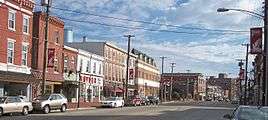 Broadway in downtown Salem in 2006
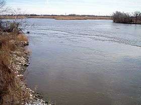 The Salem River in Salem in 2006
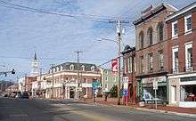 Broadway in downtown Salem in 2006
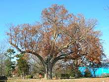 The historic Salem Oak, November 2012
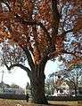 The historic Salem Oak, November 2012
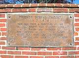 Salem Oak Commemorative Plaque, November 2012
References
- 1 2 3 4 5 6 2010 Census Gazetteer Files: New Jersey County Subdivisions, United States Census Bureau. Accessed May 21, 2015.
- 1 2 US Gazetteer files: 2010, 2000, and 1990, United States Census Bureau. Accessed September 4, 2014.
- 1 2 2012 New Jersey Legislative District Data Book, Rutgers University Edward J. Bloustein School of Planning and Public Policy, April 2006, p. 19.
- 1 2 Mayor and Council, City of Salem. Accessed July 31, 2016.
- ↑ 2016 New Jersey Mayors Directory, New Jersey Department of Community Affairs. Accessed June 14, 2016.
- ↑ City Clerk, City of Salem. Accessed July 31, 2016.
- ↑ U.S. Geological Survey Geographic Names Information System: City of Salem, Geographic Names Information System. Accessed March 14, 2013.
- 1 2 3 4 5 6 DP-1 - Profile of General Population and Housing Characteristics: 2010 for Salem city, Salem County, New Jersey, United States Census Bureau. Accessed August 17, 2012.
- 1 2 3 4 Municipalities Grouped by 2011–2020 Legislative Districts, New Jersey Department of State, p. 2. Accessed January 6, 2013.
- 1 2 3 Profile of General Demographic Characteristics: 2010 for Salem city, New Jersey Department of Labor and Workforce Development. Accessed August 17, 2012.
- 1 2 PEPANNRES - Annual Estimates of the Resident Population: April 1, 2010 to July 1, 2015 - 2015 Population Estimates for New Jersey municipalities, United States Census Bureau. Accessed May 22, 2016.
- 1 2 GCT-PH1 Population, Housing Units, Area, and Density: 2010 - State -- County Subdivision from the 2010 Census Summary File 1 for New Jersey, United States Census Bureau. Accessed August 9, 2013.
- ↑ Look Up a ZIP Code for Salem, NJ, United States Postal Service. Accessed August 17, 2012.
- ↑ Zip Codes, State of New Jersey. Accessed November 4, 2013.
- ↑ Area Code Lookup - NPA NXX for Salem, NJ, Area-Codes.com. Accessed November 4, 2013.
- 1 2 American FactFinder, United States Census Bureau. Accessed September 4, 2014.
- ↑ A Cure for the Common Codes: New Jersey, Missouri Census Data Center. Accessed August 17, 2012.
- ↑ US Board on Geographic Names, United States Geological Survey. Accessed September 4, 2014.
- ↑ Table 7. Population for the Counties and Municipalities in New Jersey: 1990, 2000 and 2010, New Jersey Department of Labor and Workforce Development, February 2011. Accessed August 17, 2012.
- ↑ "Find a County". National Association of Counties. Retrieved 2011-06-07.
- ↑ Walsh, Daniel. "History and nature to merge on byway / Officials unveil scenic bayshore route for drivers", The Press of Atlantic City, July 23, 2009. Accessed November 29, 2011. "The county has rolled out an advertising campaign that includes radio, print and television commercials, along with a new Web site, and county leaders have sought to sell outsiders on New Jersey's least-populated and most-rural county."
- ↑ Hutchinson, Viola L. The Origin of New Jersey Place Names, New Jersey Public Library Commission, May 1945. Accessed September 30, 2015.
- ↑ Gannett, Henry. The Origin of Certain Place Names in the United States, p. 272. United States Government Printing Office, 1905. Accessed September 30, 2015.
- ↑ Snyder, John P. The Story of New Jersey's Civil Boundaries: 1606–1968, Bureau of Geology and Topography; Trenton, New Jersey; 1969. p. 217. Accessed August 17, 2012.
- ↑ Clement, John (1875). A sketch of the life and character of John Fenwick. Published by Friends Historical Association. Philadelphia: Henry S. Volkmar
- ↑ Shourds, Thomas (1876). "John Fenwick." History and genealogy of Fenwick's Colony, New Jersey. Bridgeton, New Jersey, pp. 3-17 ISBN 0-8063-0714-5
- ↑ Scharf, Thomas J., History of Delaware, 1609 - 1688, 1935.
- ↑ "William Hancock House, Hancocks Bridge, New Jersey". Cup O'Jersey South. November 9, 2007. Retrieved November 23, 2009.
- ↑ Alexander Grant House, Crossroads of the American Revolution. Accessed April 14, 2015.
- ↑ "Robert Gibbon Johnson: As the story is told, it was Colonel Johnson who on September 26, 1820 once and for all proved tomatoes non-poisonous and safe for consumption.", Tomato and Health. Accessed April 14, 2015. "As the story is told, it was Colonel Johnson who on September 26, 1820 once and for all proved tomatoes non-poisonous and safe for consumption. He stood on the steps of the Salem courthouse and bravely consumed an entire basket of tomatoes without keeling over or suffering any ill effects whatsoever."
- ↑ Smith, Andrew F. (Fall–Winter 1990). "The Making of the Legend of Robert Gibbon Johnson and the Tomato". New Jersey History. New Jersey Historical Society. 108: 59–74.
- ↑ Smith, Andrew F. (1994). The Tomato in America: Early History, Culture, and Cookery. Columbia, South Carolina, US: University of South Carolina Press. pp. 1–6. ISBN 1-57003-000-6.
- 1 2 Salem, NJ, Discover Salem County. Accessed August 18, 2015. "The Old Salem County Courthouse is the second oldest courthouse in the United States; the oldest is King William County Courthouse in Virginia."
- ↑ New Jersey Atlas & Gazetteer. Yarmouth, Maine: DeLorme. 2005. ISBN 0-89933-324-9.
- ↑ Climate Summary for Salem, New Jersey
- ↑ Census Estimates for New Jersey April 1, 2010 to July 1, 2015, United States Census Bureau. Accessed May 22, 2016.
- ↑ Barnett, Bob. Population Data for Salem County Municipalities, 1800 - 2000, WestJersey.org, January 6, 2011. Accessed February 8, 2013. Population for 1840 is listed as 2,007, in conflict with two other sources included here that list the population as 2,006.
- ↑ Compendium of censuses 1726-1905: together with the tabulated returns of 1905, New Jersey Department of State, 1906. Accessed November 4, 2013.
- ↑ Bowen, Francis. American Almanac and Repository of Useful Knowledge for the Year 1843, p. 231, David H. Williams, 1842. Accessed February 8, 2013.
- ↑ Raum, John O. The History of New Jersey: From Its Earliest Settlement to the Present Time, Volume 1, p. 255, J. E. Potter and company, 1877. Accessed February 8, 2013. "Salem is the seat of justice for the county and is divided into two wards. Its population in 1830 was 1,570; in 1840, 2,006; in 1850, 3,052; in 1860, 3,901; and in 1870, 4,555."
- ↑ Debow, James Dunwoody Brownson. The Seventh Census of the United States: 1850, p. 141. R. Armstrong, 1853. Accessed February 8, 2013.
- ↑ Staff. A compendium of the ninth census, 1870, p. 260. United States Census Bureau, 1872. Accessed February 8, 2013.
- ↑ Porter, Robert Percival. Preliminary Results as Contained in the Eleventh Census Bulletins: Volume III - 51 to 75, p. 99. United States Census Bureau, 1890. Accessed February 8, 2013.
- ↑ Thirteenth Census of the United States, 1910: Population by Counties and Minor Civil Divisions, 1910, 1900, 1890, United States Census Bureau, p. 338. Accessed February 8, 2013.
- ↑ Fifteenth Census of the United States : 1930 - Population Volume I, United States Census Bureau, p. 718. Accessed February 8, 2013.
- ↑ Table 6. New Jersey Resident Population by Municipality: 1930 - 1990, New Jersey Department of Labor and Workforce Development. Accessed June 28, 2015.
- 1 2 3 4 5 Census 2000 Profiles of Demographic / Social / Economic / Housing Characteristics for Salem city, New Jersey, United States Census Bureau. Accessed February 8, 2013.
- 1 2 3 4 5 DP-1: Profile of General Demographic Characteristics: 2000 - Census 2000 Summary File 1 (SF 1) 100-Percent Data for Salem city, Salem County, New Jersey, United States Census Bureau. Accessed August 17, 2012.
- ↑ DP03: Selected Economic Characteristics from the 2006–2010 American Community Survey 5-Year Estimates for Salem city, Salem County, New Jersey, United States Census Bureau. Accessed August 17, 2012.
- ↑ "Forms of Municipal Government in New Jersey", p. 4. Rutgers University Center for Government Studies. Accessed June 3, 2015.
- ↑ Williams, Michael. "New Salem City Mayor Charles Washington calls for fresh path of growth and prosperity", South Jersey Times, January 1, 2013. Accessed February 8, 2013. "Mayor Charles Washington Jr. was sworn into office on Tuesday during the annual reorganization of city council, officially commencing his first term as mayor."
- ↑ 2015 Municipal Data Sheet, City of Salem. Accessed July 31, 2016. As of date accessed, no 2016 budget was available on the city's website.
- ↑ The Official Salem County Directory, Salem County, New Jersey, February 4, 2016. Accessed July 29, 2016.
- ↑ Municipalities in Salem County, Salem County, New Jersey Clerk. Accessed July 29, 2016.
- ↑ November 3, 2015 Summary Report Salem County Official Results, Salem County, New Jersey Clerk, updated January 13, 2016. Accessed July 29, 2016.
- 1 2 November 4, 2014 Summary Report Salem County Official Results, Salem County, New Jersey Clerk, updated November 24, 2014. Accessed July 29, 2016.
- ↑ November 5, 2013 Summary Report Salem County Unofficial Results, Salem County, New Jersey, updated November 5, 2013. Accessed July 29, 2016.
- ↑ 2012 General Election Results, Salem County, New Jersey. Accessed July 29, 2016.
- ↑ Young, Alex. "Carter appointed to fill vacant seat on Salem City Council", South Jersey Times, October 8, 2013. Accessed November 4, 2013. "Longtime city resident Ruth Carter was appointed to fill the city council seat left vacant after former Councilman Bob Johnson resigned last month.... The seat Carter is taking over became available when Johnson — a longtime city councilman — decided to resign on Sept. 16, due to an out-of-state family obligation.... Puma said Carter will serve in her appointment seat until Nov. 4, 2014 (Election Day), and whoever wins that election would serve the remainder of Johnson's term until it expires on Dec. 31, 2016."
- ↑ Williams, Michael. "Salem City Council names new member to fill open seat", South Jersey Times, January 31, 2013. Accessed November 4, 2013. "A new member was appointed to Salem City Council to fill the seat vacated by Mayor Charles Washington Jr., city officials said. During a special meeting this week, council selected city resident Vaughn Groce to fill Washington's unexpired term through the end of the year."
- ↑ Plan Components Report, New Jersey Redistricting Commission, December 23, 2011. Accessed January 6, 2013.
- ↑ 2016 New Jersey Citizen's Guide to Government, p. 64, New Jersey League of Women Voters. Accessed July 20, 2016.
- ↑ Districts by Number for 2011-2020, New Jersey Legislature. Accessed January 6, 2013.
- ↑ Directory of Representatives: New Jersey, United States House of Representatives. Accessed January 5, 2012.
- ↑ About Cory Booker, United States Senate. Accessed January 26, 2015. "He now owns a home and lives in Newark's Central Ward community."
- ↑ Biography of Bob Menendez, United States Senate, January 26, 2015. "He currently lives in Paramus and has two children, Alicia and Robert."
- ↑ Senators of the 114th Congress from New Jersey. United States Senate. Accessed January 26, 2015. "Booker, Cory A. - (D - NJ) Class II; Menendez, Robert - (D - NJ) Class I"
- ↑ Legislative Roster 2016-2017 Session, New Jersey Legislature. Accessed January 17, 2016.
- ↑ "About the Governor". State of New Jersey. Retrieved 2010-01-21.
- ↑ "About the Lieutenant Governor". State of New Jersey. Retrieved 2010-01-21.
- ↑ Board of Chosen Freeholders, Salem County, New Jersey. Accessed July 27, 2014.
- ↑ 2014 County Data Sheet, Salem County, New Jersey. Accessed July 27, 2014.
- ↑ County Clerk, Salem County Clerk's Office . Accessed July 27, 2014.
- ↑ Sheriff's Office, Salem County, New Jersey. Accessed July 27, 2014.
- ↑ Surrogate's Court, Salem County, New Jersey. Accessed July 27, 2014.
- ↑ The Official 2013 Salem County Directory, Salem County, New Jersey. Accessed July 27, 2014.
- 1 2 Voter Registration Summary - Salem, New Jersey Department of State Division of Elections, March 23, 2011. Accessed February 8, 2013.
- ↑ GCT-P7: Selected Age Groups: 2010 - State -- County Subdivision; 2010 Census Summary File 1 for New Jersey, United States Census Bureau. Accessed February 8, 2013.
- ↑ "Presidential General Election Results - November 6, 2012 - Salem County" (PDF). New Jersey Department of Elections. March 15, 2013. Retrieved December 24, 2014.
- ↑ "Number of Registered Voters and Ballots Cast - November 6, 2012 - General Election Results - Salem County" (PDF). New Jersey Department of Elections. March 15, 2013. Retrieved December 24, 2014.
- ↑ 2008 Presidential General Election Results: Salem County, New Jersey Department of State Division of Elections, December 23, 2008. Accessed February 8, 2013.
- ↑ 2004 Presidential Election: Salem County, New Jersey Department of State Division of Elections, December 13, 2004. Accessed February 8, 2013.
- ↑ "Governor - Salem County" (PDF). New Jersey Department of Elections. January 29, 2014. Retrieved December 24, 2014.
- ↑ "Number of Registered Voters and Ballots Cast - November 5, 2013 - General Election Results - Salem County" (PDF). New Jersey Department of Elections. January 29, 2014. Retrieved December 24, 2014.
- ↑ 2009 Governor: Salem County, New Jersey Department of State Division of Elections, December 31, 2009. Accessed February 8, 2013.
- ↑ Abbott School Districts, New Jersey Department of Education. Accessed June 15, 2016.
- ↑ What are SDA Districts?, New Jersey Schools Development Authority. Accessed August 17, 2012. "SDA Districts are 31 special-needs school districts throughout New Jersey. They were formerly known as Abbott Districts, based on the Abbott v. Burke case in which the New Jersey Supreme Court ruled that the State must provide 100 percent funding for all school renovation and construction projects in special-needs school districts.... The districts were renamed after the elimination of the Abbott designation through passage of the state's new School Funding Formula in January 2008."
- ↑ SDA Districts, New Jersey Schools Development Authority. Accessed August 17, 2012.
- ↑ District information for Salem School District, National Center for Education Statistics. Accessed September 14, 2014.
- ↑ School Data for the Salem City School District, National Center for Education Statistics. Accessed September 14, 2014.
- ↑ John Fenwick School, Salem City School District. Accessed August 9, 2013.
- ↑ Salem Middle School, Salem City School District. Accessed August 9, 2013.
- ↑ Salem High School, Salem City School District. Accessed August 9, 2013.
- ↑ Our Schools, Salem City School District. Accessed February 8, 2013.
- ↑ New Jersey School Directory: Salem City Board of Education, New Jersey Department of Education. Accessed February 8, 2013.
- ↑ Sending Districts, Salem City School District. Accessed September 14, 2014. "Salem High School welcomes students from the following schools in Salem County: Elsinboro Township School, Lower Alloways Creek Township School, Mannington Township School, Quinton Township Elementary School"
- ↑ Bumpus, Robert L. Salem County Report on Consolidation and Regionalization, Salem County, New Jersey Executive County Superintendent, March 15, 2010. Accessed September 14, 2014. "In this area of Salem County four P-8 districts, Lower Alloway Creek, Quinton, Elsinboro, and Mannington Townships have a send/receive agreement with neighboring Salem City to send their students to Salem High School."
- ↑ Salem High School, South Jersey Magazine. Accessed September 14, 2014. "Students from Elsinboro, Lower Alloways Creek Township, Mannington Township and Quinton Township attend the high school as part of a sending/receiving relationship, according to the school's 2010 Report Card from the NJ Department of Education."
- ↑ Rouse, Ewart. "Partnership Will Take Over Dock At Salem The Public Part Of The Salem Port Will Be Leased To Private Investors. The Signing Is Today.", The Philadelphia Inquirer, December 18, 1996. Accessed September 14, 2014. "The facility, about a half-mile off the Delaware River, dates to October 1682. That's when it received a charter as a British Crown point of entry."
- ↑ Port of Salem Terminal, South Jersey Port Corporation. Accessed July 19, 2013.
- ↑ Morris County Mileage by Municipality and Jurisdiction, New Jersey Department of Transportation, May 2010. Accessed November 4, 2013.
- ↑ Route 45 Straight Line Diagram, New Jersey Department of Transportation, January 2010. Accessed November 4, 2013.
- ↑ Route 49 Straight Line Diagram, New Jersey Department of Transportation, January 2009. Accessed November 4, 2013.
- ↑ Salem County Bus / Rail Connections, New Jersey Transit, backed up by the Internet Archive as of July 26, 2010. Accessed August 17, 2012.
- ↑ South Jersey Transit Guide, Cross County Connection, as of April 1, 2010. Accessed September 14, 2014.
- ↑ Staff. "Delaware City-Salem Ferry expands operating schedule, offers shuttle service in Salem", South Jersey Times, June 22, 2013. Accessed November 4, 2013.
- ↑ "Delaware City – Salem Ferry Changes Name to Forts Ferry Crossing" (PDF). Delaware River and Bay Authority. March 13, 2015. Retrieved June 1, 2016.
- ↑ BARBER, Isaac Ambrose, Biographical Directory of the United States Congress. Accessed November 4, 2013.
- ↑ Ephraim Bee – 1802–1888 Early Settler and a Founder of Doddridge County, W. VA, Ephraim's Clamping Vipers. Accessed September 3, 2015. "Ephraim Bee was born December 26, 1802 in Salem, New Jersey, and died October 23, 1888 on Cabin Run, Doddridge County, West Virginia."
- ↑ Benjamin H. Brewster (1882–1885): Attorney General, Miller Center of Public Affairs. Accessed November 27, 2007.
- ↑ Harvin, Al. "Mistake in Identity Pays Compliment to a Rookie", The New York Times, August 1, 1989. Accessed November 4, 2013. "'I would've been upset getting drafted on the eighth round, but because it was the Jets, I was excited,' said Brown, who grew up in the South Jersey town of Salem, where he broke the high school record of the former Colts star Lydell Mitchell for yards rushing and touchdowns scored in a season.
- ↑ Alexander Gilmore Cattell, Biographical Directory of the United States Congress. Accessed July 30, 2007.
- ↑ Manfredi, Fernando. "llega a uruguay john chowning, pionero en la sintetizacion de los sonidos, algo indispensable para el musico de ahora: La música de las computadoras - El destacado creador realizará un concierto con sus obras y una conferencia para todo público", El País (Uruguay), September 25, 2006. Accessed August 17, 2012. "Nacido en la ciudad de Salem, (Nueva Jersey) en el año 1934, Chowning estudió en la Universidad de Wittenberg."
- ↑ John Chowning, Stanford University Center for Computer Research in Music and Acoustics. Accessed September 30, 2015. "Chowning was born in Salem, New Jersey in 1934."
- ↑ Gordon, Geo W. "Hon. Henry T. Ellett; A Biographical Sketch", Proceedings of the Annual Session of the Bar Association of Tennessee, p. 102. Tennessee Bar Association. Accessed November 4, 2013. "Henry T. Ellett was born in Salem, New Jersey, on the eighth of March, 1812, and died in Memphis, Tennessee, on the fifteenth day of October, 1887, in the presence of assembled thousands, who had just listened to his eminently appropriate, eloquent and patriotic address of welcome to the President of the United States."
- ↑ Duke Esper, Baseball-reference.com. Accessed November 4, 2013.
- ↑ Johnny Gaudreau, hockeyDB.com. Accessed May 28, 2015.
- ↑ Cooper, Josh. "Johnny Gaudreau: Cult hero, 'shy, humble, little guy'", Yahoo! Sports, January 24, 2015. Accessed August 18, 2015. "Johnny Gaudreau is a 5-foot-9 150-pound 21-year-old kid from Salem, New Jersey just trying to make his way in the hockey world."
- ↑ Staff. "Goose Goslin: Hero of Salem - Horse & Plow", Salem County, New Jersey, Summer 2009. Accessed January 12, 2011.
- ↑ William John Hughes, Biographical Directory of the United States Congress. Accessed July 30, 2007.
- ↑ Lydell Mitchell, database Football. Accessed February 22, 2008.
- ↑ Staff. Manual of the Legislature of New Jersey, p. 241. J.A. Fitzgerald, 1985. Accessed August 25, 2016. "Pankok was born in Salem July 9, 1931."
- ↑ John R. Patrick, Lehigh University. Accessed September 30, 2015. "Birthplace: Salem, NJ"
- ↑ Bass, Alison. "CHEMISTRY NOBEL IS SHARED BY 3; 2 WIN IN PHYSICS", The Boston Globe, October 15, 1987. Accessed September 30, 2015. "Pedersen, 83, reached at his home in Salem, N.J., told reporters: 'I've never had an experience like this. It is a great honor.'"
- ↑ Clement Hall Sinnickson, Biographical Directory of the United States Congress. Accessed June 26, 2007.
- ↑ Alice Barber Stephens, Schwarz Gallery. Accessed September 30, 2015. "The painter and illustrator Alice Barber Stephens was born in Salem, New Jersey."
- ↑ John Test, Indiana State Library. Accessed November 4, 2013. "John Test was born on November 12, 1771, in Salem, New Jersey."
- ↑ THOMPSON, Hedge, (1780 - 1828), Biographical Directory of the United States Congress. Accessed September 30, 2015. "THOMPSON, Hedge, a Representative from New Jersey; born in Salem, N.J., January 28, 1780"
- ↑ White, James Terry. The National Cyclopedia of American Biography, p. 216. J.T. White, 1900. Accessed September 30, 2015. "TRENCHARD, Edward, naval officer, was born at Salem, Salem co., N. J., in 1784."
- ↑ Staff. "JOHN WADDINGTON, 70, JERSEY AIDE", The New York Times, June 4, 1981. Accessed September 30, 2015. "John A. Waddington, former New Jersey State Senator and director of the State Division of Motor Vehicles, died Monday at the Salem County Memorial Hospital in Salem, N.J. He was 70 years old and lived in Salem."
Bibliography
- Shourds, Thomas (1876), History and genealogy of Fenwick's Colony, New Jersey, New Jersey: Bridgeton, ISBN 0-8063-0714-5
External links
- Salem, New Jersey
- Salem Main Street Program
-
 "Salem, a city and the county seat of Salem co., New Jersey". The American Cyclopædia. 1879.
- "Salem. A city and the county-seat of Salem County, N. J.". New International Encyclopedia. 1905.
- "Salem, a city and the county-seat of Salem county, New Jersey, U.S.A.". Encyclopædia Britannica (11th ed.). 1911.