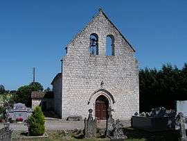
Sainte-Radegonde, Dordogne
| Sainte-Radegonde | ||
|---|---|---|
 | ||
| ||
 Sainte-Radegonde | ||
|
Location within Nouvelle-Aquitaine region  Sainte-Radegonde | ||
| Coordinates: 44°41′29″N 0°40′45″E / 44.6914°N 0.6792°ECoordinates: 44°41′29″N 0°40′45″E / 44.6914°N 0.6792°E | ||
| Country | France | |
| Region | Nouvelle-Aquitaine | |
| Department | Dordogne | |
| Arrondissement | Bergerac | |
| Canton | Issigeac | |
| Government | ||
| • Mayor (2008–2014) | Anne-Marie Queille-Rivier | |
| Area1 | 4.81 km2 (1.86 sq mi) | |
| Population (2008)2 | 55 | |
| • Density | 11/km2 (30/sq mi) | |
| Time zone | CET (UTC+1) | |
| • Summer (DST) | CEST (UTC+2) | |
| INSEE/Postal code | 24492 / 24560 | |
| Elevation |
72–113 m (236–371 ft) (avg. 100 m or 330 ft) | |
|
1 French Land Register data, which excludes lakes, ponds, glaciers > 1 km² (0.386 sq mi or 247 acres) and river estuaries. 2 Population without double counting: residents of multiple communes (e.g., students and military personnel) only counted once. | ||

Sainte-Radegonde is a commune in the Dordogne department in Nouvelle-Aquitaine in southwestern France.
Population
| Historical population | ||
|---|---|---|
| Year | Pop. | ±% |
| 1962 | 115 | — |
| 1968 | 95 | −17.4% |
| 1975 | 71 | −25.3% |
| 1982 | 86 | +21.1% |
| 1990 | 76 | −11.6% |
| 1999 | 64 | −15.8% |
| 2008 | 55 | −14.1% |
See also
References
| Wikimedia Commons has media related to Sainte-Radegonde (Dordogne). |
This article is issued from Wikipedia - version of the 11/9/2016. The text is available under the Creative Commons Attribution/Share Alike but additional terms may apply for the media files.