Sainte-Marie-Outre-l'Eau
| Sainte-Marie-Outre-l'Eau | |
|---|---|
 | |
 Sainte-Marie-Outre-l'Eau | |
|
Location within Normandy region  Sainte-Marie-Outre-l'Eau | |
| Coordinates: 48°56′11″N 1°01′22″W / 48.9364°N 1.0228°WCoordinates: 48°56′11″N 1°01′22″W / 48.9364°N 1.0228°W | |
| Country | France |
| Region | Normandy |
| Department | Calvados |
| Arrondissement | Vire |
| Canton | Saint-Sever-Calvados |
| Intercommunality | Séverine |
| Government | |
| • Mayor (2008–2014) | Joël Gilles |
| Area1 | 5.75 km2 (2.22 sq mi) |
| Population (2008)2 | 85 |
| • Density | 15/km2 (38/sq mi) |
| Time zone | CET (UTC+1) |
| • Summer (DST) | CEST (UTC+2) |
| INSEE/Postal code | 14619 / 14380 |
| Elevation |
46–192 m (151–630 ft) (avg. 65 m or 213 ft) |
|
1 French Land Register data, which excludes lakes, ponds, glaciers > 1 km² (0.386 sq mi or 247 acres) and river estuaries. 2 Population without double counting: residents of multiple communes (e.g., students and military personnel) only counted once. | |
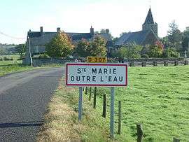
Sainte-Marie-Outre-l'Eau is a French commune in the Calvados department in the Normandy region in northwestern France. The name roughly translates as Saint Mary beyond the Water.
Geography
The village is located approximately 1 kilometre east from Pont-Farcy, on the left bank of the river Vire. The village is a collection of farm houses and a church. The overall population is 85 (in 2008), including outlying farms. Other nearby communes include Pont-Bellanger and Beaumesnil. The nearest large towns are Villedieu-les-Poeles and Vire.
The village is located close to the Calvados tourist attraction Grotte de Bion
Population
| Historical population | ||
|---|---|---|
| Year | Pop. | ±% |
| 1962 | 242 | — |
| 1968 | 224 | −7.4% |
| 1975 | 149 | −33.5% |
| 1982 | 119 | −20.1% |
| 1990 | 106 | −10.9% |
| 1999 | 81 | −23.6% |
| 2008 | 85 | +4.9% |
See also
References
| Wikimedia Commons has media related to Sainte-Marie-Outre-l'Eau. |
This article is issued from Wikipedia - version of the 3/16/2016. The text is available under the Creative Commons Attribution/Share Alike but additional terms may apply for the media files.