Sainte-Anne-du-Lac, Laurentides, Quebec
Not to be confused with the former municipality of Sainte-Anne-du-Lac in Chaudière-Appalaches which is now part of Adstock, Quebec.
Not to be confused with Sainte-Anne-des-Lacs, Quebec.
| Sainte-Anne-du-Lac | ||
|---|---|---|
| Municipality | ||
|
Sainte-Anne-du-Lac and Lake Tapani | ||
| ||
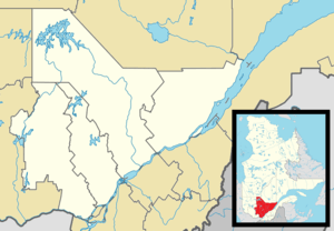
_Quebec_location_diagram.png) Location within Antoine-Labelle RCM. | ||
 Sainte-Anne-du-Lac Location in central Quebec. | ||
| Coordinates: 46°53′N 75°20′W / 46.883°N 75.333°WCoordinates: 46°53′N 75°20′W / 46.883°N 75.333°W[1] | ||
| Country |
| |
| Province |
| |
| Region | Laurentides | |
| RCM | Antoine-Labelle | |
| Settled | 1910s | |
| Constituted | December 30, 1976 | |
| Government[2] | ||
| • Mayor | Aimé Lachapelle | |
| • Federal riding | Laurentides—Labelle | |
| • Prov. riding | Labelle | |
| Area[2][3] | ||
| • Total | 344.70 km2 (133.09 sq mi) | |
| • Land | 322.67 km2 (124.58 sq mi) | |
| Population (2011)[3] | ||
| • Total | 619 | |
| • Density | 1.9/km2 (5/sq mi) | |
| • Pop 2006-2011 |
| |
| • Dwellings | 426 | |
| Time zone | EST (UTC−5) | |
| • Summer (DST) | EDT (UTC−4) | |
| Postal code(s) | J0W 1V0 | |
| Area code(s) | 819 | |
| Highways |
| |
| Website |
www -anne-du-lac | |


Sainte-Anne-du-Lac is a municipality and village in the Laurentides region of Quebec, Canada, part of the Antoine-Labelle Regional County Municipality.
Sainte-Anne-du-Lac is the northern-most place in the Laurentides region, about 46 kilometres (29 mi) from Mont-Laurier. The village itself is located at the northern terminus of Quebec Route 309, on the south shore of Lake Tapani.
Demographics
Population trend:[4]
- Population in 2011: 619 (2006 to 2011 population change: 1.0%)
- Population in 2006: 613
- Population in 2001: 570
- Population in 1996: 623
- Population in 1991: 637
Private dwellings occupied by usual residents: 290 (total dwellings: 426)
Mother tongue:
- English as first language: 1.6%
- French as first language: 94.3%
- English and French as first language: 0%
- Other as first language: 4.1%
See also
References
- ↑ Reference number 77617 of the Commission de toponymie du Québec (French)
- 1 2 Geographic code 79115 in the official Répertoire des municipalités (French)
- 1 2 Statistics Canada 2011 Census - Sainte-Anne-du-Lac census profile
- ↑ Statistics Canada: 1996, 2001, 2006, 2011 census
 |
Lac-Douaire | | ||
| Ferme-Neuve | |
Lac-Douaire | ||
| ||||
| | ||||
| Ferme-Neuve | Mont-Saint-Michel |
| Cities/towns | |
|---|---|
| Municipalities | |
| Villages | |
| Unorganized territories | |
| |
This article is issued from Wikipedia - version of the 3/8/2014. The text is available under the Creative Commons Attribution/Share Alike but additional terms may apply for the media files.