Saint-Pons-la-Calm
| Saint-Pons-la-Calm | ||
|---|---|---|
|
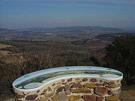
The orientation table at the Gardie lookout | ||
| ||
 Saint-Pons-la-Calm | ||
|
Location within Occitanie region  Saint-Pons-la-Calm | ||
| Coordinates: 44°06′11″N 4°33′25″E / 44.103°N 4.557°ECoordinates: 44°06′11″N 4°33′25″E / 44.103°N 4.557°E | ||
| Country | France | |
| Region | Occitanie | |
| Department | Gard | |
| Arrondissement | Nîmes | |
| Canton | Bagnols-sur-Cèze | |
| Intercommunality | Val de Tave | |
| Government | ||
| • Mayor (2008–2014) | Pierre Baume | |
| Area1 | 6.37 km2 (2.46 sq mi) | |
| Population (2008)2 | 412 | |
| • Density | 65/km2 (170/sq mi) | |
| Time zone | CET (UTC+1) | |
| • Summer (DST) | CEST (UTC+2) | |
| INSEE/Postal code | 30292 / 30330 | |
| Elevation |
82–282 m (269–925 ft) (avg. 100 m or 330 ft) | |
|
1 French Land Register data, which excludes lakes, ponds, glaciers > 1 km² (0.386 sq mi or 247 acres) and river estuaries. 2 Population without double counting: residents of multiple communes (e.g., students and military personnel) only counted once. | ||
.svg.png)
Saint-Pons-la-Calm is a commune in the Gard department in southern France.
Geography
It is located near Bagnols-sur-Cèze, the third-largest city of Gard, a few minutes away from the Pont du Gard, from Uzès, Nîmes, Avignon, Alès, and the Cévennes. Saint-Pons benefits from being at the crossroads of the valleys of the Tave, the Cèze and the Rhône.
Population
| Historical population | ||
|---|---|---|
| Year | Pop. | ±% |
| 1962 | 328 | — |
| 1968 | 330 | +0.6% |
| 1975 | 327 | −0.9% |
| 1982 | 375 | +14.7% |
| 1990 | 391 | +4.3% |
| 1999 | 410 | +4.9% |
| 2008 | 412 | +0.5% |
See also
References
| Wikimedia Commons has media related to Saint-Pons-la-Calm. |
This article is issued from Wikipedia - version of the 11/9/2016. The text is available under the Creative Commons Attribution/Share Alike but additional terms may apply for the media files.