Saint-Michel-des-Saints, Quebec
| Saint-Michel-des-Saints | |
|---|---|
| Municipality | |
 | |
 Location within Matawinie RCM. | |
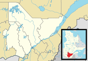 Saint-Michel-des-Saints Location in central Quebec. | |
| Coordinates: 46°41′N 73°55′W / 46.683°N 73.917°WCoordinates: 46°41′N 73°55′W / 46.683°N 73.917°W[1] | |
| Country |
|
| Province |
|
| Region | Lanaudière |
| RCM | Matawinie |
| Settled | 1863 |
| Constituted | March 3, 1979 |
| Government[2] | |
| • Mayor | Jean-Pierre Bellerose |
| • Federal riding | Joliette |
| • Prov. riding | Berthier |
| Area[2][3] | |
| • Total | 568.00 km2 (219.31 sq mi) |
| • Land | 501.28 km2 (193.55 sq mi) |
| Population (2011)[4] | |
| • Total | 2,436 |
| • Density | 4.9/km2 (13/sq mi) |
| • Pop 2006-2011 |
|
| • Dwellings | 1,990 |
| Time zone | EST (UTC−5) |
| • Summer (DST) | EDT (UTC−4) |
| Postal code(s) | J0K 3B0 |
| Area code(s) | 450 and 579 |
| Highways |
|
| Website |
www dessaints |
Saint-Michel-des-Saints is a municipality in the Matawinie Regional County Municipality of Quebec, Canada. During its history, agriculture, forestry, recreation and tourism were the main purposes of the region.
History

In 1863, Thomas-Léandre Brassard settled near the falls of Pine Lake (Lac des Pins) where he built a mill and a manor. Three years later, there were 136 inhabitants. In 1870, the post office opened. By 1883, the Parish of Saint-Michel-des-Saints was officially formed and followed two years later in 1885 by the formation of the parish municipality. The name Saint-Michel-des-Saints, chosen by Ignace Bourget at the suggestion of Father Brassard, honours Michael de Sanctis who lived from 1591 to 1625.[1]
In 1929, the dam on the Matawin River was constructed that would result in the formation of the Taureau Reservoir. This reservoir drowned the neighbouring village of Saint-Ignace-du-Lac (founded in 1877) and consequently this municipality was annexed by Saint-Michel-des-Saints in 1931, thereby increasing its territory by about 15 square kilometres (5.8 sq mi).[1]
In 1979, the Parish Municipality of Saint-Michel-des-Saints and the United Township Municipality of Masson-et-Laviolette (founded in 1914) were merged to form the new Municipality of Saint-Michel-des-Saints.[1]
Geography
Saint-Michel-des-Saints is the largest and northern-most municipality in the Lanaudière region (not considering the unorganized territories). The village itself is located at the northern end of Quebec Route 131 along the Matawin River, near the south-western corner of Taureau Reservoir.[1][2]
The larger lakes in the municipality include Durand, Beauséjour, Hazen, and Kaiagamac. These and the many other ones attract many summer cottage vacationers. The area's forests are popular for hunting and trapping.[1]
Demographics
Population
In the 2011 Census, Statistics Canada originally reported that Saint-Michel-des-Saints had a population of 2,201 living in 979 of its 1,774 total dwellings, an 18.9% change from its 2006 population of 2,713.[5] Statistics Canada subsequently amended the 2011 census results to a population of 2,436 living in 1,084 of its 1,990 total dwellings, a -10.2% change from 2006.[4] With a land area of 501.28 km2 (193.55 sq mi), it had a population density of 4.8596/km2 (12.5862/sq mi) in 2011.[4][5]
| Historical Census Data - Saint-Michel-des-Saints, Quebec[6] | ||||||||||||||||||||||||||
|---|---|---|---|---|---|---|---|---|---|---|---|---|---|---|---|---|---|---|---|---|---|---|---|---|---|---|
|
|
| ||||||||||||||||||||||||
Language
Mother tongue:[7]
- English as first language: 1.5%
- French as first language: 95.7%
- English and French as first language: 0.4%
- Other as first language: 2.4%
Cultural twinning
Saint-Michel-des-Saints is twinned with the community of Saint-Varent in the Deux-Sèvres department in western France.
See also
- List of municipalities in Quebec
- Mauricie
- Matawin River
- Regional Park of Taureau Lake
- Lanaudière
- Matawinie
References
- 1 2 3 4 5 6 "Saint-Michel-des-Saints (Municipalité)" (in French). Commission de toponymie du Québec. Retrieved 2009-11-30.
- 1 2 3 Ministère des Affaires municipales, des Régions et de l'Occupation du territoire
- ↑ Statistics Canada 2011 Census - Saint-Michel-des-Saints census profile
- 1 2 3 "Corrections and updates". Statistics Canada. 2012-10-24. Retrieved 2012-11-11.
- 1 2 "Population and dwelling counts, for Canada, provinces and territories, and census subdivisions (municipalities), 2011 and 2006 censuses (Quebec)". Statistics Canada. 2012-02-08. Retrieved 2012-11-11.
- ↑ Statistics Canada: 1996, 2001, 2006, 2011 census
- ↑ Statistics Canada 2006 Census - Saint-Michel-des-Saints community profile
| Wikimedia Commons has media related to Saint-Michel-des-Saints. |
 |
Lac-Matawin | Baie-de-la-Bouteille | | |
| |
Baie-de-la-Bouteille | |||
| ||||
| | ||||
| Saint-Guillaume-Nord | Saint-Zénon |
| Municipalities | |
|---|---|
| Parishes | |
| Unorganized Territories | |
| |