Saint-André-lez-Lille
| Saint-André-lez-Lille | |
|---|---|
|
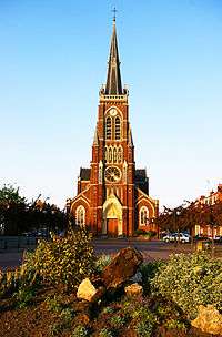
Church of Saint André | |
 Saint-André-lez-Lille | |
|
Location within Hauts-de-France region  Saint-André-lez-Lille | |
| Coordinates: 50°39′39″N 3°02′42″E / 50.6608°N 3.045°ECoordinates: 50°39′39″N 3°02′42″E / 50.6608°N 3.045°E | |
| Country | France |
| Region | Hauts-de-France |
| Department | Nord |
| Arrondissement | Lille |
| Canton | Lille-Ouest |
| Intercommunality | Lille Métropole |
| Government | |
| • Mayor (2008–2014) | Olivier Henno (MoDem) |
| Area1 | 3.16 km2 (1.22 sq mi) |
| Population (2006)2 | 10,931 |
| • Density | 3,500/km2 (9,000/sq mi) |
| Time zone | CET (UTC+1) |
| • Summer (DST) | CEST (UTC+2) |
| INSEE/Postal code | 59527 / 59350 |
| Elevation |
16–22 m (52–72 ft) (avg. 15 m or 49 ft) |
|
1 French Land Register data, which excludes lakes, ponds, glaciers > 1 km² (0.386 sq mi or 247 acres) and river estuaries. 2 Population without double counting: residents of multiple communes (e.g., students and military personnel) only counted once. | |
Saint-André-lez-Lille is a commune in the Nord department in northern France.
It is part of the Urban Community of Lille Métropole.
Heraldry
.svg.png) |
The arms of Saint-André-lez-Lille are blazoned : Per fess 1: Gules, the door of the abbey of Marquette Or; 2: Azure, in fess 3 capes ermine on swords palewise argent. |
International relations
Twin towns – Sister cities
Saint-André-lez-Lille is twinned with:
See also
References
- ↑ "Wieliczka Miasta partnerskie" [Polish]. Urząd Miasta i Gminy Wieliczka. Retrieved 2013-06-25.
| Wikimedia Commons has media related to Saint-André-lez-Lille. |
.svg.png)
This article is issued from Wikipedia - version of the 9/16/2016. The text is available under the Creative Commons Attribution/Share Alike but additional terms may apply for the media files.