Saint-André-du-Lac-Saint-Jean, Quebec
| Saint-André-du-Lac-Saint-Jean | |
|---|---|
| Village municipality | |
 | |
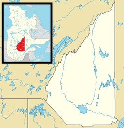 Saint-André-du-Lac-Saint-Jean Location in Saguenay–Lac-Saint-Jean Quebec. | |
| Coordinates: 48°18′54″N 71°59′21″W / 48.3150°N 71.9893°WCoordinates: 48°18′54″N 71°59′21″W / 48.3150°N 71.9893°W[1] | |
| Country |
|
| Province |
|
| Region | Saguenay–Lac-Saint-Jean |
| RCM | Le Domaine-du-Roy |
| Constituted | November 29, 1969 |
| Government[2] | |
| • Mayor | Gabriel Martel |
| • Federal riding | Roberval—Lac-Saint-Jean |
| • Prov. riding | Roberval |
| Area[2][3] | |
| • Total | 146.50 km2 (56.56 sq mi) |
| • Land | 145.29 km2 (56.10 sq mi) |
| Population (2011)[3] | |
| • Total | 488 |
| • Density | 3.4/km2 (9/sq mi) |
| • Pop (2006–11) |
|
| • Dwellings | 299 |
| Time zone | EST (UTC−5) |
| • Summer (DST) | EDT (UTC−4) |
| Postal code(s) | G0W 2K0 |
| Area code(s) | 418 and 581 |
Saint-André-du-Lac-Saint-Jean is a village municipality in Quebec, Canada.
Demographics
Population trend:[4]
- Population in 2011: 488 (2006 to 2011 population change: 0.8%)
- Population in 2006: 484
- Population in 2001: 554
- Population in 1996: 580
- Population in 1991: 606
Private dwellings occupied by usual residents: 199 (total dwellings: 299)
Mother tongue:[5]
- English as first language: 0%
- French as first language: 100%
- English and French as first language: 0%
- Other as first language: 0%
References
- ↑ Reference number 55603 of the Commission de toponymie du Québec (French)
- 1 2 Ministère des Affaires municipales, des Régions et de l'Occupation du territoire - Répertoire des municipalités: Saint-André-du-Lac-Saint-Jean
- 1 2 "Saint-André-du-Lac-Saint-Jean census profile". 2011 Census data. Statistics Canada. Retrieved 2010-12-06.
- ↑ Statistics Canada: 1996, 2001, 2006, 2011 census
- ↑ "Saint-André-du-Lac-Saint-Jean community profile". 2006 Census data. Statistics Canada. Retrieved 2010-12-06.
 |
Chambord | Desbiens | Métabetchouan–Lac-à-la-Croix | |
| Saint-François-de-Sales | |
|||
| ||||
| | ||||
| Lac-Bouchette | Belle-Rivière |
| Cities & Towns | |
|---|---|
| Municipalities | |
| Parishes | |
| Villages | |
| Unorganized territories | |
| |
This article is issued from Wikipedia - version of the 1/25/2014. The text is available under the Creative Commons Attribution/Share Alike but additional terms may apply for the media files.