Sahand
| Sahand | |
|---|---|
 | |
| Highest point | |
| Elevation | 3,707 m (12,162 ft) [1] |
| Prominence | 1,826 m (5,991 ft) [1] |
| Listing | Ultra |
| Coordinates | 37°43′51″N 46°30′00″E / 37.73083°N 46.50000°ECoordinates: 37°43′51″N 46°30′00″E / 37.73083°N 46.50000°E [1] |
| Geography | |
 Sahand Iran | |
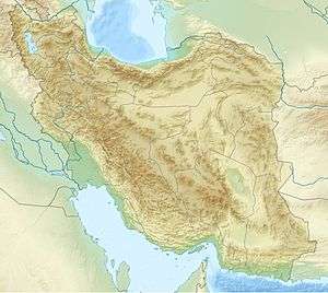
| Location | East Azarbaijan, Iran |
| Geology | |
| Age of rock | 12–0.14 million years |
| Mountain type | Stratovolcano |
| Last eruption | Unknown |
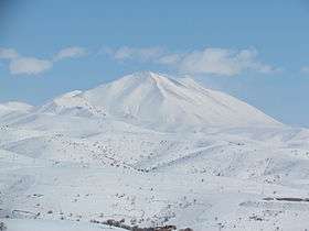
Sahand (Persian : سهند), is a massive, heavily eroded stratovolcano in East Azerbaijan Province, northwestern Iran. At 3,707 m (12,162 ft), it is the highest mountain in the province of East Azarbaijan.
It is one of the highest mountains in Iranian Azerbaijan, in addition to being an important dormant volcano in the country. The Sahand mountains are directly south of Tabriz, the highest peak of which is Kamal at an elevation of 3,707 m.. Approximately 17 peaks can be accounted for as being over 3,000 m. in height. Due to the presence of a variety of flora and fauna, the Sahand mountains are known as the bride of mountains in Iran.
The absolute dating of Sahand rocks indicates that this volcano has been sporadically active from 12 million years ago up to almost 0.14 million years ago. Sahand is made chiefly of dacite and associated felsic rocks.
Winter sports
Sahand Ski Resort is on the northern foothills of the mountain and near the city of Tabriz. This complex, also known as the Sahand Skiing Stadium, has a 1200 meters length ski area and skiing and snowboarding is practiced in the resort. The snow statue competition, which runs once a year at mid-winter in the stadium is a famous and amusing event, which attracts spectators and competitors from all over the country.
See also
- List of volcanoes in Iran
- Sahand University of Technology
- List of Ultras of West Asia
- Kandovan rock dwellings
References
- 1 2 3 "Iran: 54 Mountain Summits with Prominence of 1,500 meters or greater". Peaklist.org. Retrieved 2014-05-25.