Sachigo River
| Sachigo River | |
| Country | Canada |
|---|---|
| Province | Ontario |
| Region | Northwestern Ontario |
| District | Kenora |
| Part of | Hudson Bay drainage basin |
| Tributaries | |
| - left | Beaver Stone River, Thorne River, Sherman River |
| - right | Wapaseese River, Morrison River, Rottenfish River |
| Source | Broadside Lake |
| - elevation | 272 m (892 ft) |
| - coordinates | 53°37′10″N 92°38′19″W / 53.61944°N 92.63861°W |
| Mouth | Severn River |
| - elevation | 75 m (246 ft) |
| - coordinates | 55°04′33″N 88°59′02″W / 55.07583°N 88.98389°WCoordinates: 55°04′33″N 88°59′02″W / 55.07583°N 88.98389°W |
| Length | 380 km (236 mi) |
| Discharge | for Sachigo River below Beaverstone River[1] |
| - average | 144.25 m3/s (5,094 cu ft/s) |
| - max | 191.53 m3/s (6,764 cu ft/s) |
| - min | 104.70 m3/s (3,697 cu ft/s) |
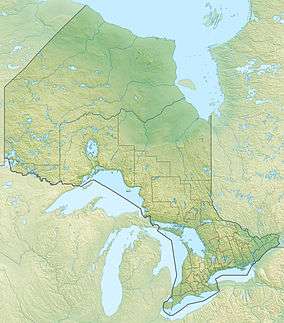 Location of the mouth of the Sachigo River in Ontario | |
The Sachigo River is a river in the Hudson Bay drainage basin in Kenora District in Northwestern Ontario, Canada. It is a tributary of the Severn River.
Course
The Sachigo River begins at Broadside Lake and flows northeast through Pasateko Lake, past the Sachigo Hills, to Sachigo Lake, the location of the Sachigo Lake First Nation and the Sachigo Lake Airport, and where it takes in the right tributary Morrison River. It then heads north, past the Wetiko Hills, to Little Sachigo Lake, exits the lake east and heads once again northeast. The river divides into two branches, takes in the Sherman River on the left branch, then recombines. It continues northeast to reach its mouth at the Severn River, which flows to Hudson Bay.
Tributaries
- Beaver Stone River (left)
- Wapaseese River (right)
- Thorne River (left)
- Sherman River (left)
- Sachigo Lake
- Morrison River (right)
- Rottenfish River (right)
See also
References
- ↑ "Sachigo River below Beaverstone River". South and East Hudson Bay. R-ArcticNET. Retrieved 2011-04-06.
- "Sachigo River". Geographical Names Data Base. Natural Resources Canada. Retrieved 2011-04-06.
- "Sachigo River". Atlas of Canada. Natural Resources Canada. 2010-02-04. Retrieved 2011-04-06. Shows the river course.
External links
- Image of the Sachigo River, given as an example of a glacial spillway; at the Canadian Landscapes Photo Collection, Geological Survey of Canada
This article is issued from Wikipedia - version of the 3/11/2016. The text is available under the Creative Commons Attribution/Share Alike but additional terms may apply for the media files.