Sabra, Gaza
| Sabra | |
|---|---|
| Neighborhood | |
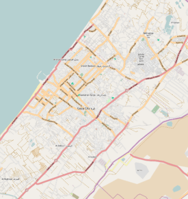 Sabra Location in Gaza Strip | |
| Coordinates: 31°30′16″N 34°27′19.1″E / 31.50444°N 34.455306°E | |
| Country |
|
| Governorate | Gaza Governorate |
| City | Gaza |
| Time zone | EET (UTC+2) |
| • Summer (DST) | +3 (UTC) |
Sabra is a neighborhood district in western Gaza. It was established during the Mandatory Palestine period in Palestine. It contains the city's municipal mark, built in the 1930s south of Omar Mukhtar Street.[1] Sabra is home to the Sabra family.[2] The Israeli Air Force destroyed a small dairy factory in the neighborhood in a wave of airstrikes against the Gaza Strip on 2 April 2010.[3]
References
- ↑ Shahin, 2005, p. 440.
- ↑ Moghadam, 2011, p. 213.
- ↑ Wardrop, Murray. Israel 'carries out wave of air strikes on targets in Gaza Strip'. The Daily Telegraph. 2010-04-02.
Bibliography
- Shahin, Mariam (2005). Palestine: A Guide. Interlink Books. ISBN 1-56656-557-X.
This article is issued from Wikipedia - version of the 3/22/2016. The text is available under the Creative Commons Attribution/Share Alike but additional terms may apply for the media files.