Saúde, Rio de Janeiro
| Saúde | |
|---|---|
| Neighborhood | |
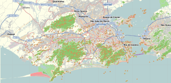 Saúde  Saúde Location in Rio de Janeiro | |
| Coordinates: 22°53′40″S 43°11′12″W / 22.89444°S 43.18667°WCoordinates: 22°53′40″S 43°11′12″W / 22.89444°S 43.18667°W | |
| Country |
|
| State | Rio de Janeiro (RJ) |
| Municipality/City | Rio de Janeiro |
| Zone | Centro |
| Population (2000) | |
| • Total | 2,186 |
Saúde is a neighborhood of Rio de Janeiro, Brazil. Its population in 2000 was 2186. Located on the coast, just north of the historical centre in downtown Rio, west of Praça Maua and east of Gamboa, Rio de Janeiro. It contains several notable hospitals such as Hospital dos Servidores de Estado and Hospital Pro Matre; the name Saúde means "Health" in Portuguese. It is marked by a large number of homes for lower middle class and by numerous sheds, warehouses and depots are located in the region.

São Francisco da Prainha Church, at Saúde
The Church of Our Lady of Saúde was built in 1789 on the seafront and gave its name to the neighborhood of Saúde, although the church belongs, nowadays, to the neighborhood of Gamboa.
Notable landmarks
- Prédio do 5 º Batalhão da Polícia Militar
- Praça Coronel Assunção (Ex-Praça da Harmonia)
- Prédio do Centro Cultural Municipal José Bonifácio
- Sitio Arqueológico Cemitério de Escravos Pretos Novos
- Prédio da Sociedade Dramática Teatral Filhos de Talma
- Igreja Católica de Nossa Senhora da Saúde
- Igreja Católica de Nossa Senhora do Livramento
- Colégio Federal Pedro II Unidade Centro
- Projetos SAGAS (Preservação de Prédios e Casarios-Saúde, Santo Cristo)
- Jardins Suspensos do Valongo
- Observatório Nacional do Valongo
- Prédio do Instituto Oceanográfico do Exercito Brasileiro
- Fortaleza do Morro da Conceição
- Complexo Residencial do Morro da Providencia
- Sitio Arqueológico Quilombola da Pedra do Sal
- Igreja Católica de São Francisco da Motta
- Complexo Residencial e Comercial do Largo da Prainha
- Largo João da Baiana
- Entreposto Negreiro e Comercial da Pedra do Sal
- Escadarias de Pedra Talhada da Pedra do Sal
- Cruzeiro das Almas no Morro da Providencia
- Coreto da Praça da Harmonia
- Estatuas Históricas da Praça Coronel Assunção
- Villa Regia Hotel
This article is issued from Wikipedia - version of the 7/27/2016. The text is available under the Creative Commons Attribution/Share Alike but additional terms may apply for the media files.