Utah State Route 140
| ||||
|---|---|---|---|---|
| Bluffdale Road | ||||
| Route information | ||||
| Defined by Utah Code §72-4-119 | ||||
| Maintained by UDOT | ||||
| Length: | 2.559 mi[1] (4.118 km) | |||
| Existed: | 1984[2] – present | |||
| Major junctions | ||||
| West end: |
| |||
| East end: |
| |||
| Highway system | ||||
| ||||

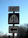
State Route 140 (SR 140) is a 2.559-mile (4.118 km) long state highway in the U.S. state of Utah. It runs from SR 68 in Bluffdale to Interstate 15 (I-15).
Route description
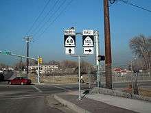
SR 140 begins at an intersection with SR 68 in Bluffdale. It crosses the South Jordan Canal before turning south for about 0.3 miles (0.48 km). It then turns east again and crosses the Jordan River.[3] After an intersection with Spring View Parkway within a residential area. It bumps slightly northward to cross over the Union Pacific Railroad[4] and the FrontRunner commuter rail line. An area near this crossing was considered as a possible location for a FrontRunner station, but the Draper Station was built much further north. It passes a Sherwin-Williams building before entering a more commercial area. Following a crossing of the East Jordan Canal,[5] SR 140 meets SR 287, known as Pony Express Road. It then turns southeast to meet a diamond interchange with I-15.[6][7] The road continues east as Highland Drive toward Draper.[8] Just beyond the end of the state route, Highland Drive passes under a disused railroad viaduct that is proposed for use by phase 2 of the TRAX Blue Line's Draper extension.
The highway is maintained by the Utah Department of Transportation (UDOT), who is responsible for maintaining highways in Utah. As part of this role, they regularly survey traffic on their highways. These surveys are mostly presented in the form of annual average daily traffic, which is the number of vehicles that travel a road during an average day during the year. In 2009, UDOT calculated that approximately 3,920 vehicles used SR 140 daily.[9] No part of the highway has been listed in the National Highway System, a system of roads important to the nation's economy, mobility, and defense.[10]
History
State Route 140, otherwise known as Bluffdale Road,[2] was first designated as State Route 160 in 1933,[11] renamed to State Route 161 in 1935,[12] and deleted from the state highway system in 1953.[13] In 1984, the route was once again added to the state highway system, this time as SR-140 (and in the process co-opted 0.18 miles (0.29 km) from the south end of SR-287), and has remained essentially the same since.[2]
Major intersections
The entire route is in Salt Lake County.
| Location | mi | km | Destinations | Notes | |
|---|---|---|---|---|---|
| Bluffdale | 0.000 | 0.000 | Western terminus | ||
| | 2.373 | 3.819 | |||
| | 2.559 | 4.118 | Eastern terminus, interchange | ||
| 1.000 mi = 1.609 km; 1.000 km = 0.621 mi | |||||
References
- ↑ "State Route 140 highway reference". Utah Department of Transportation. May 1, 2008. Retrieved April 11, 2011.
- 1 2 3 "State Route 140 highway resolutions" (PDF). Utah Department of Transportation. November 2008. Retrieved April 24, 2011.
- ↑ Federal Highway Administration. "NBI Structure Number 0F 608". National Bridge Inventory. Retrieved April 11, 2011.
- ↑ Federal Highway Administration. "NBI Structure Number 0C 779". National Bridge Inventory. Retrieved April 11, 2011.
- ↑ Federal Highway Administration. "NBI Structure Number 0E2475". National Bridge Inventory. Retrieved April 11, 2011.
- ↑ Federal Highway Administration. "NBI Structure Number 3F 207". National Bridge Inventory. Retrieved April 11, 2011.
- ↑ Federal Highway Administration. "NBI Structure Number 1F 207". National Bridge Inventory. Retrieved April 11, 2011.
- ↑ Google (April 11, 2011). "SR 140" (Map). Google Maps. Google. Retrieved April 11, 2011.
- ↑ Utah Department of Transportation (2009). "Traffic on Utah Highways" (PDF). p. 24. Retrieved April 11, 2011.
- ↑ National Highway System: Salt Lake City, Utah (PDF) (Map). Federal Highway Administration. May 2005. Retrieved April 11, 2011.
- ↑ Utah State Legislature (1933). Chapter 30. Session Laws of Utah.
(160) From Bluffdale on route 68 easterly to junction with route 1.
- ↑ Utah State Legislature (1935). Chapter 37: Designation of State Roads. Session Laws of Utah.
Route 161. From Bluffdale on route 68 easterly to junction with route 1.
- ↑ "State Route 161 highway resolutions" (PDF). Utah Department of Transportation. November 2008. Retrieved April 24, 2011.