Sør-Varanger
| Sør-Varanger kommune Mátta-Várjjaga gielda Etelä-Varengin komuuni | |||
|---|---|---|---|
| Municipality | |||
 | |||
| |||
 Sør-Varanger within Finnmark | |||
| Coordinates: 69°43′43″N 030°02′30″E / 69.72861°N 30.04167°ECoordinates: 69°43′43″N 030°02′30″E / 69.72861°N 30.04167°E | |||
| Country | Norway | ||
| County | Finnmark | ||
| District | Øst-Finnmark | ||
| Administrative centre | Kirkenes | ||
| Government | |||
| • Mayor (2015) | Rune Gjertin Rafaelsen (Ap) | ||
| Area | |||
| • Total | 3,967.40 km2 (1,531.82 sq mi) | ||
| • Land | 3,467.24 km2 (1,338.71 sq mi) | ||
| • Water | 500.16 km2 (193.11 sq mi) | ||
| Area rank | 6 in Norway | ||
| Population (2014) | |||
| • Total |
10,090 ( | ||
| • Rank | 114 in Norway | ||
| • Density | 2.54/km2 (6.6/sq mi) | ||
| • Change (10 years) | 6.2 % | ||
| Demonym(s) | Varangværing[1] | ||
| Time zone | CET (UTC+1) | ||
| • Summer (DST) | CEST (UTC+2) | ||
| ISO 3166 code | NO-2030 | ||
| Official language form | Bokmål | ||
| Website |
www | ||
|
| |||

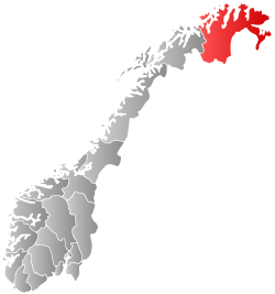
Sør-Varanger (Northern Sami: Máttá-Várjjat, Kven: Etelä-Varenki, Finnish: Etelä-Varanki, Russian: Сёр-Вара́нгер)[2] is a municipality in Finnmark county, Norway. The administrative centre of the municipality is the town of Kirkenes. Other settlements in the municipality include the villages of Bjørnevatn, Bugøynes, Elvenes, Grense Jakobselv, Hesseng, Jakobsnes, Neiden, and Sandnes. Located west of the Norway–Russia border, Sør-Varanger is the only Norwegian municipality that shares a land border with Russia, with the only legal border crossing at Storskog.
Name
The meaning of the name Sør-Varanger comes from the name of the large Varangerfjorden (Old Norse: Ver(j)angr) on the northern shore of the municipality. The first part is ver meaning "fishing village" and the last part is angr which means "fjord". It was first probably used for the narrow fjord on the inside of Angsnes which now is called "Meskfjorden" and leads into Varangerbotn. Sør means "south" in Norwegian. Prior to 1918, the name was spelled Sydvaranger (also meaning "South Varanger"). Before 1964, there also was a municipality named Nord-Varanger, located north of the Varangerfjorden, covering most of present-day Vadsø municipality.[3]
History
Prehistoric labyrinth constructions at Holmengrå, were possibly used for religious purposes.
The original inhabitants of the area are the Skolt Sami. This Sami group migrated between coast and inland in present Norwegian, Finnish, and Russian territory long before any borders existed. In the 16th century, they were converted to the Russian Orthodox faith, and still today the chapel of Saint George at Neiden, dating from 1565, is a reminder of eastern influence.
The Orthodox chapel of Saint George is in Neiden.
In 1826, the previously disputed areas were divided between Norway and Russia, causing great difficulties for the Sami. The Norwegian state also invited Norwegian settlers to come to the area, building Lutheran churches to counterbalance the Orthodox heritage, notably the King Oscar II Chapel, located immediately west of the Russian border. The historic border crossing station was at Skafferhullet (which was replaced with the present day station at Storskog).

The King Oscar II Chapel in Grense Jakobselv on the Russian border was built in 1869 to mark the border.
During the 19th century, Finnish settlers (Kven) arrived to the valleys, and since 1906, Norwegians came in large numbers because of the iron mining starting up near Kirkenes. After the Treaty of Tartu the area of Petsamo was ceded to Finland, and Sør-Varanger (and Norway) no longer bordered Russia, until Finland had to cede it back to the Soviet Union in 1944.
In 1906, the Sydvaranger company opened the Bjørnevatn Mine at Bjørnevatn and four years later the mine was connected to the port in Kirkenes by Kirkenes–Bjørnevatn Line, the world's most northern railway. The mine was closed in 1996, but re-opened in 2009.
In a 1944 report to Norway's prime minister in exile, a Norwegian government official (embedsmann ) in Finnmark—Thore Boye—said that Norwegian soldiers had [crop-] cut (snauklippet) "25 young girls—some of them married" who had been pointed out by local men, as having had relations with German soldiers".[4]
Establishment of municipality
The municipality of Sør-Varanger was established on 1 July 1858 when the southern district of the municipality of Vadsø (population: 1,171) was separated to form the new municipality. The borders of the municipality have not changed since that time.[5]
Coat-of-arms
The coat-of-arms were granted on 16 April 1982. The arms show three flames in gold/orange. The division of the shield symbolizes the importance of the number three: The three main sources of income are agriculture, mining, and fishing; the municipality also has three main rivers (Neiden, Pasvikelva, and Jakobselva) that form the borders of Norway, Russia, and Finland; and there are three cultures in the municipality: Norwegians, Finns, and Sami.[6]
Geography

Sør-Varanger is a vast area of about 3,700 square kilometres (1,429 sq mi), situated between Finland and Russia. Most of the area is low-lying forest of pine and birch, with barren sections facing the Barents Sea.
The Varangerfjorden runs along the northern part of the municipality and the Bøkfjorden runs north-south cutting into the municipality and flowing into the Varangerfjorden. The large island of Skogerøya lies on the west side of the Bøkfjorden. Skogerøytoppen is the tallest mountain on Skogerøya. The Bøkfjord Lighthouse lies along the mouth of the Bøkfjorden.
The municipal centre of Sør-Varanger is the town of Kirkenes, located on a peninsula in the Bøkfjorden. Other settlements include Bugøynes, Neiden, and little hamlets along the river of Pasvikelva. The local airport is called Kirkenes Airport, Høybuktmoen which is also a military camp. The Garrison of Sør-Varanger (GSV) is based at Høybuktmoen.
The flora of the area is a part of the Russian and Siberian taiga, including a few hundred spruce trees of the Russian variety. Bears also inhabit the upper valley, notably in the Øvre Pasvik National Park, Øvre Pasvik Landscape Protection Area, and Pasvik Nature Reserve.
Lakes include Ellenvatn, Gardsjøen, Garsjøen, Klistervatnet, and Ødevatn. The fjords include Korsfjorden.[7]
Climate
| Climate data for Kirkenes Airport, Høybuktmoen | |||||||||||||
|---|---|---|---|---|---|---|---|---|---|---|---|---|---|
| Month | Jan | Feb | Mar | Apr | May | Jun | Jul | Aug | Sep | Oct | Nov | Dec | Year |
| Average high °C (°F) | −8.2 (17.2) |
−7.8 (18) |
−3.8 (25.2) |
0.6 (33.1) |
5.7 (42.3) |
12.5 (54.5) |
16.1 (61) |
13.9 (57) |
8.8 (47.8) |
2.4 (36.3) |
−2.8 (27) |
−5.9 (21.4) |
2.6 (36.7) |
| Daily mean °C (°F) | −11.8 (10.8) |
−11.3 (11.7) |
−7.4 (18.7) |
−2.4 (27.7) |
3.0 (37.4) |
8.5 (47.3) |
12.1 (53.8) |
10.5 (50.9) |
6.2 (43.2) |
0.4 (32.7) |
−5.5 (22.1) |
−9.7 (14.5) |
−0.6 (30.9) |
| Average low °C (°F) | −16.2 (2.8) |
−15.1 (4.8) |
−10.8 (12.6) |
−5.7 (21.7) |
0.0 (32) |
5.2 (41.4) |
8.7 (47.7) |
7.5 (45.5) |
3.6 (38.5) |
−1.9 (28.6) |
−8.7 (16.3) |
−13.4 (7.9) |
−3.9 (25) |
| Average precipitation mm (inches) | 32 (1.26) |
23 (0.91) |
21 (0.83) |
20 (0.79) |
23 (0.91) |
41 (1.61) |
60 (2.36) |
62 (2.44) |
47 (1.85) |
35 (1.38) |
33 (1.3) |
33 (1.3) |
430 (16.93) |
| Average precipitation days (≥ 1 mm) | 8.5 | 6.5 | 6.0 | 6.2 | 6.0 | 8.2 | 8.9 | 10.5 | 9.8 | 9.5 | 8.6 | 9.0 | 97.7 |
| Source: Norwegian Meteorological Institute[8] | |||||||||||||
Government
All municipalities in Norway, including Sør-Varanger, are responsible for primary education (through 10th grade), outpatient health services, senior citizen services, unemployment and other social services, zoning, economic development, and municipal roads. The municipality is governed by a municipal council of elected representatives, which in turn elect a mayor.
Municipal council
The municipal council (Kommunestyre) of Sør-Varanger is made up of 29 representatives that are elected to every four years. Currently, the party breakdown is as follows:[9]
| Party Name | Name in Norwegian | Number of representatives | |
|---|---|---|---|
| Labour Party | Arbeiderpartiet | 15 | |
| Progress Party | Fremskrittspartiet | 2 | |
| Conservative Party | Høyre | 5 | |
| Centre Party | Senterpartiet | 5 | |
| Socialist Left Party | Sosialistisk Venstreparti | 2 | |
| Total number of members: | 29 | ||
Mayor
Mayors (ordfører) of the past and present include Cecilie Hansen (2011—incumbent as of 2015; of the Centre Party).
Transportation
Kirkenes Airport, Høybuktmoen is operated by the state-owned Avinor and serves as the main primary airport for eastern Finnmark county. Located 10 kilometers (6.2 mi) west of Kirkenes, at Høybuktmoen,[10] the airport has a 2,115-meter (6,939 ft)[11] long runway which allows Scandinavian Airlines and Norwegian Air Shuttle to operate direct flights to Oslo. In addition Widerøe uses the airport as a hub to regional airports throughout Finnmark.[12]
The Kirkenes–Bjørnevatn Line is a 8.5-kilometer (5.3 mi) railway, until 2010 the world's northern-most, which runs between Kirkenes and Bjørnevatn;[13]
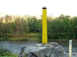
The European route E06 highway has its northern endpoint in the town of Kirkenes. This highway heads west and then south to the rest of Norway. The European route E105 highway has its northern endpoint in the village of Hesseng, just south of Kirkenes. That highway heads south into Russia through the Storskog border crossing, the only legal public crossing on the Norway-Russia border.
Practice of religion
Churches
The Church of Norway has one parish (sokn) within the municipality of Sør-Varanger. It is part of the Varanger deanery in the Diocese of Nord-Hålogaland.
| Parish (Sokn) | Church Name | Location of the Church | Year Built |
|---|---|---|---|
| Sør-Varanger | Bugøynes Chapel | Bugøynes | 1989 |
| Kirkenes Church | Kirkenes | 1959 | |
| King Oscar II Chapel | Grense Jakobselv | 1869 | |
| Neiden Chapel | Neiden | 1902 | |
| Svanvik Church | Svanvik (in the Pasvikdalen valley) | 1934 |
Archaeology
In 2015 rock carvings, estimatedly dated to 4200–5200 B.C. were found at Tømmerneset on Gamneset, several kilometers outside Kirkenes.[14][15] The carvings were discovered along an old path used by reindeers—between two crags—by an archaeologist traveling between existing excavation sites at Gamneset.[14] (A planned oil terminal will expectedly shut out the general public, from the site of the carvings.[16])
Leisure
Popular leisure activities include salmon fishing in one of the numerous rivers, hunting for moose and grouse, and snowmobile driving. Many inhabitants also own and frequently use a cabin located in more remote parts of the municipality.
See also
References
- ↑ "Navn på steder og personer: Innbyggjarnamn" (in Norwegian). Språkrådet. Retrieved 2015-12-01.
- ↑ Russian pronunciation: [ˌsʲɵr vɐˈranɡʲɪr]
- ↑ Rygh, Oluf (1924). Norske gaardnavne: Finmarkens amt (in Norwegian) (18 ed.). Kristiania, Norge: W. C. Fabritius & sønners bogtrikkeri. p. 288.
- ↑ "Skamklipt av norske soldater - NRK Dokumentar". nrk.no. Retrieved 21 August 2016.
- ↑ Jukvam, Dag (1999). "Historisk oversikt over endringer i kommune- og fylkesinndelingen" (PDF) (in Norwegian). Statistisk sentralbyrå.
- ↑ Norske Kommunevåpen (1990). "Nye kommunevåbener i Norden". Retrieved 11 December 2008.
- ↑ Mener Miljøverndepartementet lar seg presse av oljenæringen [Of the opinion that the Department of Environmental Protection lets itself coerce by the oil industry]
- ↑ "eKlima Web Portal". Norwegian Meteorological Institute.
- ↑ "Table: 04813: Members of the local councils, by party/electoral list at the Municipal Council election (M)" (in Norwegian). Statistics Norway. 2015.
- ↑ "To/from airport". Avinor. Retrieved 26 August 2012.
- ↑ "ENKR – Kirkenes/Høybuktmoen" (PDF). Avinor. 8 March 2012. Retrieved 19 August 2012.
- ↑ "Flight Timetables". Avinor. Retrieved 26 August 2012.
- ↑ Bjerke, Thor; Jerijervi, Ørjan (2003). "Aktieselskabet Sydvarangers jernbane". Ottar (in Norwegian). Tromsø: University of Tromsø. 244: 32–39.
- 1 2 "Oppdaget sensasjonelt helleristningsfelt i lunsjpausen - Aftenposten". aftenposten.no. Retrieved 21 August 2016.
- ↑ "Sensasjonelt helleristningsfunn i Varanger - NRK Finnmark - Lokale nyheter, TV og radio". nrk.no. Retrieved 21 August 2016.
- ↑ "Helleristningene i Varanger - Video | Tror ikke folk får se helleristningene". nrk.no. Retrieved 21 August 2016.
External links
| Wikimedia Commons has media related to Sør-Varanger. |
- Weather information for Sør-Varanger (Norwegian)
- Tourist information: www.visitkirkenes.no
- Video of 2015 rock carvings find, Helleristningene i Varanger