Rygge
| Rygge kommune | |||
|---|---|---|---|
| Municipality | |||
| |||
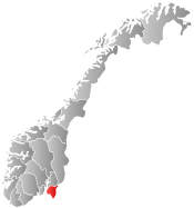
 Rygge within Østfold | |||
| Coordinates: 59°22′29″N 10°42′53″E / 59.37472°N 10.71472°ECoordinates: 59°22′29″N 10°42′53″E / 59.37472°N 10.71472°E | |||
| Country | Norway | ||
| County | Østfold | ||
| Administrative centre | Rygge | ||
| Government | |||
| • Mayor (2007) | Inger-Lise Skartlien (Ap) | ||
| Area | |||
| • Total | 74 km2 (29 sq mi) | ||
| • Land | 70 km2 (30 sq mi) | ||
| Area rank | 400 in Norway | ||
| Population (2004) | |||
| • Total | 13,753 | ||
| • Rank | 76 in Norway | ||
| • Density | 197/km2 (510/sq mi) | ||
| • Change (10 years) | 12.8 % | ||
| Demonym(s) | Ryggesokning[1] | ||
| Time zone | CET (UTC+1) | ||
| • Summer (DST) | CEST (UTC+2) | ||
| ISO 3166 code | NO-0136 | ||
| Official language form | Bokmål | ||
| Website |
www | ||
|
| |||

Rygge is a municipality in Østfold county, Norway. The administrative centre of the municipality is the village of Rygge. Rygge was established as a municipality on 1 January 1838 (see formannskapsdistrikt).
The emblem of Rygge is the Pasque flower. Rygge is connected to Oslo by double-tracked railway, and four-lane motorway.
Rygge is served by Moss Airport.
Climate
| Climate data for Rygge 1961-1990, extremes 1958-1982 | |||||||||||||
|---|---|---|---|---|---|---|---|---|---|---|---|---|---|
| Month | Jan | Feb | Mar | Apr | May | Jun | Jul | Aug | Sep | Oct | Nov | Dec | Year |
| Record high °C (°F) | 11.1 (52) |
12.8 (55) |
14.8 (58.6) |
19.7 (67.5) |
26.9 (80.4) |
31.0 (87.8) |
30.4 (86.7) |
34.2 (93.6) |
25.0 (77) |
20.0 (68) |
14.7 (58.5) |
12.1 (53.8) |
34.2 (93.6) |
| Average high °C (°F) | −1.2 (29.8) |
−0.6 (30.9) |
3.6 (38.5) |
8.8 (47.8) |
15.4 (59.7) |
19.7 (67.5) |
20.8 (69.4) |
19.9 (67.8) |
15.4 (59.7) |
10.2 (50.4) |
4.1 (39.4) |
0.5 (32.9) |
9.72 (49.48) |
| Average low °C (°F) | −7.4 (18.7) |
−7.8 (18) |
−4.1 (24.6) |
−0.1 (31.8) |
5.4 (41.7) |
9.7 (49.5) |
11.1 (52) |
10.2 (50.4) |
6.9 (44.4) |
3.7 (38.7) |
−1.7 (28.9) |
−5.9 (21.4) |
1.67 (35.01) |
| Record low °C (°F) | −21.7 (−7.1) |
−24.2 (−11.6) |
−22.1 (−7.8) |
−7.4 (18.7) |
−1.4 (29.5) |
0.0 (32) |
4.8 (40.6) |
2.5 (36.5) |
−4.1 (24.6) |
−9.7 (14.5) |
−13.1 (8.4) |
−26.5 (−15.7) |
−26.5 (−15.7) |
| Average precipitation mm (inches) | 58 (2.28) |
43 (1.69) |
54 (2.13) |
43 (1.69) |
57 (2.24) |
63 (2.48) |
73 (2.87) |
88 (3.46) |
94 (3.7) |
106 (4.17) |
87 (3.43) |
63 (2.48) |
829 (32.62) |
| Average precipitation days | 9.8 | 7.4 | 8.8 | 7.4 | 8.3 | 9.2 | 9.2 | 10.1 | 10.8 | 11.7 | 11.6 | 9.4 | 113.7 |
| Source: met Norway Eklima | |||||||||||||
General information
Name
The municipality (originally the parish) is named after the old Rygge farm, since the first church was built there. The Old Norse form of the name is not known (the oldest manuscripts from 1353-1528 use the form "Ryg(g)jof"). A possible (but uncertain) reconstruction is Rýgjuhof. The first element would then be the genitive case of rýgja, a sideform of rýgr which means "lady". (Like ylgja to ylgr, both forms with the meaning 'she-wolf'.) The last element is probably hof meaning "temple". If this is correct, then the word rýgja most probably is referring to the goddess Freyja, since the meaning of the word freyja also is 'lady'.
An alternative explanation is that the word is derived from "rygg", which means "ridge", and related to place names like "Ryen" further east. The "ridge" in question would be the end moraine that runs across the landscape here, from the other side of the fjord and stretching east through Sweden and into the Baltic region. In Østfold, this moraine is referred to as the "Raet".
Coat-of-arms
The coat-of-arms is from modern times. It was granted on 30 November 1984. The arms show a golden spur on a red background. A spur like this was found in the area that dated back to the Viking Age. It is one of the largest golden items that was ever found in Norway and was thus chosen as a symbol on the arms.[2]

Rygge Church
Rygge church (Rygge kirke) is a medieval era church located in the village of Kirkegrenda. The church belongs to Vestre Borgesyssel deanery in Diocese of Borg. Rygge church is one of the county's better preserved medieval stone churches. It is built around the year 1170. Rygge church was originally a chapter church, which had income from a larger area than a parish and contained several villages. The building is characterized by the use of large stones, partly of granite, but parts of the facade is carved of stone cultivar, including large parts of the north portal. It has long nave and lower and narrower choir. The church was restored in 1967. [3]
Military
Rygge Air Station replaced a temporary airfield constructed by German forces during World War II. The contemporary airfield, northeast of the highway and main railway is situated in Rygge and its neighbouring municipality Råde. It was constructed from 1952–1954 and until recently it was one of the largest establishments of the Royal Norwegian Air Force. The military use of the airfield is now much reduced. A civilian air terminal Moss Airport, Rygge, was opened in early 2008.
| Ancestry | Number |
|---|---|
| | 390 |
| | 261 |
| | 114 |
| | 106 |
| | 101 |
| | 86 |
| | 69 |
| | 54 |
See also
- Kirkegrenda, a village in the municipality
References
- ↑ "Navn på steder og personer: Innbyggjarnamn" (in Norwegian). Språkrådet. Retrieved 2015-12-01.
- ↑ Norske Kommunevåpen (1990). "Nye kommunevåbener i Norden". Retrieved 2008-12-15.
- ↑ Sigrid Marie Christie, Håkon Christie. "Rygge kirke". Norges Kirker. Retrieved October 1, 2016.
- ↑ "Immigrants and Norwegian-born to immigrant parents, by immigration category, country background and percentages of the population". ssb.no. Retrieved 29 June 2015.
External links
-
 Media related to Rygge at Wikimedia Commons
 -
 The dictionary definition of Rygge at Wiktionary
 - Municipal fact sheet from Statistics Norway
-

Wikivoyage has a travel guide for Østfold.