Rye, Colorado
| Town of Rye, Colorado | |
|---|---|
| Town | |
|
Main Street in Rye, looking east. | |
 Location in Pueblo County and the state of Colorado | |
| Coordinates: 37°55′19″N 104°55′48″W / 37.92194°N 104.93000°WCoordinates: 37°55′19″N 104°55′48″W / 37.92194°N 104.93000°W | |
| Country | United States |
| State | Colorado |
| County[1] | Pueblo County |
| Incorporated | November 22, 1937[2] |
| Government | |
| • Type | Statutory Town[1] |
| Area | |
| • Total | 0.1 sq mi (0.3 km2) |
| • Land | 0.1 sq mi (0.3 km2) |
| • Water | 0 sq mi (0 km2) |
| Elevation | 6,801 ft (2,073 m) |
| Population (2000) | |
| • Total | 202 |
| • Density | 2,020/sq mi (673.3/km2) |
| Time zone | Mountain (MST) (UTC-7) |
| • Summer (DST) | MDT (UTC-6) |
| ZIP code[3] | 81069 |
| Area code(s) | 719 |
| FIPS code | 08-66895 |
| GNIS feature ID | 0193917 |

Rye is a Statutory Town in Pueblo County, Colorado, United States. It is part of the Pueblo, Colorado Metropolitan Statistical Area. The population was 202 at the 2000 census.
A post office called Rye has been in operation since 1881.[4] Some say the community was named for the wild rye native to the area, while others believe the place is named for rye whiskey.[5]
Geography
Rye is located at 37°55′19″N 104°55′48″W / 37.92194°N 104.93000°W (37.921876, −104.929999).[6]
According to the United States Census Bureau, the town has a total area of 0.1 square miles (0.26 km2), all of it land.
Climate
Rye has a humid subtropical climate (Köppen Cfa), a climate type that is common in the eastern United States, but very rare in this region of the country; steppe (Köppen BSk, BSh) or subtropical highland climates (Köppen Cwb) are more common in higher-altitude parts of this region. This isolated pocket of humid subtropical climate exists due to the orographic enhancement of precipitation levels and summers still being just hot enough to qualify for the climate type. Despite its exceptional classification, Rye has much in common with other locations in its part of Colorado. Although conditions are not wet at any time of year, there is increased precipitation in March and April, as well as a snowfall maximum in March, with the snowiest periods being November and January through April. The North American Monsoon creates a second wet period in June and July. This climate features summers with hot daytime temperatures and mild to cool nights, along with chilly and somewhat snowy winters. Typical of its region, winters are quite variable, with December–February temperatures having ranged from as low as −36 °F (−38 °C) to as high as 76 °F (24.4 °C). The all-time record high is 101 °F (38.3 °C), set on June 21, 1981, and the all-time record low is −36 °F (−37.8 °C), set on January 12, 1963.
| Climate data for Rye, Colorado | |||||||||||||
|---|---|---|---|---|---|---|---|---|---|---|---|---|---|
| Month | Jan | Feb | Mar | Apr | May | Jun | Jul | Aug | Sep | Oct | Nov | Dec | Year |
| Record high °F (°C) | 76 (24) |
75 (24) |
80 (27) |
87 (31) |
98 (37) |
101 (38) |
100 (38) |
98 (37) |
95 (35) |
88 (31) |
83 (28) |
76 (24) |
101 (38) |
| Average high °F (°C) | 47 (8) |
49 (9) |
56 (13) |
64 (18) |
73 (23) |
82 (28) |
87 (31) |
84 (29) |
78 (26) |
68 (20) |
55 (13) |
46 (8) |
65.8 (18.8) |
| Average low °F (°C) | 20 (−7) |
21 (−6) |
27 (−3) |
34 (1) |
43 (6) |
51 (11) |
57 (14) |
56 (13) |
47 (8) |
37 (3) |
27 (−3) |
19 (−7) |
36.6 (2.5) |
| Record low °F (°C) | −36 (−38) |
−25 (−32) |
−14 (−26) |
0 (−18) |
14 (−10) |
31 (−1) |
42 (6) |
37 (3) |
21 (−6) |
−1 (−18) |
−19 (−28) |
−27 (−33) |
−36 (−38) |
| Average precipitation inches (mm) | 0.84 (21.3) |
0.95 (24.1) |
1.96 (49.8) |
2.18 (55.4) |
1.82 (46.2) |
1.54 (39.1) |
2.00 (50.8) |
2.35 (59.7) |
0.93 (23.6) |
1.19 (30.2) |
1.20 (30.5) |
1.12 (28.4) |
18.08 (459.1) |
| Average snowfall inches (cm) | 9.9 (25.1) |
11.2 (28.4) |
15.1 (38.4) |
9.6 (24.4) |
1.2 (3) |
0.1 (0.3) |
0 (0) |
0 (0) |
0.5 (1.3) |
4.1 (10.4) |
9.4 (23.9) |
7.7 (19.6) |
68.8 (174.8) |
| Source: The Weather Channel,[7] Weatherbase (snowfall)[8] | |||||||||||||
Demographics
| Historical population | |||
|---|---|---|---|
| Census | Pop. | %± | |
| 1940 | 163 | — | |
| 1950 | 166 | 1.8% | |
| 1960 | 179 | 7.8% | |
| 1970 | 207 | 15.6% | |
| 1980 | 232 | 12.1% | |
| 1990 | 168 | −27.6% | |
| 2000 | 202 | 20.2% | |
| 2010 | 153 | −24.3% | |
| Est. 2015 | 156 | [9] | 2.0% |
As of the census[11] of 2000, there were 202 people, 87 households, and 52 families residing in the town. The population density was 2,016.5 people per square mile (779.9/km²). There were 119 housing units at an average density of 1,187.9 per square mile (459.5/km²). The racial makeup of the town was 91.09% White, 0.50% African American, 0.50% Native American, 1.49% from other races, and 6.44% from two or more races. Hispanic or Latino of any race were 3.47% of the population.
There were 87 households out of which 27.6% had children under the age of 18 living with them, 43.7% were married couples living together, 5.7% had a female householder with no husband present, and 39.1% were non-families. 34.5% of all households were made up of individuals and 14.9% had someone living alone who was 65 years of age or older. The average household size was 2.32 and the average family size was 3.02.
In the town the population was spread out with 23.8% under the age of 18, 8.9% from 18 to 24, 23.8% from 25 to 44, 24.3% from 45 to 64, and 19.3% who were 65 years of age or older. The median age was 42 years. For every 100 females there were 110.4 males. For every 100 females age 18 and over, there were 102.6 males.
The median income for a household in the town was $33,750, and the median income for a family was $43,750. Males had a median income of $21,250 versus $20,625 for females. The per capita income for the town was $15,681. About 7.1% of families and 11.8% of the population were below the poverty line, including 13.3% of those under the age of eighteen and 11.8% of those sixty five or over.
See also
References
- 1 2 "Active Colorado Municipalities". State of Colorado, Department of Local Affairs. Retrieved 2007-09-01.
- ↑ "Colorado Municipal Incorporations". State of Colorado, Department of Personnel & Administration, Colorado State Archives. 2004-12-01. Retrieved 2007-09-02.
- ↑ "ZIP Code Lookup" (JavaScript/HTML). United States Postal Service. Retrieved January 1, 2008.
- ↑ "Post offices". Jim Forte Postal History. Retrieved 9 July 2016.
- ↑ Dawson, John Frank. Place names in Colorado: why 700 communities were so named, 150 of Spanish or Indian origin. Denver, CO: The J. Frank Dawson Publishing Co. p. 44.
- ↑ "US Gazetteer files: 2010, 2000, and 1990". United States Census Bureau. 2011-02-12. Retrieved 2011-04-23.
- ↑ "Average Weather for Rye, CO". The Weather Channel. Retrieved February 26, 2012.
- ↑ "Historical Weather for Rye, Colorado". Weatherbase. Retrieved February 26, 2012.
- ↑ "Annual Estimates of the Resident Population for Incorporated Places: April 1, 2010 to July 1, 2015". Retrieved July 2, 2016.
- ↑ "Census of Population and Housing". Census.gov. Retrieved June 4, 2015.
- ↑ "American FactFinder". United States Census Bureau. Retrieved 2008-01-31.
External links
Municipalities and communities of Pueblo County, Colorado, United States | ||
|---|---|---|
| City | 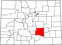 | |
| Towns | ||
| CDPs | ||
| Unincorporated communities | ||
| Ghost town | ||
