Russellville, Kentucky
| Russellville | |
|---|---|
| City | |
|
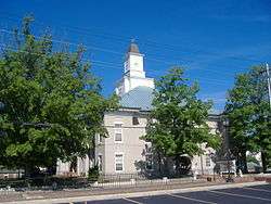
Logan County courthouse in Russellville, Kentucky | |
 Location in the state of Kentucky | |
| Coordinates: 36°50′33″N 86°53′34″W / 36.84250°N 86.89278°WCoordinates: 36°50′33″N 86°53′34″W / 36.84250°N 86.89278°W | |
| Country | United States |
| State | Kentucky |
| County | Logan |
| Established | 1810[1] |
| Incorporated | 1840[1] |
| Named for | a local landowner |
| Government | |
| • Mayor | Mark Stratton |
| Area | |
| • Total | 10.6 sq mi (27.6 km2) |
| • Land | 10.6 sq mi (27.5 km2) |
| • Water | 0.0 sq mi (0.0 km2) |
| Elevation | 594 ft (181 m) |
| Population (2010) | |
| • Total | 6,947 |
| Time zone | CST (UTC-6) |
| • Summer (DST) | CDT (UTC-5) |
| ZIP Code | 42276 |
| Area code(s) | 270 & 364 |
| FIPS code | 21-67512 |
| GNIS feature ID | 0502534 |
| Website |
www |
Russellville is a home rule-class city[2] in Logan County, Kentucky, in the United States. It is the seat of its county.[3] The population was 6,947 at the time of the 2010 U.S. Census.
History

Local historian. Alex C. Finley claimed the area was first settled by Gasper Butcher, as a frontier settlement of the Transylvania Colony, of Virginia, now present-day Russellville, Kentucky, around 1780, but others have questioned this claim.[4] Although the area is known to have been called Big Boiling Spring, Gasper Butcher's Spring, and Butcher's Station, W.R. Jillson was unable to find written records of any habitation before 1790, when William Cook and his wife erected Cook's Cabin, accompanied by eighteen-year-old William Stewart.[4][5] Also known as Cook's Station, the community – located about 1 mile (1.6 km) east of the present city[4] – became Logan Court House when it was chosen as the seat of newly formed Logan County in 1792.
Gen. William Russell was given a 2,000-acre (810 ha) grant for his military service during the American Revolution. He donated part of this property, in 1795, as a platted section for the county seat, known as Logan Court House. The town was renamed in Russell's honor in 1798.[4] It was formally established by the state legislature on January 15, 1810.[1] It was incorporated as a city on February 19, 1840.[1]
In the early 19th century, the community had leaders who were politically prominent in the state. Four homes in the city still stand which at one time were the residences of future governors of Kentucky: John Breathitt, James Morehead, John J. Crittenden, and Charles S. Morehead.[5]
During the Civil War, the Kentucky General Assembly declared its neutrality and declined to secede with the rest of the South. Even Kentucky was a slave state and Confederate sentiment was strong in the Blue Grass and the west, the residents of the mountainous eastern section were mainly small farmers and pro-Union. In the summer of 1862, when Confederate troops had occupied the area, 116 prominent pro-Confederates from 43 counties met as the Russellville Convention and created a rival Confederate government for Kentucky.[5] George W. Johnson was elected as the state's Confederate governor. Despite de facto Union control over the rest of Kentucky, the government was recognized and Kentucky admitted to the Confederacy. Kentucky thus became the thirteenth star on the Confederate flag.
After the war, Kentucky struggled for some years with unrest. A gang made up of the former Confederate guerrillas Cole Younger, George Shepard, and Oliver Shepard, along with Confederate veterans John Jarrett and Arthur McCoy, robbed the Nimrod Long Bank[5] or the Southern Deposit Bank in Russellville on March 20, 1868. Brothers Frank and Jesse James, who later had their own outlaw gang, may have taken part. A Russellville bank on the city square displays a large mural painted depicting the robbery. A reenactment (called a "play on horseback") is performed annually during the city's Tobacco and Heritage Festival.
Several downtown homes have been listed on the National Register of Historic Places.
Geography
Russellville is located at 36°50′33″N 86°53′34″W / 36.84250°N 86.89278°W (36.842601, -86.892661).[6]
According to the United States Census Bureau, the city has a total area of 10.6 square miles (27 km2), all land.
Demographics
| Historical population | |||
|---|---|---|---|
| Census | Pop. | %± | |
| 1800 | 117 | — | |
| 1810 | 532 | 354.7% | |
| 1830 | 1,358 | — | |
| 1840 | 1,196 | −11.9% | |
| 1850 | 1,272 | 6.4% | |
| 1860 | 1,089 | −14.4% | |
| 1870 | 1,843 | 69.2% | |
| 1880 | 2,058 | 11.7% | |
| 1890 | 2,253 | 9.5% | |
| 1900 | 2,591 | 15.0% | |
| 1910 | 3,111 | 20.1% | |
| 1920 | 3,124 | 0.4% | |
| 1930 | 3,297 | 5.5% | |
| 1940 | 3,983 | 20.8% | |
| 1950 | 4,529 | 13.7% | |
| 1960 | 5,861 | 29.4% | |
| 1970 | 6,456 | 10.2% | |
| 1980 | 7,520 | 16.5% | |
| 1990 | 7,454 | −0.9% | |
| 2000 | 7,149 | −4.1% | |
| 2010 | 6,960 | −2.6% | |
| Est. 2015 | 7,056 | [7] | 1.4% |
As of the census[9] of 2000, there were 7,149 people, 3,064 households, and 1,973 families residing in the city. The population density was 672.1 people per square mile (259.4/km²). There were 3,458 housing units at an average density of 325.1 per square mile (125.5/km²). The racial makeup of the city was 78.64% White, 18.62% African American, 0.39% Native American, 0.36% Asian, 0.03% Pacific Islander, 0.57% from other races, and 1.38% from two or more races. Hispanic or Latino of any race were 1.58% of the population.
There were 3,064 households out of which 27.4% had children under the age of 18 living with them, 43.4% were married couples living together, 17.4% had a female householder with no husband present, and 35.6% were non-families. 32.6% of all households were made up of individuals and 15.8% had someone living alone who was 65 years of age or older. The average household size was 2.26 and the average family size was 2.84.
In the city the population was spread out with 23.7% under the age of 18, 9.0% from 18 to 24, 25.1% from 25 to 44, 24.3% from 45 to 64, and 18.0% who were 65 years of age or older. The median age was 39 years. For every 100 females there were 82.6 males. For every 100 females age 18 and over, there were 79.9 males.
The median income for a household in the city was $25,647, and the median income for a family was $31,448. Males had a median income of $27,529 versus $20,032 for females. The per capita income for the city was $15,654. About 17.1% of families and 23.0% of the population were below the poverty line, including 37.0% of those under age 18 and 20.4% of those age 65 or over.
Climate
The climate in this area is characterized by hot, humid summers and generally mild to cool winters. According to the Köppen Climate Classification system, Russellville has a humid subtropical climate, abbreviated "Cfa" on climate maps.[10]
Notable people
- Athena Cage, recording artist, producer, and songwriter
- John J. Crittenden, U.S. Attorney General, Kentucky Governor, U.S. Senator, and U.S. Representative
- Thomas L. Crittenden, Union Army major general during the Civil War general
- George B. Crittenden, Confederate Army major general during the Civil War
- Alice Allison Dunnigan, first female African American correspondent for Congress and the White House
- Elijah Hise, former United States Representative from Kentucky
- Joseph Jefferson, NFL player
- Finis McLean, former United States Representative from Kentucky
- Andre Morris, former world record holder in track and field
- Elijah Hise Norton, former United States Representative from Missouri
- Presley O'Bannon, United States Marine Corps officer and hero of the Tripolitan War, resided in Russellville
- Kelley Paul, writer and wife of current Kentucky U.S. Senator Rand Paul
- Jim Price, former NBA player
- Fletcher Stockdale, former governor of Texas
- Mark Thompson (pitcher), MLB player
- Bubba Wells, former NBA player
- Terrence W. Wilcutt, NASA astronaut
- Holly Goddard Jones, novelist
See also
References
- 1 2 3 4 Commonwealth of Kentucky. Office of the Secretary of State. Land Office. "Russellville, Kentucky". Accessed 16 September 2013.
- ↑ "Summary and Reference Guide to House Bill 331 City Classification Reform" (PDF). Kentucky League of Cities. Retrieved December 30, 2014.
- ↑ "Find a County". National Association of Counties. Retrieved 2011-06-07.
- 1 2 3 4 Rennick, Robert. Kentucky Place Names, p. 259. University Press of Kentucky (Lexington), 1987. Accessed 4 October 2013.
- 1 2 3 4 The Kentucky Encyclopedia, p. 790. "Russellville". University Press of Kentucky (Lexington), 1992. Accessed 4 October 2013.
- ↑ "US Gazetteer files: 2010, 2000, and 1990". United States Census Bureau. 2011-02-12. Retrieved 2011-04-23.
- ↑ "Annual Estimates of the Resident Population for Incorporated Places: April 1, 2010 to July 1, 2015". Retrieved July 2, 2016.
- ↑ "Census of Population and Housing". Census.gov. Retrieved June 4, 2015.
- ↑ "American FactFinder". United States Census Bureau. Retrieved 2008-01-31.
- ↑ Climate Summary for Russellville, Kentucky
External links
Municipalities and communities of Logan County, Kentucky, United States | ||
|---|---|---|
| Cities |  | |
| CDP | ||
| Other unincorporated communities | ||
| Footnotes | ‡This populated place also has portions in an adjacent county or counties | |