Rural Municipality of Rosedale No. 283
| Rosedale No. 283 | |
|---|---|
| Rural municipality | |
|
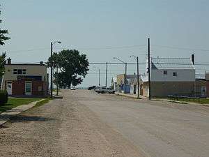
Downtown Hanley | |
 Rosedale No. 283 | |
| Coordinates: 51°34′18″N 106°28′15″W / 51.57167°N 106.47083°WCoordinates: 51°34′18″N 106°28′15″W / 51.57167°N 106.47083°W | |
| Country | Canada |
| Province | Saskatchewan |
| Area | |
| • Total | 921.38 km2 (355.75 sq mi) |
| Population (2001) | |
| • Total | 493 |
| • Density | 0.54/km2 (1.4/sq mi) |
Rosedale No. 283, Saskatchewan is a rural municipality in central Saskatchewan, Canada along Highway 11 between Saskatoon and Regina. The two Local Improvement Districts of LID 15 B 3 and LID 15 C 3 combined together to form Rural Municipality of Rosedale No. 283, Saskatchewan. The formation of Rosedale originated on December 13, 1909
Statistics
According to the Canada 2001 Census:
- Population: 493
- % Change (1996-2001): -5.2
- Dwellings: 135
- Area (km².): 921.38
- Density (persons per km².): 0.5
Communities
These communities lie within the geographical borders of Rosedale No. 283, but are technically not part of the R.M.
Towns
Hamlets
Saskatchewan railways and railway stations
(historic or current)
- Regina Branch C.N.R—serves Davidson, Bladworth, Kenaston, Strong, Hanley, Indi, Dundurn, Strehlow, Haultain, Grasswood, Nutana, Saskatoon
Saskatchewan highways and roads
- For more information see also List of Saskatchewan provincial highways
- For more information see also List of Saskatchewan provincial roads
- Highway 11—serves Hanley, Saskatchewan
- Highway 764—serves Hanley, Saskatchewan
- Highway 15—located between Hanley, Saskatchewan and Hawarden, Saskatchewan runs East-west
- Highway 19—serves Hawarden, Saskatchewan
- Township Road 300, Saskatchewan—located between Hanley, Saskatchewan and Hawarden, Saskatchewan runs East-west
See also
Footnotes
External links
- Rosedale RM
- SEREDA Region and Community Profiles South East Regional Economic Development Association
- Municipal Directory System
- Sask Biz
- Regina Gen Web
- Sarm
- Saskatchewan Rural Development
- RM Government from Municipal Directory System
- 2001 Census - Statistics Canada's page on the 2001 Census.
- Municipal Relations Division - RM Boundary Changes
- Saskatchewan Genealogy Society RM by Number
- MRD - Municipal Status Information - Rural Municipality
- SARM In Memoriam
- SARM
- Municipal Relations Division - Restructured Villages
- Map of Rosedale No. 283 at Statcan
This article is issued from Wikipedia - version of the 7/27/2016. The text is available under the Creative Commons Attribution/Share Alike but additional terms may apply for the media files.