Rumney, Cardiff
| Rumney | |
| Welsh: Tredelerch | |
 St Augustine's Church, Rumney |
|
| Population | 8,827 (2011 census)[1] |
|---|---|
| OS grid reference | ST215795 |
| Principal area | Cardiff |
| Ceremonial county | South Glamorgan |
| Country | Wales |
| Sovereign state | United Kingdom |
| Post town | CARDIFF |
| Postcode district | CF3 |
| Dialling code | 029 |
| Police | South Wales |
| Fire | South Wales |
| Ambulance | Welsh |
| EU Parliament | Wales |
| UK Parliament | Cardiff South & Penarth |
Rumney (Welsh: Tredelerch) is a district and community in the east of the city of Cardiff, Wales. It lies east of the Rhymney River, and is historically part of Monmouthshire. On 1 April 1938 the Cardiff Extension Act 1937 incorporated it into the county borough of Cardiff, and thus it became associated with the geographical county of Glamorgan.
Description

This is a predominantly residential area with a variety of social and private housing. There are many shopping outlets on Newport Road as well as local shops at the top of Rumney Hill and on Wentloog Road, Countisbury Avenue in Llanrumney also. New industrial and business estates have been developed alongside existing ones on Lamby Way providing employment opportunities.
Within the older sectors of the Rumney area are places of interest, such as the historic Rumney Pottery which is still in use today and also the remains of the old Rumney Castle which was a major stronghold on the South Wales coast. The remains of the castle were excavated in the late 70s and early 80s. An old quarry which is now being used as a children's park is situated off Ty Mawr Road (Ty Mawr – Welsh language for "Big House")
Schools in the area include Eastern High School and St Illtyd's Catholic High School.
Transport
The area is on Cardiff Bus' 44/45 routes between Cardiff central bus station and St Mellons and the 49/50 routes to Llanrumney. It is also served by the 30 service to Newport bus station.
Governance
The electoral ward of lies within the parliamentary constituency of Cardiff South and Penarth. It is bounded by the electoral wards of Pontprennau & Old St. Mellons to the north; Trowbridge to the east; Splott to the southwest; Penylan to the west; and Llanrumney to the northwest.
References
- ↑ "Ward population 2011". Retrieved 9 April 2015.
External links
- www.geograph.co.uk : photos of Rumney and surrounding area
- : The local Scout Group for Rumney and Llanrumney
| About Cardiff | 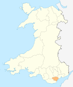 | |
|---|---|---|
| Cardiff templates |
| |
| Neighbourhoods |
| |
Principal areas of Wales | ||
Coordinates: 51°30′32″N 3°07′57″W / 51.50895°N 3.13251°W