Rhode Island Route 116
| ||||
|---|---|---|---|---|
| Route information | ||||
| Maintained by RIDOT | ||||
| Length: | 25.1 mi[1] (40.4 km) | |||
| Major junctions | ||||
| South end: |
| |||
|
| ||||
| North end: |
| |||
| Location | ||||
| Counties: | Providence | |||
| Highway system | ||||
| ||||

Route 116 is a state highway running 25.1 miles (40.4 km) in Providence County, Rhode Island.
Route description
Route 116 takes the following route through the State:
- Coventry: 2.7 miles (4.3 km); Route 117 to Scituate town line
- Knotty Oak Road
- Scituate: 9.5 miles (15.3 km); Coventry town line to Glocester town line
- North Road, East Road and West Greenville Road
- Glocester: 0.6 miles (0.97 km); Scituate town line to Smithfield town line
- West Greenville Road
- Smithfield: 7.6 miles (12.2 km); Glocester town line to Lincoln town line
- Smith Avenue, Putnam Pike, Pleasant View Avenue, Farnum Pike and George Washington Highway
- Lincoln: 3.8 miles (6.1 km); Smithfield town line to Cumberland town line
- George Washington Highway
- Cumberland: 2.1 miles (3.4 km); Lincoln town line to Route 114
- George Washington Highway, Mendon Road and Angell Road
Major intersections
The entire route is in Providence County.
| Location | mi[1] | km | Destinations | Notes | |
|---|---|---|---|---|---|
| Coventry | 0.0 | 0.0 | Southern terminus | ||
| Hope | 2.9 | 4.7 | West end of Route 115 | ||
| Scituate | 4.9 | 7.9 | |||
| 6.9 | 11.1 | ||||
| North Scituate | 10.7 | 17.2 | |||
| Greenville | 14.0 | 22.5 | Southern terminus of concurrency with US 44 | ||
| 14.1 | 22.7 | Northern terminus of concurrency with US 44 | |||
| 15.0 | 24.1 | Southern terminus of concurrency with Route 5 | |||
| Smithfield | 16.8 | 27.0 | Southern terminus of concurrency with Route 104 | ||
| 17.0 | 27.4 | Northern terminus of concurrency with Routes 5 and 104 | |||
| 18.3 | 29.5 | ||||
| Lincoln | 21.4 | 34.4 | Interchange | ||
| 22.2 | 35.7 | ||||
| Blackstone River | 23.1 | 37.2 | Bridge | ||
| Cumberland | 23.3 | 37.5 | Southern terminus of concurrency with Route 122 | ||
| 23.4 | 37.7 | Southern terminus of concurrency with Route 122 | |||
| 25.1 | 40.4 | Northern terminus | |||
1.000 mi = 1.609 km; 1.000 km = 0.621 mi
| |||||
Notes
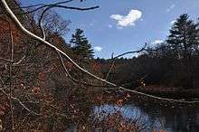
The Route 116 (Washington Highway) bridge over the Woonasquatucket River is visible in the background
Route 116 is a major corridor in Lincoln, Cumberland and parts of Smithfield.
The interchange between Route 116 and Route 146 was the first cloverleaf interchange to be constructed in the state. As of July 2005 it was in the process of being reconstructed.
References
- 1 2 Google (December 30, 2013). "Route 116" (Map). Google Maps. Google. Retrieved December 30, 2013.
This article is issued from Wikipedia - version of the 6/12/2016. The text is available under the Creative Commons Attribution/Share Alike but additional terms may apply for the media files.