Roslyn Heights, New York
| Roslyn Heights, New York | |
|---|---|
| Hamlet and census-designated place | |
|
Roslyn Highlands firehouse | |
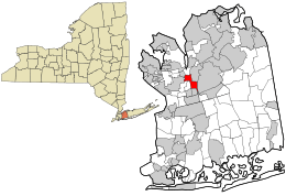 Location in Nassau County and the state of New York. | |
 Roslyn Heights, New York Location within the state of New York | |
| Coordinates: 40°46′57″N 73°38′29″W / 40.78250°N 73.64139°WCoordinates: 40°46′57″N 73°38′29″W / 40.78250°N 73.64139°W | |
| Country | United States |
| State | New York |
| County | Nassau |
| Area | |
| • Total | 1.5 sq mi (3.9 km2) |
| • Land | 1.5 sq mi (3.9 km2) |
| • Water | 0.0 sq mi (0.0 km2) |
| Elevation | 174 ft (53 m) |
| Population (2010) | |
| • Total | 6,577 |
| Time zone | Eastern (EST) (UTC-5) |
| • Summer (DST) | EDT (UTC-4) |
| ZIP code | 11577 |
| Area code(s) | 516 |
| FIPS code | 36-63814 |
| GNIS feature ID | 0962934 |

Roslyn Heights is both a hamlet and census-designated place (CDP) in Nassau County, New York, United States. It is considered part of the Greater Roslyn area, which is anchored by the Village of Roslyn. The population was 6,577 at the 2010 census.
Roslyn Heights is in the eastern part of the Town of North Hempstead at exit 37 on the Long Island Expressway (Interstate 495).
Geography
According to the United States Census Bureau, the CDP has a total area of 1.5 square miles (3.9 km2), all land.
Demographics
Roslyn Heights is part of the greater Roslyn area. Though most of Roslyn Heights belongs to the Roslyn School District, portions of the school-aged population are enrolled in the East Williston school district, and attend The Wheatley School from eighth through twelfth grades. Portions of Roslyn Heights also belong to the Herricks School District, as well as the Mineola School District.
As of the census[1] of 2000, there were 6,295 people, 2,168 households, and 1,773 families residing in the CDP. The population density was 4,223.6 per square mile (1,631.2/km²). There were 2,226 housing units at an average density of 1,493.5/sq mi (576.8/km²). The racial makeup of the CDP was 79.03% White, 6.45% African American, 0.11% Native American, 10.01% Asian, 2.00% from other races, and 2.40% from two or more races. Hispanic or Latino of any race were 6.45% of the population.
There were 2,168 households out of which 39.1% had children under the age of 18 living with them, 65.8% were married couples living together, 12.5% had a female householder with no husband present, and 18.2% were non-families. 15.6% of all households were made up of individuals and 8.9% had someone living alone who was 65 years of age or older. The average household size was 2.89 and the average family size was 3.21.
In the CDP the population was spread out with 26.7% under the age of 18, 5.8% from 18 to 24, 25.8% from 25 to 44, 25.7% from 45 to 64, and 15.9% who were 65 years of age or older. The median age was 40 years. For every 100 females there were 93.6 males. For every 100 females age 18 and over, there were 90.6 males.
The median income for a household in the village was $84,705, and the median income for a family was $100,474. Males had a median income of $76,812 versus $38,343 for females. The per capita income for the village was $40,132. About 4.5% of families and 5.7% of the population were below the poverty line, including 8.4% of those under age 18 and 2.7% of those age 65 or over.
References
- ↑ "American FactFinder". United States Census Bureau. Retrieved 2008-01-31.