Roshtqal'a District
| Roshtqal'a District Ноҳияи Роштқалъа Shakhdara | |
|---|---|
| District | |
| Ноҳияи Роштқалъа | |
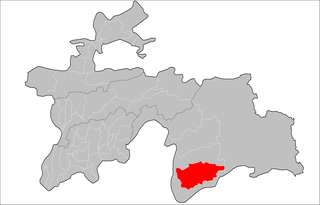 Location of Roshtqal'a District in Tajikistan | |
| Country |
|
| Province | Gorno-Badakhshan Autonomous Region |
| Capital | Roshtqal'a |
| Area | |
| • Total | 1,700 sq mi (4,300 km2) |
| Population (2010) | |
| • Total | 24,400 |
| as of 21 Sept 2010 Census | |
| Time zone | TJT (UTC+5) |
| Postal code | 736112 |
| Area code(s) | +992 3555 |
Roshtqal'a District or Nohiya-i Roshtqal'a (Tajik: Ноҳияи Роштқалъа / Persian: ناحیۀ راشت قلعه, also spelled Roshtkala from Russian transliteration) is a district in east Tajikistan, in the south-western part of the Gorno-Badakhshan Autonomous Region (GBAO). It stretches along the Shakhdara River between the Shughnon Range to the north and the Shakhdara Range to the south, enclosed within GBAO, without international borders.[1] The population of Roshtqal'a district is 24,400 (21 September 2010 Census).[2] Its administrative capital is Roshtqal'a (Roshtkala) in the west part of the district, about 30 km south-east of the provincial capital Khorugh.
The district is equivalent to the valley of the Shakhdara River. It is bounded on the north by Shughnon District, on the west and south by Ishkashim district and on the east by Murghab district. Unlike the neighboring districts, it does not go all the way west to the Panj River.
Roshtkala town, the district capital, is about 30 km upstream from Khorog. The name means 'red fort'. The fort, built in the 9th-10th century (ruins only) was once the capital of Shugnan.
The Shakhdara River defines the district. Its valley is between the Shugnon Range in the north and the Shakhdara Range in the south. It flows into the Gunt River above Khorog a few miles before that river flows into the Panj River. Going upstream, it first goes southeast for about 40 km(straight line). At Bidiz there is a gorge and one of the few forests in Gorno-Badikshan. The river turns east. At Sindev is the fort of the last Mingbashi or ruler of Shakhdara. The head of the river is the Jawshangoz plain where there were clashes between nomadic Kirghiz and settled Tajiks in the 18th and 19th centuries. There is a ruined fort from the 2nd or 3rd century and views of Karl Marx Peak to the south. A road of some sort goes north to the Koitezek Pass on the Pamir Highway with a branch west to Turumtaikul Lake and another route goes over the Maz pass to the Pamir River.
References
| Districts | 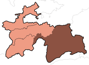 | |
|---|---|---|
| Main cities and towns | ||
| Geography | ||