Romanija
Not to be confused with Romania.
| Romanija | |
|---|---|
|
Landscape in the Romanija mountain | |
| Highest point | |
| Elevation | 1,652 m (5,420 ft) |
| Coordinates | 43°51′36″N 18°40′12″E / 43.86000°N 18.67000°ECoordinates: 43°51′36″N 18°40′12″E / 43.86000°N 18.67000°E |
| Geography | |
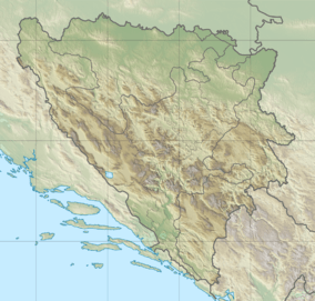 Romanija Location of Romanija | |
| Location | Bosnia and Herzegovina |
| Parent range | Dinaric Alps |
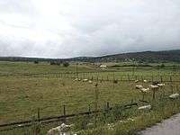
Romanija (Serbian Cyrillic: Романија) is a mountain and geographical region in eastern Bosnia and Herzegovina, including the main towns of Pale, Sokolac, and Han Pijesak, to the north-east of Sarajevo. Its geographical extent lies within Republika Srpska. Its highest point is Veliki Lupoglav (1,652 m).
A football club from the neighbouring town of Pale bears its name, FK Romanija.
See also
References
| Geographical |  | |
|---|---|---|
| Historical |
| |
| Wikimedia Commons has media related to Romanija. |
This article is issued from Wikipedia - version of the 11/23/2016. The text is available under the Creative Commons Attribution/Share Alike but additional terms may apply for the media files.