Rocky River (Michigan)
| Rocky River | |
|---|---|
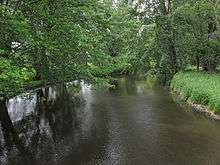 The Rocky River in Flowerfield Township | |
| Country | United States |
| Basin | |
| Main source | Southwest Marcellus Township in Cass County, Michigan |
| River mouth | St. Joseph River in Three Rivers |
| River system | St. Joseph River |
| Basin size | 450 km2 (170 sq mi)[1] |
| Physical characteristics | |
| Length | 28 mi (45 km)[2] |
| Discharge |
|
The Rocky River is a 28.3-mile-long (45.5 km)[2] stream located in the southwest part of the U.S. state of Michigan that flows into the St. Joseph River at 41°56′33″N 85°37′59″W / 41.94250°N 85.63306°W[3] in the city of Three Rivers in St. Joseph County. The Rocky River, along with the St. Joseph River and the Portage River, are the three rivers from which the city of Three Rivers takes its name.
The Rocky River rises in southwest Marcellus Township in Cass County at 41°59′43″N 85°51′04″W / 41.99528°N 85.85111°W.[3] It flows to the northeast, arcing gently to the southeast before turning sharply to the south in eastern Flowerfield Township, shortly after being joined by the Flowerfield Creek. It then flows mostly southward until joining the St. Joseph River in Three Rivers.
The Rocky River watershed encompasses over 112,000 acres (45,000 ha) and drains all or portions of the following cities and townships:[1]
- In Cass County
- In Kalamazoo County
- Prairie Ronde Township (via Flowerfield Creek)
- Schoolcraft Township (via Spring Creek)
- Texas Charter Township
- In St. Joseph County
- Fabius Township (via Kerr Creek)
- Flowerfield Township
- Lockport Township
- Park Township
- Three Rivers
- In Van Buren County
- Porter Township (via Sheldon Creek, Flowerfield Creek, and Four County Drain)
Tributaries
- (left) Kerr Creek[4]
- (left) Armalege Drain[7]
- Goose Lake[8]
- (right) Flowerfield Creek[9]
- (right) Spring Creek[10]
- (right) Four County Drain[11]
- (left) Ayers Lake[12]
- (right) Sheldon Creek[13]
- (left) Pickerel Lake[16]
- (right) Huyck Lake[20]
References
- 1 2 Rocky River Watershed Management Plan, prepared by Sarah VanDelfzijl, Watershed Coordinator, St. Joseph County Conservation District
- 1 2 U.S. Geological Survey. National Hydrography Dataset high-resolution flowline data. The National Map, accessed May 19, 2011
- 1 2 U.S. Geological Survey Geographic Names Information System: Rocky River
- ↑ U.S. Geological Survey Geographic Names Information System: Kerr Creek
- ↑ U.S. Geological Survey Geographic Names Information System: Little Pleasant Lake
- ↑ U.S. Geological Survey Geographic Names Information System: Pleasant Lake
- ↑ U.S. Geological Survey Geographic Names Information System: Armalege Drain
- ↑ U.S. Geological Survey Geographic Names Information System: Goose Lake
- ↑ U.S. Geological Survey Geographic Names Information System: Flowerfield Creek
- ↑ U.S. Geological Survey Geographic Names Information System: Spring Creek
- ↑ U.S. Geological Survey Geographic Names Information System: Four County Drain
- ↑ U.S. Geological Survey Geographic Names Information System: Ayers Lake
- ↑ U.S. Geological Survey Geographic Names Information System: Sheldon Creek
- ↑ U.S. Geological Survey Geographic Names Information System: Lewis Lake
- ↑ U.S. Geological Survey Geographic Names Information System: Mud Lake
- ↑ U.S. Geological Survey Geographic Names Information System: Pickerel Lake
- ↑ U.S. Geological Survey Geographic Names Information System: Skyhawk Lake
- ↑ U.S. Geological Survey Geographic Names Information System: Streaters Mill Pond
- ↑ U.S. Geological Survey Geographic Names Information System: Bogart Lake
- ↑ U.S. Geological Survey Geographic Names Information System: Huyck Lake