Rockford, Washington
| Rockford, Washington | |
|---|---|
| Town | |
 Location of Rockford, Washington | |
| Coordinates: 47°27′3″N 117°7′58″W / 47.45083°N 117.13278°WCoordinates: 47°27′3″N 117°7′58″W / 47.45083°N 117.13278°W | |
| Country | United States |
| State | Washington |
| County | Spokane |
| Area[1] | |
| • Total | 0.68 sq mi (1.76 km2) |
| • Land | 0.68 sq mi (1.76 km2) |
| • Water | 0 sq mi (0 km2) |
| Elevation | 2,388 ft (728 m) |
| Population (2010)[2] | |
| • Total | 470 |
| • Estimate (2015)[3] | 468 |
| • Density | 691.2/sq mi (266.9/km2) |
| Time zone | Pacific (PST) (UTC-8) |
| • Summer (DST) | PDT (UTC-7) |
| ZIP code | 99030 |
| Area code | 509 |
| FIPS code | 53-59145 |
| GNIS feature ID | 1507868[4] |
| Website | rockfordwa.com |
Rockford is a town in Spokane County, Washington, United States. The population was 470 at the 2010 census.
History
Rockford was first settled in 1878 by D.C. Farnsworth.[5] The town took its name from a rocky ford on Rock Creek.[6] Rockford was incorporated as a town in 1890.[7]
Geography
Rockford is located at 47°27′3″N 117°7′58″W / 47.45083°N 117.13278°W (47.450891, -117.132870).[8]
According to the United States Census Bureau, the town has a total area of 0.68 square miles (1.76 km2), all of it land.[1]
Demographics
| Historical population | |||
|---|---|---|---|
| Census | Pop. | %± | |
| 1890 | 644 | — | |
| 1900 | 433 | −32.8% | |
| 1910 | 663 | 53.1% | |
| 1920 | 435 | −34.4% | |
| 1930 | 381 | −12.4% | |
| 1940 | 130 | −65.9% | |
| 1950 | 152 | 16.9% | |
| 1960 | 369 | 142.8% | |
| 1970 | 327 | −11.4% | |
| 1980 | 442 | 35.2% | |
| 1990 | 481 | 8.8% | |
| 2000 | 413 | −14.1% | |
| 2010 | 470 | 13.8% | |
| Est. 2015 | 468 | [9] | −0.4% |
| U.S. Decennial Census[10] 2015 Estimate[3] | |||
2010 census
As of the census[2] of 2010, there were 470 people, 192 households, and 136 families residing in the town. The population density was 691.2 inhabitants per square mile (266.9/km2). There were 213 housing units at an average density of 313.2 per square mile (120.9/km2). The racial makeup of the town was 92.6% White, 0.4% African American, 3.0% Native American, 1.3% Asian, 1.7% from other races, and 1.1% from two or more races. Hispanic or Latino of any race were 3.0% of the population.
There were 192 households of which 27.1% had children under the age of 18 living with them, 57.3% were married couples living together, 8.3% had a female householder with no husband present, 5.2% had a male householder with no wife present, and 29.2% were non-families. 20.8% of all households were made up of individuals and 7.3% had someone living alone who was 65 years of age or older. The average household size was 2.45 and the average family size was 2.78.
The median age in the town was 44.9 years. 19.4% of residents were under the age of 18; 6.9% were between the ages of 18 and 24; 24% were from 25 to 44; 33.4% were from 45 to 64; and 16.2% were 65 years of age or older. The gender makeup of the town was 50.2% male and 49.8% female.
2000 census
As of the census of 2000, there were 413 people, 149 households, and 111 families residing in the town. The population density was 607.1 people per square mile (234.5/km²). There were 169 housing units at an average density of 248.4 per square mile (96.0/km²). The racial makeup of the town was 97.34% White, 0.24% African American, 0.48% Native American, and 1.94% from two or more races. Hispanic or Latino of any race were 0.48% of the population.
There were 149 households out of which 40.3% had children under the age of 18 living with them, 59.1% were married couples living together, 9.4% had a female householder with no husband present, and 25.5% were non-families. 20.8% of all households were made up of individuals and 9.4% had someone living alone who was 65 years of age or older. The average household size was 2.77 and the average family size was 3.17.
In the town the age distribution of the population shows 29.1% under the age of 18, 7.3% from 18 to 24, 26.9% from 25 to 44, 23.0% from 45 to 64, and 13.8% who were 65 years of age or older. The median age was 38 years. For every 100 females there were 99.5 males. For every 100 females age 18 and over, there were 98.0 males.
The median income for a household in the town was $40,227, and the median income for a family was $45,125. Males had a median income of $31,339 versus $25,417 for females. The per capita income for the town was $16,411. About 11.9% of families and 12.1% of the population were below the poverty line, including 18.4% of those under age 18 and 3.6% of those age 65 or over.
References
- 1 2 "US Gazetteer files 2010". United States Census Bureau. Retrieved 2012-12-19.
- 1 2 "American FactFinder". United States Census Bureau. Retrieved 2012-12-19.
- 1 2 "Population Estimates". United States Census Bureau. Retrieved July 12, 2016.
- ↑ "US Board on Geographic Names". United States Geological Survey. 2007-10-25. Retrieved 2008-01-31.
- ↑ Majors, Harry M. (1975). Exploring Washington. Van Winkle Publishing Co. p. 111. ISBN 978-0-918664-00-6.
- ↑ Sullivan, Julie (March 16, 1989). "Architect builds historical interest with trivia". Spokane Chronicle. pp. S9. Retrieved 2 May 2015.
- ↑ "Rockford, WA". City-Data. Retrieved 2 May 2015.
- ↑ "US Gazetteer files: 2010, 2000, and 1990". United States Census Bureau. 2011-02-12. Retrieved 2011-04-23.
- ↑ "Annual Estimates of the Resident Population for Incorporated Places: April 1, 2010 to July 1, 2015". Retrieved July 2, 2016.
- ↑ United States Census Bureau. "Census of Population and Housing". Retrieved October 4, 2013.
Municipalities and communities of Spokane County, Washington, United States | ||
|---|---|---|
| Cities | 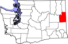 | |
| Towns | ||
| CDPs | ||
| Unincorporated communities | ||
| Ghost towns | ||