Roche Harbor Airport
| Roche Harbor Airport | |||||||||||
|---|---|---|---|---|---|---|---|---|---|---|---|
| IATA: RCE – ICAO: none – FAA LID: WA09 | |||||||||||
| Summary | |||||||||||
| Airport type | Private | ||||||||||
| Owner | Roche Harbor Airport Inc. | ||||||||||
| Serves | Roche Harbor, Washington | ||||||||||
| Elevation AMSL | 100 ft / 30 m | ||||||||||
| Coordinates | 48°36′44″N 123°08′19″W / 48.61222°N 123.13861°WCoordinates: 48°36′44″N 123°08′19″W / 48.61222°N 123.13861°W | ||||||||||
| Map | |||||||||||
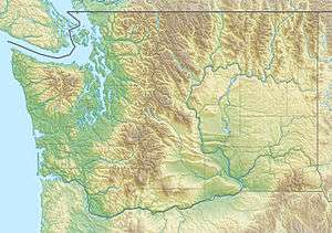 WA09 Location of airport in Washington | |||||||||||
| Runways | |||||||||||
| |||||||||||
Roche Harbor Airport (IATA: RCE[2], FAA LID: WA09) is a private airport located one nautical mile (2 km) northeast of the central business district of Roche Harbor, in San Juan County, Washington, United States.[1] It was formerly a public use airport (FAA ID: 9S1).[3]
Facilities
Roche Harbor Airport resides at elevation of 100 feet (30 m) above mean sea level. It has one runway designated 7/25 with an asphalt surface measuring 3,593 by 30 feet (1,095 x 9 m).[1]
See also
References
- 1 2 3 FAA Airport Master Record for WA09 (Form 5010 PDF). Federal Aviation Administration. Effective November 15, 2012.
- ↑ "Airline and Airport Code Search (RCE: Roche Harbor)". International Air Transport Association (IATA). Retrieved June 4, 2013.
- ↑ "Economic Profile: Roche Harbor Airport (9S1)" (PDF). Washington State Department of Transportation. 2001.
External links
- Roche Harbor Airport at WSDOT Airport Directory
- Roche Harbor Airport Web Cam
- Aerial image as of July 1990 from USGS The National Map
- Resources for this airport:
- FAA airport information for WA09
- AirNav airport information for WA09
- FlightAware airport information and live flight tracker
- SkyVector aeronautical chart for WA09
This article is issued from Wikipedia - version of the 12/4/2016. The text is available under the Creative Commons Attribution/Share Alike but additional terms may apply for the media files.