Robert Gray Army Airfield
| Robert Gray Army Airfield Robert Gray Air Force Base (former Camp Hood Air Force Base) (former Killeen Army Airfield) | |||||||||||
|---|---|---|---|---|---|---|---|---|---|---|---|
|
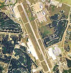
USGS 2006 orthophoto | |||||||||||
| IATA: GRK – ICAO: KGRK – FAA LID: GRK | |||||||||||
| Summary | |||||||||||
| Airport type | Public / Military | ||||||||||
| Owner | U.S. Army ATCA-ASO | ||||||||||
| Location | Fort Hood / Killeen, Texas | ||||||||||
| Elevation AMSL | 1,015 ft / 309 m | ||||||||||
| Coordinates | 31°04′02″N 097°49′44″W / 31.06722°N 97.82889°WCoordinates: 31°04′02″N 097°49′44″W / 31.06722°N 97.82889°W | ||||||||||
| Map | |||||||||||
 GRK Location of airport in Texas | |||||||||||
| Runways | |||||||||||
| |||||||||||
| Statistics (2010) | |||||||||||
| |||||||||||
Robert Gray Army Airfield[1] (IATA: GRK, ICAO: KGRK, FAA LID: GRK) is a military joint-use airport that operates alongside Killeen–Fort Hood Regional Airport.[2] The airport is based inside the south end of the Fort Hood Military Reservation (known as West Fort Hood), six nautical miles (7 mi, 11 km) southwest of the central business district of Killeen, Texas,[2] in unincorporated Bell County.
As per Federal Aviation Administration records, the airport had 232,299 passenger boardings (enplanements) in calendar year 2008,[3] 231,500 enplanements in 2009, and 243,861 in 2010.[4] It is included in the National Plan of Integrated Airport Systems for 2011–2015, which categorized it as a primary commercial service airport (more than 10,000 enplanements per year).[5]
History
The base was named after a Killeen native who was a pilot of a B-25 bomber on the famous Doolittle Raid on Tokyo in 1942. He was killed later in World War II flying combat missions.[6]
Facilities and aircraft
The airport has one runway designated 15/33 with a PEM (Porous European Mix) surface measuring 10,000 by 200 feet (3,048 x 61 m). For the 12-month period ending April 10, 2010, the airport had 12,208 aircraft operations, an average of 33 per day: 98.5% scheduled commercial and 1.5% general aviation.[2]
The base is also served by Hood Army Airfield (IATA: HLR, ICAO: KHLR, FAA LID: HLR) and two asphalt auxiliary landing strips used for training at North Fort Hood:
- Shorthorn Aux Landing Strip (FAA LID: 23XS) – 2,130 by 46 feet (649 m × 14 m) (RWY 15 1,583 feet (482 m) usable, RWY 33 1,897 feet (578 m) usable) at 31°21′40″N 97°40′23″W / 31.361°N 97.673°W, elevation 720 feet (220 m), magnetic variation 5.1° E[7][8]
- Longhorn Aux Landing Strip (FAA LID: 22XS) – 3,490 by 75 feet (1,064 m × 23 m) (unmarked numbers, but same magnetic heading as Shorthorn at 153 degrees) at 31°22′26″N 97°40′01″W / 31.374°N 97.667°W, elevation 720 feet (220 m), magnetic variation 5.1° E[9][10]
See also
References
- 1 2 Killeen–Fort Hood Regional Airport
- 1 2 3 4 FAA Airport Master Record for GRK (Form 5010 PDF). Federal Aviation Administration. Effective May 31, 2012.
- ↑ "Enplanements for CY 2008" (PDF, 1.0 MB). CY 2008 Passenger Boarding and All-Cargo Data. Federal Aviation Administration. December 18, 2009. External link in
|work=(help) - ↑ "Enplanements for CY 2010" (PDF, 189 KB). CY 2010 Passenger Boarding and All-Cargo Data. Federal Aviation Administration. October 4, 2011. External link in
|work=(help) - ↑ "2011–2015 NPIAS Report, Appendix A" (PDF, 2.03 MB). National Plan of Integrated Airport Systems. Federal Aviation Administration. October 4, 2010. External link in
|work=(help) - ↑ Fort Hood: The Great Place to Call Home, Fort Hood's Official Post Guide, Fort Hood History, page 72. Marcoa Publishing Inc., 2004, under contract with Fort Hood. Editorial content is edited, prepared and provided by the Public Affairs Office of Fort Hood.
- ↑ "Airport data for Shorthorn Aux Landing Strip". FAA. April 3, 2014. Retrieved April 4, 2014.
- ↑ "Pilot Information for Shorthorn Aux Landing Strip". OurAirports.com. Retrieved April 4, 2014.
- ↑ "Airport data for Longhorn Aux Landing Strip". FAA. April 3, 2014. Retrieved April 4, 2014.
- ↑ "Pilot Information for Longhorn Aux Landing Strip". OurAirports.com. Retrieved April 4, 2014.
Other sources
- Freeman, Paul (2008) Abandoned & Little-Known Airfields: Texas
- Maurer, Maurer (1983). Air Force Combat Units Of World War II. Maxwell AFB, Alabama: Office of Air Force History. ISBN 0-89201-092-4.
- Ravenstein, Charles A. (1984). Air Force Combat Wings Lineage and Honors Histories 1947-1977. Maxwell AFB, Alabama: Office of Air Force History. ISBN 0-912799-12-9.
- Thole, Lou (1999), Forgotten Fields of America : World War II Bases and Training, Then and Now - Vol. 2. Publisher: Pictorial Histories Pub, ISBN 1-57510-051-7
External links
|
|
| Flying Training |
|  | ||||||
|---|---|---|---|---|---|---|---|---|
| Technical Training |
| |||||||