Robbinsville Township, New Jersey
| Robbinsville Township, New Jersey | |
|---|---|
| Township | |
| Township of Robbinsville | |
|
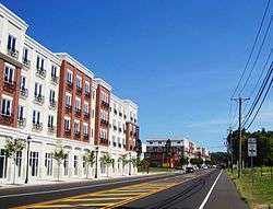
Robbinsville Town Center along Route 33 | |
| Motto: "Be at the Center of it All"[1] | |
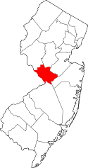
 Location in Mercer County and the state of New Jersey. | |
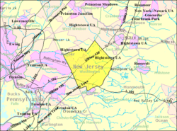 Census Bureau map of Washington Township, Mercer County, New Jersey (currently known as Robbinsville Township) | |
| Coordinates: 40°13′29″N 74°35′38″W / 40.224723°N 74.594025°WCoordinates: 40°13′29″N 74°35′38″W / 40.224723°N 74.594025°W[2][3] | |
| Country |
|
| State |
|
| County | Mercer |
| Incorporated | March 15, 1859, as Washington Township |
| Renamed | January 1, 2008, as Robbinsville Township |
| Named for | George R. Robbins |
| Government[4][5] | |
| • Type | Faulkner Act (Mayor-Council) |
| • Body | Township Council |
| • Mayor | David Fried (term ends December 31, 2017)[6] |
| • Administrator | Joy Tozzi[7] |
| • Clerk | Michele Seigfried[8] |
| Area[2] | |
| • Total | 20.491 sq mi (53.072 km2) |
| • Land | 20.316 sq mi (52.618 km2) |
| • Water | 0.175 sq mi (0.454 km2) 0.86% |
| Area rank |
139th of 565 in state 5th of 12 in county[2] |
| Elevation[9] | 121 ft (37 m) |
| Population (2010 Census)[10][11][12] | |
| • Total | 13,642 |
| • Estimate (2015)[13] | 14,176 |
| • Rank |
180th of 565 in state 9th of 12 in county[14] |
| • Density | 671.5/sq mi (259.3/km2) |
| • Density rank |
416th of 566 in state 11th of 12 in county[14] |
| Time zone | Eastern (EST) (UTC-5) |
| • Summer (DST) | Eastern (EDT) (UTC-4) |
| ZIP code | 08691[15] |
| Area code(s) | 609[16] |
| FIPS code | 3402163850[2][17][18] |
| GNIS feature ID | 0882122[2][19] |
| Website |
www |
Robbinsville Township is a township in Mercer County, New Jersey, United States, in the New York City metropolitan area. As of the 2010 United States Census, the township's population was 13,642,[10][11][12] reflecting an increase of 3,367 (+32.8%) from the 10,275 counted in the 2000 Census, which had in turn increased by 4,460 (+76.7%) from the 5,815 counted in the 1990 Census.[20] The township is named for George R. Robbins, who lived in the area.[21]
What is now Robbinsville Township was originally incorporated as Washington Township (named for George Washington[21]) by an act of the New Jersey Legislature on March 15, 1859, from portions of East Windsor Township.[22] On November 6, 2007, voters approved by a vote of 1,816 to 693[23] a measure that changed the township's name from Washington Township (the name of five other municipalities in New Jersey) to Robbinsville, named after a settlement within the township. The official changeover took place January 1, 2008, as signs and other items with "Washington" on them began to be changed.[24]
Geography
According to the United States Census Bureau, the township as of 2010 had a total area of 20.491 square miles (53.072 km2), including 20.316 square miles (52.618 km2) of land and 0.175 square miles (0.454 km2) of water (0.86%).[2][3] The township borders East Windsor Township, Hamilton Township, and West Windsor Township in Mercer County; and Allentown, Millstone Township and Upper Freehold Township in Monmouth County.[25] Unincorporated communities, localities and place names located partially or completely within the township include Allens Station, Carsons Mills, Hillside Terrace, Meadows Terrace, New Canton, New Sharon, Pages Corners, and Windsor.[26]
Demographics
| Historical population | |||
|---|---|---|---|
| Census | Pop. | %± | |
| 1860 | 1,279 | — | |
| 1870 | 1,294 | 1.2% | |
| 1880 | 1,281 | −1.0% | |
| 1890 | 1,126 | −12.1% | |
| 1900 | 1,157 | 2.8% | |
| 1910 | 1,090 | −5.8% | |
| 1920 | 1,161 | 6.5% | |
| 1930 | 1,347 | 16.0% | |
| 1940 | 1,365 | 1.3% | |
| 1950 | 1,843 | 35.0% | |
| 1960 | 2,156 | 17.0% | |
| 1970 | 3,311 | 53.6% | |
| 1980 | 3,487 | 5.3% | |
| 1990 | 5,815 | 66.8% | |
| 2000 | 10,275 | 76.7% | |
| 2010 | 13,642 | 32.8% | |
| Est. 2015 | 14,176 | [13][27] | 3.9% |
| Population sources: 1860-1920[28] 1860-1870[29] 1870[30] 1880-1890[31] 1890-1910[32] 1910-1930[33] 1930-1990[34] 2000[35][36] 2010[10][11][12] | |||
Census 2010
The 2010 United States Census counted 13,642 people, 5,087 households, and 3,591 families residing in the township. The population density was 671.5 per square mile (259.3/km2). The township contained 5,277 housing units at an average density of 259.7 per square mile (100.3/km2). The racial makeup of the township was 81.59% (11,131) White, 3.12% (426) Black or African American, 0.10% (13) Native American, 12.67% (1,729) Asian, 0.00% (0) Pacific Islander, 0.71% (97) from other races, and 1.80% (246) from two or more races. Hispanics or Latinos of any race were 4.13% (564) of the population.[10]
Out of a total of 5,087 households, 41.7% had children under the age of 18 living with them, 60.0% were married couples living together, 7.7% had a female householder with no husband present, and 29.4% were non-families. 25.8% of all households were made up of individuals, and 8.6% had someone living alone who was 65 years of age or older. The average household size was 2.66 and the average family size was 3.26.[10]
In the township, 28.7% of the population were under the age of 18, 4.3% from 18 to 24, 28.4% from 25 to 44, 28.8% from 45 to 64, and 9.7% who were 65 years of age or older. The median age was 39.2 years. For every 100 females the census counted 91.3 males, but for 100 females at least 18 years old, it was 87.8 males.[10]
The Census Bureau's 2006-2010 American Community Survey showed that (in 2010 inflation-adjusted dollars) median household income was $92,440 (with a margin of error of +/- $11,773) and the median family income was $124,816 (+/- $10,353). Males had a median income of $96,156 (+/- $4,577) versus $65,327 (+/- $8,597) for females. The per capita income for the borough was $44,149 (+/- $2,813). About 2.7% of families and 3.1% of the population were below the poverty line, including 3.7% of those under age 18 and 4.9% of those age 65 or over.[37]
Census 2000
As of the 2000 United States Census[17] there were 10,275 people, 4,074 households, and 2,815 families residing in the township. The population density was 501.8 people per square mile (193.7/km²). There were 4,163 housing units at an average density of 203.3 per square mile (78.5/km²). The racial makeup of the township was 91.00% White, 2.89% African American, 0.14% Native American, 4.31% Asian, 0.55% from other races, and 1.11% from two or more races. Hispanic or Latino of any race were 2.72% of the population.[35][36]
There were 4,074 households out of which 36.0% had children under the age of 18 living with them, 59.8% were married couples living together, 7.3% had a female householder with no husband present, and 30.9% were non-families. 26.4% of all households were made up of individuals and 7.4% had someone living alone who was 65 years of age or older. The average household size was 2.52 and the average family size was 3.09.[35][36]
In the township the population was spread out with 26.1% under the age of 18, 3.7% from 18 to 24, 37.9% from 25 to 44, 22.6% from 45 to 64, and 9.7% who were 65 years of age or older. The median age was 37 years. For every 100 females there were 91.4 males. For every 100 females age 18 and over, there were 87.7 males.[35][36]
The median income for a household in the township was $71,377, and the median income for a family was $90,878. Males had a median income of $61,589 versus $44,653 for females. The per capita income for the township was $35,529. About 2.5% of families and 3.7% of the population were below the poverty line, including 4.1% of those under age 18 and 5.0% of those age 65 or over.[35][36]
Government
Local government
In November 2004, township residents voted to change their form of government from a Township Committee to a Mayor-Council form under the Faulkner Act. The new form of government took effect as of July 1, 2005.[4][5] In the new Mayor-Council form of government, the Mayor and Council function as independent branches of government. The Mayor is the Chief Executive of the Township and heads its Administration. The Mayor is elected on a non-partisan basis and serves for a four-year term. The Mayor may attend Council meetings but is not obliged to do so.[5] The Council is the legislative branch. The five members of the Township Council are elected on a non-partisan basis for staggered four-year terms of office as part of the November general election in odd-numbered years with three seats up one year and the two other seats (and the mayoral seat) up for election two years laterr. At the annual organizational meeting held during the first week of January of each year, the Council selects a President and Vice President to serve for one-year terms. The Council President chairs the meetings of the governing body.[38] Following an ordinance passed in December 2011, municipal elections were shifted from May to November, with the terms of all township council members then serving extend by six months, to December 31.[39]
As of 2016, the Mayor of Robbinsville Township is David Fried, whose term of office ends December 31, 2017.[40] Members of the Township Council are Council President Ronald C. Witt (2019), Council Vice President Vincent J. Calcagno (2017), Christine Ciaccio (2015), Sheree S. McGowan (2017), Dan Schuberth (2019).[5][41][42][43][44][45]
Federal, state and county representation
Robbinsville Township is located in the 4th Congressional District[46] and is part of New Jersey's 14th state legislative district.[11][47][48] Prior to the 2011 reapportionment following the 2010 Census, Robbinsville Township had been in the 30th state legislative district.[49]
New Jersey's Fourth Congressional District is represented by Christopher Smith (R).[50] New Jersey is represented in the United States Senate by Cory Booker (D, Newark, term ends 2021)[51] and Bob Menendez (D, Paramus, 2019).[52][53]
For the 2016–2017 session (Senate, General Assembly), the 14th Legislative District of the New Jersey Legislature is represented in the State Senate by Linda R. Greenstein (D, Plainsboro Township) and in the General Assembly by Daniel R. Benson (D, Hamilton Township, Mercer County) and Wayne DeAngelo (D, Hamilton Township).[54] The Governor of New Jersey is Chris Christie (R, Mendham Township).[55] The Lieutenant Governor of New Jersey is Kim Guadagno (R, Monmouth Beach).[56]
Mercer County is governed by a County Executive who oversees the day-to-day operations of the county and by a seven-member Board of Chosen Freeholders that acts in a legislative capacity, setting policy. All officials are chosen at-large in partisan elections, with the executive serving a four-year term of office while the freeholders serve three-year terms of office on a staggered basis, with either two or three seats up for election each year.[57] As of 2014, the County Executive is Brian M. Hughes (D, term ends December 31, 2015; Princeton).[58] Mercer County's Freeholders are Freeholder Chair Andrew Koontz (D, 2016; Princeton),[59] Freeholder Vice Chair Samuel T. Frisby, Sr. (2015; Trenton),[60] Ann M. Cannon (2015; East Windsor Township),[61] Anthony P. Carabelli (2016; Trenton),[62] John A. Cimino (2014, Hamilton Township),[63] Pasquale "Pat" Colavita, Jr. (2015; Lawrence Township)[64] and Lucylle R. S. Walter (2014; Ewing Township)[65][66][67] Mercer County's constitutional officers are County Clerk Paula Sollami-Covello (D, 2015),[68] Sheriff John A. Kemler (D, 2014)[69] and Surrogate Diane Gerofsky (D, 2016).[70][71]
Politics
As of March 23, 2011, there were a total of 8,361 registered voters in Robbinsville Township, of which 2,186 (26.1%) were registered as Democrats, 2,068 (24.7%) were registered as Republicans and 4,101 (49.0%) were registered as Unaffiliated. There were 6 voters registered to other parties.[72]
In the 2012 presidential election, Democrat Barack Obama received 49.6% of the vote (3,332 cast), ahead of Republican Mitt Romney with 49.1% (3,297 votes), and other candidates with 1.3% (88 votes), among the 7,310 ballots cast by the township's 9,099 registered voters (593 ballots were spoiled), for a turnout of 80.3%.[73][74] In the 2008 presidential election, Democrat Barack Obama received 51.3% of the vote here (3,406 cast), ahead of Republican John McCain with 46.7% (3,099 votes) and other candidates with 1.1% (76 votes), among the 6,643 ballots cast by the township's 8,413 registered voters, for a turnout of 79.0%.[75] In the 2004 presidential election, Republican George W. Bush received 52.9% of the vote here (3,215 ballots cast), outpolling Democrat John Kerry with 44.7% (2,718 votes) and other candidates with 0.6% (43 votes), among the 6,075 ballots cast by the township's 7,447 registered voters, for a turnout percentage of 81.6.[76]
In the 2013 gubernatorial election, Republican Chris Christie received 60.6% of the vote (2,102 cast), ahead of Democrat Barbara Buono with 35.4% (1,228 votes), and other candidates with 3.9% (136 votes), among the 4,433 ballots cast by the township's 9,076 registered voters (967 ballots were spoiled), for a turnout of 48.8%.[77][78] In the 2009 gubernatorial election, Republican Chris Christie received 57.9% of the vote here (2,508 ballots cast), ahead of Democrat Jon Corzine with 34.7% (1,503 votes), Independent Chris Daggett with 6.0% (262 votes) and other candidates with 0.6% (28 votes), among the 4,331 ballots cast by the township's 8,379 registered voters, yielding a 51.7% turnout.[79]
Education
The Robbinsville Public School District now serves students in Kindergarten through twelfth grade. As of the 2011-12 school year, the district's three schools had an enrollment of 2,858 students and 221.5 classroom teachers (on an FTE basis), for a student–teacher ratio of 12.90:1.[80] Schools in the district (with 2011-12 enrollment data from the National Center for Education Statistics[81]) are Sharon Elementary School[82] (865 students; in grades K-4), Pond Road Middle School[83] (1,115; 5-8) and Robbinsville High School[84] (878; 9-12).[85]
Prior to the 2006-07 school year, high school students from here were sent to Lawrence High School in Lawrence Township as part of a now-ended sending/receiving relationship with the Lawrence Township Public Schools. Robbinsville High School serves all of Robbinsville Township's high school students on site and graduated its first class of 150 students in June 2008.[86]
Development
Robbinsville Town Center, near the intersection of U.S. Route 130 and Route 33, is a mix of about 1,000 housing units, including loft-style condominiums, townhouses, duplexes, single-family homes, and real estate space.[87]
Plans are underway to redevelop the portion of the township which lies to the south of Route 33, between the Hamilton Township border and U.S. Route 130.[88] In December 2010, the state approved designating this property as an area in need of development, which allows the township to draft a plan and appoint a redeveloper to revive stalled construction projects there.[89]
A planned Burger King restaurant at the corner of U.S. Route 130 south and Main Street has similarly generated concerns from neighbors.[90] It has been since replaced with a Taco Bell restaurant which was scheduled to be completed in late 2014 but opened on April 15, 2015.[91][92]
Robbinsville is home to a large warehouse colony, located on West Manor Way, just adjacent to the entrances and exit ramps to exits 7 and 8 off of Interstate 195. It is home to a variety of companies' distribution centers, including Scholastic Books, JDSU, Sleepy's, and Grainger Products. The Robbinsville Field House is a large membership gym located at the entrance to the warehouse colony near Route 526. An Amazon.com Fulfillment Center warehouse opened in the Matrix Business Park off of CR 539 in July 2014.[93]
Transportation
Roads and highways
As of May 2010, the township had a total of 99.99 miles (160.92 km) of roadways, of which 78.26 miles (125.95 km) were maintained by the municipality, 8.16 miles (13.13 km) by Mercer County, 8.37 miles (13.47 km) by the New Jersey Department of Transportation and 5.20 miles (8.37 km) by the New Jersey Turnpike Authority.[94]
County routes that pass through include County Route 526 which passes through the center of the township, and County Route 524 and County Route 539 (Old York Road), both of which travel along the southeastern border of the township. Four major U.S./State/Interstate routes pass through the Township: U.S. Route 130, Route 33, Interstate 195 (the Central Jersey Expressway), and the New Jersey Turnpike (Interstate 95).
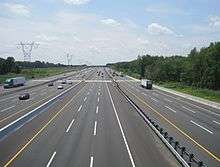
I-195 is a major artery that connects Trenton to the Jersey Shore and the New Jersey Turnpike. Interchange 7A (for the Turnpike) is located in the township, with a 13-lane toll gate. 7A is well known for leading to not only Trenton, but to Six Flags Great Adventure in Jackson Township and "Shore Points." In addition, exit 7A is the connector between the free Interstate 295 versus the tolled Turnpike. Trucks and many other vehicles are now beginning to shunpike by using 295 north to 195 east, to the Turnpike northbound (and vice versa). Furthermore, the turnpike interchange gives access to motorists who wish to continue on I-95 (by using I-295) since I-95 (the section north of Trenton) "abruptly" ends in Lawrence Township. (All signage directs drivers wishing to continue on I-95 north to take I-295 south to I-195 east to the Turnpike, I-95 at exit 7A.)
In November 2006, a bypass of Route was proposed to be constructed near the intersection at CR 526 to the intersection of U.S. Route 130 and Gold Drive in the township of Hamilton.
The New Jersey Turnpike Authority completed a major Turnpike widening project by building new outer roadways (or truck lanes) extending the "dual-dual" configuration to exit 6 (Mansfield Township) from its former southern end at exit 8A (Monroe Township). In Robbinsville, the old exit 7A ramps were demolished and replaced with new ramp movements: two-lane high speed ramps to the turnpike north and from the turnpike south, and two-lane ramps from the turnpike north and to the turnpike south. The 7A toll gate was expanded with the addition of three more toll lanes. All the overpasses that cross over and pass underneath the turnpike were reconstructed. Finally, sound barriers were built at various locations along the turnpike, including by the Woods of Washington. The project was announced in December 2004 and completed in early November 2014.[95][96][97]
Public transportation
New Jersey Transit provides bus service to and from Trenton on the 606 route.[98]
Robbinsville Township is home to Trenton-Robbinsville Airport (identifier N87), an uncontrolled general aviation airport, with a 4,275-foot (1,303 m) long runway. The airport averages 30,000 aircraft operations per year.[99]
Points of interest
Wineries
Restaurants
Religious institutions
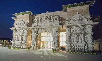
- Swaminarayanan Akshardham – the world's largest Hindu temple, inaugurated in 2014[100]
Notable people
People who were born in, residents of, or otherwise closely associated with Robbinsville Township include:
- Frank Eliason (born 1972), corporate executive and author.
- Elijah C. Hutchinson (1855–1932), represented New Jersey's 4th congressional district from 1915–1923.[101]
- Robert "Bobby" Smith (born 1951), retired U.S. soccer defender and National Soccer Hall of Fame member, owner of Bob Smith Soccer Academy in Robbinsville Township.[102]
References
- ↑ Kuperinsky, Amy. "'The Jewel of the Meadowlands'?: N.J.'s best, worst and weirdest town slogans", NJ Advance Media for NJ.com, January 22, 2015. Accessed July 12, 2016. " Robbinsville, another Mercer County township, beckons visitors to 'Be at the Center of it All.' This refers to the community's literal centrality within the state. To drive the point home, the town logo plants the dot on the 'I' in 'Robbinsville' smack dab in the middle of a mini New Jersey."
- 1 2 3 4 5 6 2010 Census Gazetteer Files: New Jersey County Subdivisions, United States Census Bureau. Accessed May 21, 2015.
- 1 2 US Gazetteer files: 2010, 2000, and 1990, United States Census Bureau. Accessed September 4, 2014.
- 1 2 2012 New Jersey Legislative District Data Book, Rutgers University Edward J. Bloustein School of Planning and Public Policy, March 2013, p. 135. Form of government listed as Township.
- 1 2 3 4 Township Council, Robbinsville Township. July 11, 2016.
- ↑ 2016 New Jersey Mayors Directory, New Jersey Department of Community Affairs. Accessed June 14, 2016. As of date accessed, Fried is listed with an incorrect term-end date of June 30, 2017.
- ↑ Department of Administration, Robbinsville Township. Accessed July 11, 2016.
- ↑ Municipal Clerk, Robbinsville Township. Accessed July 11, 2016.
- ↑ U.S. Geological Survey Geographic Names Information System: Township of Robbinsville, Geographic Names Information System. Accessed March 11, 2013.
- 1 2 3 4 5 6 DP-1 - Profile of General Population and Housing Characteristics: 2010 for Robbinsville township, Mercer County, New Jersey, United States Census Bureau. Accessed September 12, 2012.
- 1 2 3 4 Municipalities Grouped by 2011-2020 Legislative Districts, New Jersey Department of State, p. 7. Accessed January 6, 2013.
- 1 2 3 Profile of General Demographic Characteristics: 2010 for Robbinsville township, New Jersey Department of Labor and Workforce Development. Accessed September 12, 2012.
- 1 2 PEPANNRES - Annual Estimates of the Resident Population: April 1, 2010 to July 1, 2015 - 2015 Population Estimates for New Jersey municipalities, United States Census Bureau. Accessed May 22, 2016.
- 1 2 GCT-PH1 Population, Housing Units, Area, and Density: 2010 - State -- County Subdivision from the 2010 Census Summary File 1 for New Jersey, United States Census Bureau. Accessed August 9, 2013.
- ↑ Look Up a ZIP Code for Robbinsville, NJ, United States Postal Service. Accessed September 12, 2012.
- ↑ Area Code Lookup - NPA NXX for Robbinsville, NJ, Area-Codes.com. Accessed October 23, 2014.
- 1 2 American FactFinder, United States Census Bureau. Accessed September 4, 2014.
- ↑ A Cure for the Common Codes: New Jersey, Missouri Census Data Center. Accessed September 12, 2012.
- ↑ US Board on Geographic Names, United States Geological Survey. Accessed September 4, 2014.
- ↑ Table 7. Population for the Counties and Municipalities in New Jersey: 1990, 2000 and 2010, New Jersey Department of Labor and Workforce Development, February 2011. Accessed September 12, 2012.
- 1 2 Hutchinson, Viola L. The Origin of New Jersey Place Names, New Jersey Public Library Commission, May 1945. Accessed August 26, 2015.
- ↑ Snyder, John P. The Story of New Jersey's Civil Boundaries: 1606-1968, Bureau of Geology and Topography; Trenton, New Jersey; 1969. p. 165. Accessed September 12, 2012.
- ↑ "A change of name but town's the same", The Trenton Times, November 7, 2007.
- ↑ 1 Of N.J.'s 6 Washington Townships Changes Name, NBC 10, November 7, 2007. While this and other sources state that the change was immediate, the Township Clerk stated that the change would take place on January 1, 2008.
- ↑ Areas touching Robbinsville Township, MapIt. Accessed January 5, 2015.
- ↑ Locality Search, State of New Jersey. Accessed January 5, 2015.
- ↑ Census Estimates for New Jersey April 1, 2010 to July 1, 2015, United States Census Bureau. Accessed May 22, 2016.
- ↑ Compendium of censuses 1726-1905: together with the tabulated returns of 1905, New Jersey Department of State, 1906. Accessed July 18, 2013.
- ↑ Raum, John O. The History of New Jersey: From Its Earliest Settlement to the Present Time, Volume 1, p. 276, J. E. Potter and company, 1877. Accessed July 18, 2013. "Washington contained in 1860 a population of 1,279; and in 1870, 1,294."
- ↑ Staff. A compendium of the ninth census, 1870, p. 260. United States Census Bureau, 1872. Accessed November 20, 2012.
- ↑ Porter, Robert Percival. Preliminary Results as Contained in the Eleventh Census Bulletins: Volume III - 51 to 75, p. 98. United States Census Bureau, 1890. Accessed September 12, 2012.
- ↑ Thirteenth Census of the United States, 1910: Population by Counties and Minor Civil Divisions, 1910, 1900, 1890, United States Census Bureau, p. 337. Accessed September 12, 2012.
- ↑ Fifteenth Census of the United States : 1930 - Population Volume I, United States Census Bureau, p. 716. Accessed September 12, 2012.
- ↑ Table 6. New Jersey Resident Population by Municipality: 1930 - 1990, New Jersey Department of Labor and Workforce Development. Accessed June 28, 2015.
- 1 2 3 4 5 Census 2000 Profiles of Demographic / Social / Economic / Housing Characteristics for Robbinsville township, Mercer County, New Jersey, United States Census Bureau. Accessed September 12, 2012.
- 1 2 3 4 5 DP-1: Profile of General Demographic Characteristics: 2000 - Census 2000 Summary File 1 (SF 1) 100-Percent Data for Robbinsville township, Mercer County, New Jersey, United States Census Bureau. Accessed September 12, 2012.
- ↑ DP03: Selected Economic Characteristics from the 2006-2010 American Community Survey 5-Year Estimates for Robbinsville township, Mercer County, New Jersey, United States Census Bureau. Accessed September 12, 2012.
- ↑ Form of Government, Robbinsville Township. Accessed July 11, 2016.
- ↑ Township Code § 2-6 Membership; term of office., Robbinsville Township. Accessed June 30, 2015. "The Township Council shall consist of five members, elected at-large by the voters of the Township at the regular nonpartisan municipal election to be held at the time of the November general election. The terms of the members of the Council shall be four years, beginning on January 1 following such election. Accordingly, the terms of the Council members holding office at the time of the adoption of this ordinance[1] shall be extended until December 31 beyond the expiration of their present term of office.[1]:Editor's Note: "This ordinance" refers to Ord. No. 2011-26, adopted 12-22-2011."
- ↑ Office of the Mayor, Robbinsville Township. Accessed July 11, 2016.
- ↑ 2016 Municipal User Friendly Budget, Robbinsville Township. July 11, 2016.
- ↑ Mercer County Elected Officials, Mercer County, New Jersey, as of January 1, 2016. Accessed July 11, 2016.
- ↑ Guide to Robbinsville Township Officials, Mercer County Library System. Accessed July 11, 2016.
- ↑ Mercer County November 3, 2015 General Election Results, Mercer County, New Jersey, updated November 17, 2015. Accessed July 11, 2016.
- ↑ Mercer County November 5, 2013 General Election Results, Mercer County, New Jersey, updated November 13, 2013. Accessed July 11, 2016.
- ↑ Plan Components Report, New Jersey Redistricting Commission, December 23, 2011. Accessed January 6, 2013.
- ↑ 2016 New Jersey Citizen's Guide to Government, p. 63, New Jersey League of Women Voters. Accessed July 20, 2016.
- ↑ Districts by Number for 2011-2020, New Jersey Legislature. Accessed January 6, 2013.
- ↑ 2011 New Jersey Citizen's Guide to Government, p. 63, New Jersey League of Women Voters. Accessed May 22, 2015.
- ↑ Directory of Representatives: New Jersey, United States House of Representatives. Accessed January 5, 2012.
- ↑ About Cory Booker, United States Senate. Accessed January 26, 2015. "He now owns a home and lives in Newark's Central Ward community."
- ↑ Biography of Bob Menendez, United States Senate, January 26, 2015. "He currently lives in Paramus and has two children, Alicia and Robert."
- ↑ Senators of the 114th Congress from New Jersey. United States Senate. Accessed January 26, 2015. "Booker, Cory A. - (D - NJ) Class II; Menendez, Robert - (D - NJ) Class I"
- ↑ Legislative Roster 2016-2017 Session, New Jersey Legislature. Accessed January 17, 2016.
- ↑ "About the Governor". State of New Jersey. Retrieved 2010-01-21.
- ↑ "About the Lieutenant Governor". State of New Jersey. Retrieved 2010-01-21.
- ↑ Elected Officials, Mercer County, New Jersey. Accessed September 6, 2014.
- ↑ Brian M. Hughes, County Executive, Mercer County, New Jersey. Accessed September 6, 2014.
- ↑ Andrew Koontz, Mercer County. Accessed September 6, 2014.
- ↑ Samuel T. Frisby, Sr., Mercer County. Accessed September 6, 2014.
- ↑ Ann M. Cannon, Mercer County. Accessed September 6, 2014.
- ↑ Anthony P. Carabelli, Mercer County. Accessed September 6, 2014.
- ↑ John A. Cimono, Mercer County. Accessed September 6, 2014.
- ↑ Pasquale "Pat" Colavita, Jr., Mercer County. Accessed September 6, 2014.
- ↑ Lucylle R. S. Walter, Mercer County. Accessed September 6, 2014.
- ↑ Meet the Freeholders, Mercer County. Accessed September 6, 2014.
- ↑ 2014 County Data Sheet, Mercer County. Accessed September 6, 2014.
- ↑ County Clerk, Mercer County. Accessed September 6, 2014.
- ↑ Sheriff, Mercer County. Accessed September 6, 2014.
- ↑ County Surrogate, Mercer County. Accessed September 6, 2014.
- ↑ Elected Officials for Mercer County, State of New Jersey. Accessed September 6, 2014.
- ↑ Voter Registration Summary - Mercer, New Jersey Department of State Division of Elections, March 23, 2011. Accessed November 21, 2012.
- ↑ "Presidential General Election Results - November 6, 2012 - Mercer County" (PDF). New Jersey Department of Elections. March 15, 2013. Retrieved December 23, 2014.
- ↑ "Number of Registered Voters and Ballots Cast - November 6, 2012 - General Election Results - Mercer County" (PDF). New Jersey Department of Elections. March 15, 2013. Retrieved December 23, 2014.
- ↑ 2008 Presidential General Election Results: Mercer County, New Jersey Department of State Division of Elections, December 23, 2008. Accessed November 21, 2012.
- ↑ 2004 Presidential Election: Mercer County, New Jersey Department of State Division of Elections, December 13, 2004. Accessed November 21, 2012.
- ↑ "Governor - Mercer County" (PDF). New Jersey Department of Elections. January 31, 2014. Retrieved December 23, 2014.
- ↑ "Number of Registered Voters and Ballots Cast - November 5, 2013 - General Election Results - Mercer County" (PDF). New Jersey Department of Elections. January 31, 2014. Retrieved December 23, 2014.
- ↑ 2009 Governor: Mercer County, New Jersey Department of State Division of Elections, December 31, 2009. Accessed November 21, 2012.
- ↑ District information for Robbinsville Township School District, National Center for Education Statistics. Accessed January 5, 2015.
- ↑ School Data for the Washington Township Public Schools, National Center for Education Statistics. Accessed January 5, 2015.
- ↑ Sharon Elementary School, Robbinsville Public School District. Accessed August 9, 2013.
- ↑ Pond Road Middle School, Robbinsville Public School District. Accessed August 9, 2013.
- ↑ Robbinsville High School, Robbinsville Public School District. Accessed August 9, 2013.
- ↑ New Jersey School Directory for the Robbinsville Public School District, New Jersey Department of Education. Accessed August 9, 2013.
- ↑ Kahn, Lea. "Lawrence: School district earns $1 million from solar panels", The Lawrence Ledger, March 30, 2011. Accessed April 18, 2011. "School district officials began exploring the possibility of installing solar panels on each of the seven school buildings in 2004, Mr. Meara said. The goal was to address the loss of revenue as a result of Robbinsville Township's decision to build its own high school, ending the sending-receiving relationship between the Lawrence and Robbinsville school districts."
- ↑ Robbinsville Town Center, Accessed November 29, 2010.
- ↑ Preliminary Redevelopment Investigation, Accessed November 29, 2010.
- ↑ Degnan, Joanne. "ROBBINSVILLE: State OKs redevelopment designation for Town Center South", CentralJersey.com, December 8, 2010. Accessed September 15, 2015.
- ↑ Fast-food proposal raises traffic concerns, Accessed December 11, 2010.
- ↑ Mercer County Land Development Committee, November 13, 2013 Report, Accessed August 30, 2014.
- ↑ Robbinsville Officially Welcomes Taco Bell, Robbinsville Township, press release dated June 11, 2015. Accessed September 12, 2015.
- ↑ Davis, Mike. "Amazon's new mega-warehouse in Robbinsville ships first order - A sonic water jet system", The Times (Trenton), July 30, 2014. Accessed September 15, 2015.
- ↑ Mercer County Mileage by Municipality and Jurisdiction, New Jersey Department of Transportation, May 2010. Accessed July 18, 2014.
- ↑ Seeking the sound of silence, The Trenton Times, February 4, 2007.
- ↑ NJ Turnpike Interchange 6 to Widening program Overview, New Jersey Turnpike Authority. Accessed November 3, 2014.
- ↑ Gov. Christie, NJDOT Commissioner FoxPraise $2.3 Billion NJ Turnpike Infrastructure Investment Project, New Jersey Turnpike Authority. Accessed November 3, 2014. "The Widening Program created a three-lane Outer Roadway in each direction over the 25 miles between Interchange 6 in Mansfield Township, Burlington County, and Interchange 8A in Monroe Township, Middlesex County."
- ↑ Mercer County Bus / Rail Connections, New Jersey Transit, backed up by the Internet Archive as of May 22, 2009. Accessed November 20, 2012.
- ↑ Trenton-Robbinsville Airport, Airnav.com. Accessed April 18, 2011.
- ↑ Frances Kai-Hwa Wang (July 28, 2014). "World's Largest Hindu Temple Being Built in New Jersey". NBC News. Retrieved October 15, 2016.
- ↑ Elijah Cubberley Hutchinson, Biographical Directory of the United States Congress. Accessed September 7, 2007.
- ↑ About Bob Smith, Bob Smith Soccer Academy. Accessed February 20, 2016.
External links
| Wikimedia Commons has media related to Robbinsville Township, New Jersey. |
- Robbinsville Township website
- Robbinsville Schools
- Robbinsville Schools's 2014–15 School Report Card from the New Jersey Department of Education
- Data for the Robbinsville Schools, National Center for Education Statistics
- Robbinsville Professional Fire Fighters Association IAFF Local 3786
 |
West Windsor Township | East Windsor Township | | |
| Hamilton Township | |
Millstone Township | ||
| ||||
| | ||||
| Allentown Upper Freehold Township |