Riverview, St. Louis
| Riverview | |
|---|---|
| St. Louis neighborhood | |
|
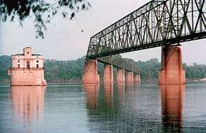
Riverview Neighborhood at its northern end, where the Chain of Rocks Bridge enters Missouri. | |
 Location of Riverview within St. Louis | |
| Country | United States |
| State | Missouri |
| City | St. Louis |
| Wards | 2 |
| Government | |
| • Aldermen | Dionne Flowers |
| Area | |
| • Total | 1.34 sq mi (3.5 km2) |
| Population (2010)[1] | |
| • Total | 304 |
| • Density | 230/sq mi (88/km2) |
| ZIP code(s) | Part of 63137 |
| Area code(s) | 314 |
| Website | stlouis-mo.gov |
Riverview is a neighborhood of St. Louis, Missouri. Riverview comprises the extreme northern section of the city, bounded by the Mississippi River to the east, the city limits to the west, and Chain of Rocks Road to the south, with the northern boundary lying a third of a mile north of I-270.[2] The only major road in Riverview is Riverview Drive.
Demographics
In 2010 Riverview's racial makeup was 68.9% Black, 28.9% White, 0.3% Native American, 1.6% Asian, and 0.3% Two or More Races. 0.3% of the population was of Hispanic or Latino origin.[3]
See also
- Riverview, St. Louis County, Missouri, a village in adjoining St. Louis County
References
Coordinates: 38°44′48″N 90°11′51″W / 38.7468°N 90.1975°W
This article is issued from Wikipedia - version of the 10/10/2016. The text is available under the Creative Commons Attribution/Share Alike but additional terms may apply for the media files.