River Ridge, Louisiana
| River Ridge | |
| Census-designated place | |
 Welcome to River Ridge sign on Jefferson Highway | |
| Country | United States |
|---|---|
| State | Louisiana |
| Parish | Jefferson |
| Coordinates | 29°57′43″N 90°13′04″W / 29.96194°N 90.21778°WCoordinates: 29°57′43″N 90°13′04″W / 29.96194°N 90.21778°W |
| Area | 3.6 sq mi (9.3 km2) |
| - land | 2.8 sq mi (7 km2) |
| - water | 0.8 sq mi (2 km2), 22.22% |
| Population | 13,494 (2010) |
| Density | 4,827.9/sq mi (1,864.1/km2) |
| Timezone | CST (UTC-6) |
| - summer (DST) | CDT (UTC-5) |
| Area code | 504 |
 Location of River Ridge in Louisiana | |
 Location of Louisiana in the United States | |
River Ridge is a census-designated place (CDP) in Jefferson Parish, Louisiana, United States, and a suburb of New Orleans. The population was 13,494 at the 2010 census.[1]
History
The land that is now River Ridge was developed by French colonists and their descendants in the late 18th and early 19th centuries for large sugar plantations; these lined the Mississippi River in traditional French long-lot fashion. The plantations had relatively narrow waterfronts, in order to provide water access, and extended deeply back from the river. These plantations were developed by French colonists and their descendants; they depended on the labor of African slaves. Major landowners included members of the Trudeau and Sauve families. (Pierre Sauve (1805-1867) had a major plantation here known as Providence.)
The alignment of the major streets in the area are vestiges of this era. Sauve Road continues to be a main thoroughfare in River Ridge.
In 1849 a major flooding event known as Sauve's Crevasse occurred. The crude river levee at the Sauve Providence plantation failed under pressure of high water on the Mississippi. The massive flood inundated much of the land to the east, including parts of New Orleans. This crevasse occurred where a former meander of the Mississippi River once branched to form the Metairie and Gentilly Ridges.
In the early 20th century, an interurban transit line was constructed through this area. It served to connect the cities of New Orleans and Kenner. It was aligned along the present course of Jefferson Highway, which was improved from earlier roads.
For many years the area remained rural farmland, until the post-World War II suburbanization era. Aided by funding under the GI Bill, when enabled veterans to buy houses, large-scale suburban development began in the early 1950s. By 1965 virtually all of the area along the Mississippi River between Harahan and Kenner was developed. This area at the time was known as Little Farms, a name which well described its pre-urban history; this was also the place name officially recognized by the Post Office. (To this day Little Farms Avenue remains a major River Ridge thoroughfare.) Other subdivision names such as "East Bank" and "Rural Acres" were used as place names for the area at the time.
To eliminate confusion and create some sense of community identity, the area between Kenner, Harahan, Metairie, and the Mississippi River was officially renamed as "River Ridge" in 1974.
Geography
River Ridge is located along a 3-mile (4.8 km) stretch of Jefferson Highway. Its boundaries include Harahan to the east, Kenner to the west, Metairie to the north, and the Mississippi River to the south.
River Ridge is located at 29°57′43″N 90°13′4″W / 29.96194°N 90.21778°W (29.961875, -90.217696).[1] According to the United States Census Bureau, the CDP has a total area of 3.6 square miles (9.2 km²), of which, 2.8 square miles (7.3 km²) of it is land and 0.8 square miles (1.9 km²) of it (21.07%) is water.
Demographics
| Historical population | |||
|---|---|---|---|
| Census | Pop. | %± | |
| 1970 | 15,713 | — | |
| 1980 | 17,146 | 9.1% | |
| 1990 | 14,800 | −13.7% | |
| 2000 | 14,588 | −1.4% | |
| 2010 | 13,494 | −7.5% | |
| U.S. Decennial Census [2][3] | |||
As of the census[4] of 2000, there were 14,588 people, 6,030 households, and 4,082 families residing in the CDP. The population density was 5,181.6 people per square mile (1,997.3/km²). There were 6,325 housing units at an average density of 2,246.6 per square mile (866.0/km²). The racial makeup of the CDP was 86.76% White, 10.99% African American, 0.23% Native American, 0.78% Asian, 0.03% Pacific Islander, 0.45% from other races, and 0.76% from two or more races. Hispanic or Latino of any race were 2.92% of the population.
There were 6,030 households out of which 27.8% had children under the age of 18 living with them, 53.8% were married couples living together, 10.9% had a female householder with no husband present, and 32.3% were non-families. 27.9% of all households were made up of individuals and 10.1% had someone living alone who was 65 years of age or older. The average household size was 2.42 and the average family size was 2.99.
In the CDP the population was spread out with 22.7% under the age of 18, 6.9% from 18 to 24, 28.4% from 25 to 44, 25.6% from 45 to 64, and 16.5% who were 65 years of age or older. The median age was 41 years. For every 100 females there were 91.3 males. For every 100 females age 18 and over, there were 88.6 males.
The median income for a household in the CDP was $46,286, and the median income for a family was $58,139. Males had a median income of $44,211 versus $28,285 for females. The per capita income for the CDP was $27,088. About 6.7% of families and 8.9% of the population were below the poverty line, including 13.0% of those under age 18 and 6.2% of those age 65 or over.
Culture
- Paradise Manor Community Club is the swimming and tennis club for River Ridge.
- According to Census 2000, River Ridge had 30 houses valued at $1,000,000 or more.
Education
Jefferson Parish Public Schools operates public schools.[5] Students are zoned to Hazel Park/Hilda Knoff Elementary School in River Ridge,[6] Riverdale Middle School in Jefferson,[7] and Riverdale High School in Jefferson.[8] In regards to the advanced studies academies, students are zoned to Airline Park Academy.[9]
St. Matthew Catholic School is in River Ridge. Many of the Catholic high schools are close by such as Archbishop Rummel High School and Archbishop Chapelle. Non-Catholic schools located nearby include St. Martin's Episcopal School, Kehoe-France, John Curtis, and Ridgewood Preparatory School,
Jefferson Parish Library operates the River Ridge e-Branch in River Ridge.[10][11] The library held its grand opening ceremony on Tuesday July 26, 2005.[10]
References
| Wikimedia Commons has media related to River Ridge, Louisiana. |
- 1 2 "US Gazetteer files: 2010, 2000, and 1990". United States Census Bureau. 2011-02-12. Retrieved 2011-04-23.
- ↑ "CENSUS OF POPULATION AND HOUSING (1790-2000)". U.S. Census Bureau. Retrieved 2010-07-17.
- ↑ Census area returned as Little Farms in 1970.
- ↑ "American FactFinder". United States Census Bureau. Retrieved 2008-01-31.
- ↑ "2010 CENSUS - CENSUS BLOCK MAP: River Ridge CDP, LA" (Archive). U.S. Census Bureau. Retrieved on May 18, 2014.
- ↑ "Elementary School Districts 2012-2013 East Bank of Jefferson Parish Louisiana" (Archive). Jefferson Parish Public School System. Retrieved on May 18, 2014.
- ↑ "Middle School Districts 2012-2013 East Bank of Jefferson Parish Louisiana" (Archive) Jefferson Parish Public School System. Retrieved on May 18, 2014.
- ↑ "High School Districts 2012-2013 East Bank of Jefferson Parish Louisiana." (Archive) Jefferson Parish Public School System. Retrieved on May 18, 2014.
- ↑ "East Bank Advanced Studies Attendance Zones" (Archive). Jefferson Parish Public School System. Retrieved on May 18, 2014.
- 1 2 "River Ridge e-Branch." Jefferson Parish Library. Retrieved on September 29, 2010.
- ↑ "River Ridge CDP, Louisiana." U.S. Census Bureau. Retrieved on September 29, 2010.
Municipalities and communities of Jefferson Parish, Louisiana, United States | ||
|---|---|---|
| Cities | 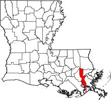 | |
| Towns | ||
| CDPs | ||
| Others Unincorporated communities | ||