Hudson River
| Hudson River | |
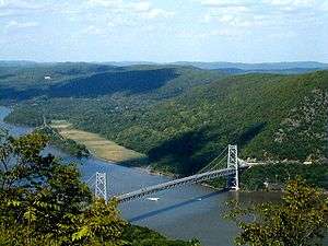 The Bear Mountain Bridge across the Hudson River as seen from Bear Mountain | |
| Country | United States |
|---|---|
| States | New York, New Jersey |
| Tributaries | |
| - left | Boreas River, Schroon River, Batten Kill, Hoosic River, Kinderhook Creek, Roeliff Jansen Kill, Wappinger Creek, Croton River |
| - right | Cedar River, Indian River, Sacandaga River, Mohawk River, Normans Kill, Catskill Creek, Esopus Creek, Rondout Creek/Wallkill River |
| City | See Populated places on the Hudson River |
| Source | Near or at Lake Tear of the Clouds or near or at Henderson Lake (See Sources) |
| - location | Adirondack Mountains, New York, United States |
| - elevation | 4,590 ft (1,399 m) |
| - coordinates | 44°7′4″N 73°55′4″W / 44.11778°N 73.91778°W "Mount Marcy, NY" 1:25,000 quadrangle, USGS |
| Mouth | Upper New York Bay |
| - location | Jersey City, New Jersey and Lower Manhattan, New York, United States |
| - elevation | 0 ft (0 m) |
| - coordinates | 40°42′11″N 74°01′34″W / 40.70306°N 74.02611°WCoordinates: 40°42′11″N 74°01′34″W / 40.70306°N 74.02611°W |
| Length | 315 mi (507 km) |
| Basin | 14,000 sq mi (36,260 km2) |
| Discharge | for Lower New York Bay, max and min at Green Island |
| - average | 21,900 cu ft/s (620 m3/s) [1] |
| - max | 215,000 cu ft/s (6,088 m3/s) |
| - min | 882 cu ft/s (25 m3/s) |
| Discharge elsewhere (average) | |
| - Troy | 15,000 cu ft/s (425 m3/s) |
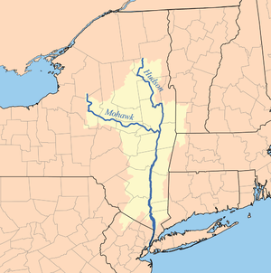 Hudson and Mohawk watersheds | |
The Hudson River is a 315-mile (507 km) river that flows from north to south primarily through eastern New York in the United States. The river originates in the Adirondack Mountains of Upstate New York, flows through the Hudson Valley, and eventually drains into the Atlantic Ocean, between New York City and Jersey City. The river serves as a political boundary between the states of New Jersey and New York, and further north between New York counties. The lower half of the river is a tidal estuary occupying the Hudson Fjord, which formed during the most recent period of North American glaciation, estimated at 26,000 to 13,300 years ago.[2] Tidal waters influence the Hudson's flow from as far north as Troy.
The river is named after Henry Hudson, an Englishman sailing for the Dutch East India Company, who explored it in 1609, and after whom Canada's Hudson Bay is also named. It had previously been observed by Italian explorer Giovanni da Verrazano sailing for King Francis I of France in 1524, as he became the first European known to have entered the Upper New York Bay, but he considered the river to be an estuary. The Dutch called the river the North River – with the Delaware River called the South River – and it formed the spine of the Dutch colony of New Netherland. Settlements of the colony clustered around the Hudson, and its strategic importance as the gateway to the American interior led to years of competition between the English and the Dutch over control of the river and colony.
During the eighteenth century, the river valley and its inhabitants were the subject and inspiration of Washington Irving, the first internationally acclaimed American author. In the nineteenth century, the area inspired the Hudson River School of landscape painting, an American pastoral style, as well as the concepts of environmentalism and wilderness. The Hudson was also the eastern outlet for the Erie Canal, which, when completed in 1825, became an important transportation artery for the early-19th-century United States.
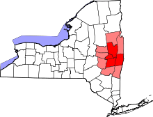
| Hamilton |
| Essex |
| Warren |
| Washington |
| Saratoga |
| Albany |
| Rensselaer |
| Greene |
| Columbia |
| Ulster |
| Dutchess |
| Putnam |
| Orange |
| Rockland |
| Westchester |
| Bronx |
| Bergen (NJ) |
| Hudson (NJ) |
| New York |
| Source:[3] |
Course
Sources
The source of the Hudson River is Lake Tear of the Clouds in the Adirondack Park at an altitude of 4,322 feet (1,317 m).[4] The river is not cartographically called the Hudson River until miles downstream. The river is named Feldspar Brook until its confluence with Calamity Brook, and then is named Calamity Brook until the river reaches Indian Pass Brook, flowing south from the outlet of Henderson Lake. From that point on, the stream is cartographically known as the Hudson River.[5][6][7]
Although numerous sources show the river originating directly at Henderson Lake, per the U.S. Geological Survey (USGS), the river cartographically begins at the confluence of Indian Pass Brook and Calamity Brook near the outlet of Henderson Lake in Newcomb, in the Adirondack Park.[3]
The longest source of the Hudson River as shown on the most detailed USGS maps is the "Opalescent River" on the west slopes of Little Marcy Mountain, originating two miles north of Lake Tear of the Clouds, and a mile longer than "Feldspar Brook", which flows out of that lake in the Adirondack Mountains. Popular culture and convention, however, more often cite the photogenic Lake Tear of the Clouds as the source.
Upper Hudson River
South of the confluence of Indian Pass Brook and Calamity Brook, the Hudson River flows south into Sanford Lake. South of the outlet of the lake, the Opalescent River flows into the Hudson. The Hudson then flows south, taking in Beaver Brook and the outlet of Lake Harris. After its confluence with the Indian River, the Hudson forms the boundary between Essex and Hamilton counties. In the hamlet of North River, the Hudson flows entirely in Warren County and takes in the Schroon River. Further south, the river forms the boundary between Warren and Saratoga Counties. The river then takes in the Sacandaga River from the Great Sacandaga Lake. Shortly thereafter, the river leaves the Adirondack Park, flows under Interstate 87, and through Glens Falls, just south of Lake George although receiving no streamflow from the lake. It next goes through Hudson Falls. At this point the river forms the boundary between Washington and Saratoga Counties.[7] At this point the river has an altitude of 200 feet.[4] Just south in Fort Edward, the river reaches its confluence with the Champlain Canal,[7] which historically provided boat traffic between New York City and Montreal and the rest of Eastern Canada via the Hudson, Lake Champlain and the Saint Lawrence Seaway.[8] Further south the Hudson takes in water from the Batten Kill River and Fish Creek near Schuylerville. The river then forms the boundary between Saratoga and Rensselaer counties. The river then enters the heart of the Capital District. It takes in water from the Hoosic River, which extends into Massachusetts. Shortly thereafter the river has its confluence with the Mohawk River, the largest tributary of the Hudson River, in Waterford.[4][7] Shortly thereafter, the river reaches the Federal Dam in Troy, marking an impoundment of the river.[7] At an elevation of 2 feet (0.61 m), the bottom of the dam marks the beginning of the tidal influence in the Hudson as well as the beginning of the lower Hudson River.[4]
Lower Hudson River

South of the Federal Dam, the Hudson River begins to widen considerably. The river enters the Hudson Valley, flowing along the west bank of Albany and the east bank of Rensselaer. Interstate 90 crosses the Hudson into Albany at this point in the river. The Hudson then leaves the Capital District, forming the boundary between Greene and Columbia Counties. The river then meets its confluence with Schodack Creek, widening considerably at this point. After flowing by Hudson, the river then forms the boundary between Ulster and Columbia Counties and Ulster and Dutchess Counties, flowing by Germantown and Kingston. The Delaware and Hudson Canal meets the river at this point. The river then flows by Hyde Park, former residence of Franklin D. Roosevelt. The river then flows alongside the city of Poughkeepsie, flowing under the Walkway over the Hudson and the Mid-Hudson Bridge. Afterwards, the Hudson flows by Wappingers Falls and takes in Wappinger Creek. The river then forms the boundary between Orange and Dutchess Counties. The river flows between Newburgh and Beacon and under the Newburgh Beacon Bridge taking in the Fishkill Creek. Shortly thereafter, the river enters the Hudson Highlands between Putnam and Orange Counties, flowing between mountains such as Storm King Mountain, Breakneck Ridge, and Bear Mountain. The river narrows considerably here before flowing under the Bear Mountain Bridge, which connects Westchester and Rockland Counties.[7]
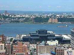
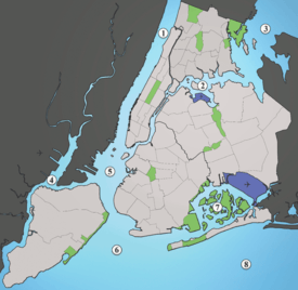
Afterward leaving the Hudson Highlands, the river enters Haverstraw Bay, the widest point of the river at 3.5 miles (5.6 km) wide.[4] Shortly thereafter, the river forms the Tappan Zee and flows under the Tappan Zee Bridge, which carries the New York State Thruway between Tarrytown and Nyack in Westchester and Rockland Counties respectively. South of the Tappan Zee Bridge, the west bank of the Hudson becomes Bergen and Hudson Counties of New Jersey, and further south the east bank of the river becomes Yonkers and then the Riverdale neighborhood of the Bronx in New York City. The Palisades, large, rocky cliffs along the west bank of the river, begin along the west bank of the river opposite the Bronx. South of the confluence of the Hudson and Spuyten Duyvil Creek, the east bank of the river becomes Manhattan.[7] Known as the North River at this point, the George Washington Bridge crosses the river between Fort Lee and the Washington Heights neighborhood of Manhattan.[9] The Lincoln Tunnel and the Holland Tunnel also cross under the river between Manhattan and New Jersey. South of Battery Park, the East River meets the Hudson River and forms Upper New York Bay, also known as New York Harbor. Now in the harbor, sea-going boats can travel through The Narrows between Brooklyn and Staten Island, under the Verrazano Bridge, and into Lower New York Bay and the Atlantic Ocean.[7]
Watershed

The lower Hudson is actually a tidal estuary, with tidal influence extending as far as the Federal Dam in Troy. Strong tides make parts of New York Harbor difficult and dangerous to navigate. During the winter, ice floes drift south or north, depending upon the tides. The Mahican name of the river represents its partially estuarine nature: muh-he-kun-ne-tuk means "the river that flows both ways."[10] The Hudson is often mistaken for one of the largest rivers in the United States, but it is an estuary throughout most of its length below Troy and thus only a small fraction of fresh water, about 15,000 cubic feet (425 m³) per second, is present. The mean fresh water discharge at the river's mouth in New York is approximately 21,400 cubic feet (606 m³) per second. The Hudson and its tributaries, notably the Mohawk River, drain a large area. Parts of the Hudson River form coves, such as Weehawken Cove in Hoboken and Weehawken in New Jersey.
Landmarks
Along the river runs the Metro-North Railroad's Hudson Line, from Manhattan to Poughkeepsie (continuing north as Amtrak's Empire Corridor to Albany) and The Palisades (from Jersey City to Nyack).
Notable landmarks on the Hudson, from its source to mouth, include Lake Tear of the Clouds, Hudson River Islands State Park, Bard College, Home of Franklin D. Roosevelt National Historic Site, the Culinary Institute of America, Marist College, the Walkway over the Hudson, Bannerman's Castle, Hudson Highlands State Park, the United States Military Academy, Indian Point Energy Center, Croton Point Park, Sing Sing Correctional Facility, Fort Tryon Park with The Cloisters, Stevens Institute of Technology, the World Trade Center, and Liberty State Park. Liberty Island, housing the Statue of Liberty, is just outside the river's mouth.
A similar 30-mile (48 km) stretch on the east bank of the Hudson has been designated the Hudson River Historic District, a National Historic Landmark.[11] The Hudson River was designated as an American Heritage River in 1997.[12] The Hudson River estuary system is part of The National Estuarine Research Reserve System as the Hudson River National Estuarine Research Reserve.[13]
History
Names
The river was called Ca-ho-ha-ta-te-a ("the river")[14] by the Iroquois, and it was known as Muh-he-kun-ne-tuk ("river that flows two ways") by the Mohican tribe who formerly inhabited both banks of the lower portion of the river. The Delaware Tribe of Indians (Bartlesville, Oklahoma) considers the closely related Mohicans to be a part of the Lenape people,[15] and so the Lenape also claim the Hudson as part of their ancestral territory, naming the river Muhheakantuck ("river that flows two ways").[16]
The first known European name for the river was the Rio San Antonio as named by the Portuguese explorer in Spain's employ, Esteban Gomez, who explored the Mid-Atlantic coast in 1525.[17]
An other early name for the Hudson used by the Dutch was Rio de Montaigne.[18] Later, they generally termed it the Noortrivier, or "North River", the Delaware River being known as the Zuidrivier, or "South River". Other occasional names for the Hudson included: Manhattes rieviere "Manhattan River", Groote Rivier "Great River", and de grootte Mouritse reviere, or "the Great Mouritse River" (Mouritse is a Dutch surname).[19] The translated name North River was used in the New York metropolitan area up until the early 1900s, with limited use continuing into the present-day.[20] The term persists in radio communication among commercial shipping traffic, especially below the Tappan Zee.[21] The term also continues to be used in names of facilities in the river's southern portion, such as the North River piers, North River Tunnels, and the North River Wastewater Treatment Plant.
In 1939, the magazine Life described the river as "America's Rhine", comparing it to the 40-mile (64 km) stretch of the Rhine in Central and Western Europe.[22]
Exploration of the Hudson River
In 1497, Jean and Sebastian Cabot, sailing for England sailed along the coast and claimed the entire country for England.[17] In 1524, Florentine Jean de Verrazano visited the bay of New York, in service of Francis I of France.[17] On his voyage, Verrazano sailed north along the Atlantic seaboard, starting in the Carolinas. Verrazano sailed all the way to New York Harbor, which he though was the mouth of a major river. Verrazano sailed his boat into the harbor, and possibly sailed over what is now Battery Park (Battery Park was created with landfill). However, Verrazano never sailed up the Hudson River, and left the harbor shortly thereafter.[23] A year later, Estevan Gomez, a Portuguese explorer sailing for Spain in search of the Northwest Passage visited New York Bay. The extent of his explorations in the bay is unknown. Yet as Charles H. Winfield has noted, as late as 1679, there was a tradition among the Indians that the Spanish arrived before the Dutch, and that from them it was that the natives obtained the maize or Spanish wheat. Maps of that era based on Gomez's map labeled the coast from New Jersey to Rhode Island, as the "land of Estevan Gomez".[17]
In 1598 some Dutch employed by the Greenland Company wintered in the Bay.[17] 11 years later, the Dutch East India Company financed English navigator Henry Hudson in his attempt to search for the Northwest Passage. During this attempt, Henry Hudson decided to sail his ship up the river that would later be named after him. As he continued up the river, its width expanded, into Haverstraw Bay, leading him to believe he had successfully reached the Northwest Passage. He docked his ship on the western shore of Haverstraw Bay and claimed the territory as the first Dutch settlement in North America. He also proceeded upstream as far as present-day Troy before concluding that no such strait existed there.[24]
On March 10, 1648, navigation of the river was banned without a license.
Colonization
After Henry Hudson realized that the Hudson River was not the Northwest Passage, the Dutch began to colonize the region, establishing the colony of New Netherland. The Dutch settled three major outposts: New Amsterdam, Wiltwyck, and Fort Orange.[25] New Amsterdam was founded at the mouth of the Hudson River, and would later become known as New York City. Wiltwyck was founded roughly halfway up the Hudson River between New Amsterdam and Fort Orange. That outpost would later become Kingston. Fort Orange was the outpost that was the furthest up the Hudson River. That outpost would later become known as Albany.[25]
New Netherland and its associated outposts were set up as fur-trading outposts.[26] The Dutch West India Company operated a monopoly on the region for roughly twenty years before other businessmen were allowed to set up their own ventures in the colony.[25] New Amsterdam quickly became the colony's most important city, operating as its capital and its merchant hub.[26] The other outposts functioned as settlements in the wilderness. At first, the colony was made up of mostly single adventures looking to make money, but over time the region transitioned into maintaining family households. New economic activity in the form of food, tobacco, timber, and slaves was eventually incorporated into the colonial economy.[25]
In 1647, Director-General Peter Stuyvesant took over management of the colony. He found the colony in chaos due to a border war with the English along the Connecticut River, and Indian battles throughout the region. Stuyvesant quickly cracked down on smuggling and associated activity before expanding the outposts along the Hudson River, especially Wiltwyck at the mouth of Esopus Creek. Stuyvesant attempted to establish a fort midway up the Hudson River. However, before that could be done, the British invaded New Netherland via the port of New Amsterdam.[25] Given that the city of New Amsterdam was largely defenseless, Stuyvesant was forced to surrender the city and the colony to the British.[27] New Amsterdam and the overall colony of New Netherland was renamed New York, after the Duke of York.[27] The Dutch regained New York temporarily, only to relinquish it again a few years later, thus ending Dutch control over New York and the Hudson River.[27]
Revolutionary War

The Hudson River was a key river during the Revolution. The Hudson River was important for a few reasons. Firstly, the Hudson's connection to the Mohawk River allowed travelers to eventually get to the Great Lakes and the Mississippi River. In addition, the river's close proximity to Lake George and Lake Champlain would allow the British navy to control the water route from Montreal to New York City.[28] In doing so, the British, under general John Burgoyne's strategy, would be able to cut off the patriot hub of New England (which is on the eastern side of the Hudson River) and focus on rallying the support of loyalists in the South and Mid-Atlantic regions. The British knew that total occupation of the colonies would be unfeasible, which is why this strategy was chosen.[29]
As a result of the strategy, numerous battles were fought along the river and in nearby waterways. August 27, 1776, the Battle of Long Island was fought in Brooklyn on the eastern shore of the Verrazano Narrows, the mouth of the Hudson River. Utilizing the vast natural harbor that is New York Harbor, the British sent in an entire armada in order to take on Washington's army in battle. The British, led by General William Howe first arrived in Staten Island, on the western shore of the Narrows. The armada then sailed across the Narrows to a waiting Continental Army. Washington's army was vastly outnumbered at the battle with 12,000 soldiers; the British had 45,000 soldiers. As expected, the British badly defeated the continentals at the battle and nearly crushed the rebellion.[30] However, under the cover of night, Washington ordered the camp fires to be extinguished, and then he and his army fled under the cover of darkness and fog across the East River by boat to Manhattan. The army then marched north to Harlem.[31] As a result of the battle, the British took control of New York City and the harbor, and thus they took control of the mouth of the Hudson River. The British would turn New York City into its headquarters for the war, and occupy it for the rest of the war. The harbor would later be used for prison ships to hold the captured American soldiers.[32]
On September 15, 1776, The Battle of Harlem Heights was fought in what is now Washington Heights, Upper Manhattan. After Washington's army retreated to the northern section of the Manhattan Island, British troops pursued his army. Washington was just finishing a report about the Battle of Long Island when the British began to advance on his position. Washington then counterattacked the British with a plan of his own. Washington ordered a feint in order to fix the British army into a favorable position. Once this was accomplished, Washington ordered Lieutenant Colonel Thomas Knowlton, his rangers, and other units to flank around the right side of the British and attack from the rear. The plan almost worked, but some of the Continental troops attacked too early, allowing the British to retreat and await reinforcements. Once those reinforcements began to arrive, Washington called off the attack. Although not a complete defeat of the British attacking force, the battle was nonetheless a Continental Army victory, the first of the war. This fact greatly enhanced troop morale.[33] Washington would later retreat further north to White Plains, New York as the British pursued him and his army.[34]
While the British advanced towards Washington's Army, Washington decided to take a stand in White Plains. In October, 1776, Howe's army advanced from New Rochelle, and Scarsdale. Washington set up defensive positions in the hills around the village. When the British attacked, the British managed to break the Continental's defenses at Chatterton Hill, now known as Battle Hill. Once the British managed to reach the top of the hill, Washington was forced to retreat. The main positive for Washington after this battle was that he managed to avoid being enveloped by the British Army.[35] Washington ordered his men to retreat across the Hudson River, eventually reaching New Jersey and Pennsylvania.[36] Because Washington was able to preserve what was left of his army, this retreat would eventually lead to the successful surprise attacks on Trenton, New Jersey and Princeton, New Jersey in December of the same year.[35] Fort Washington in Upper Manhattan later fell after this retreat.[36]
Once Washington retreated to Pennsylvania, New England militias had to fortify the Hudson Highlands, a choke point on the river north of Haverstraw Bay. As a result, the Continentals started building Fort Clinton on the other side of the river from Fort Montgomery. In the year 1777, Washington expected General Howe to sail his army north to Saratoga in order to meet up with General Burgoyne. This would result in the Hudson River being sealed off. However, Howe surprised Washington by sailing his army south to Philadelphia, conquering the Patriot capital. Washington was out of position and sought to defend Philadelphia, but to no avail. Meanwhile, Howe left Sir Henry Clinton in charge of a smaller force to be docked in New York City, with the permission to strike the Hudson Valley at any time. On October 5, 1777, Henry Clinton's army did just that, sailing his army up the Hudson River in order to attack the Twin Forts. At the Battle of the Hudson Highlands, a British force commanded by Sir Henry Clinton sailed up the Hudson River and attacked the twin forts. Along the way, Henry Clinton's army looted and pillaged the village of Peeksill. The Continentals fought hard at the battle, but they were badly outnumbered and were fighting in unfinished forts. Washington's men were caught between defending Philadelphia and defending the Hudson Valley. In the end, the British took the fort, as well as taking Philadelphia around the same time. However, Clinton and his men returned to New York City soon afterward.[37]
The Continentals later decided to build the Great West Point Chain in order to prevent another British fleet from sailing up the Hudson River in a similar manner as during the previous battle. The chain that was by the forts was simply circumvented by the British army via attacking on the shores. The new chain, designed by engineer Captain Thomas Machin, could have theoretically been lowered in order to let friendly ships sail down the river, but the chain was never tested, and was later discarded after the war.[38]

In 1777, a major battle, part of the Battles of Saratoga, was unfolding 30 miles north of Albany in Saratoga, New York.[37] British general Burgoyne sought to put into action his plan of taking over Albany and the Hudson River. Burgoyne and his army advanced southward from Canada towards Albany. Meanwhile, an army led by General Barry St. Leger marched east along the Mohawk River towards the same location,[39] taking Fort Ticonderoga along the way. This fort was (and is) located at the southern end of Lake Champlain, and thus was seen as critical in defending Albany.[40] Once Burgoyne took the fort, he made the mistake of deciding not to take the water route along Lake George, instead deciding to take the land route from the fort. Philip Schuyler punished Burgoyne for this mistake. He and his army chopped down trees and littered the pathway that Burgoyne would have to take through the swampy wilderness of the area. As a result of the decision to march south, Burgoyne's supply lines were strained.[40]
Burgoyne sent a column of his troops into Vermont in the hopes of securing needed supplies. However, Continental general John Stark and the New Hampshire-Vermont Militia thwarted Burgoyne's resupply run in the Battle of Bennington. The lack of supplies and the surrender of his column severely weakened his army. Meanwhile, Continental general Benedict Arnold halted the advance of General St. Ledger during the Siege of Fort Stanwix. This had the effect of preventing a British army from attacking the rear of the American troops during the Battle of Saratoga.[40] Burgoyne expected Sir Henry Clinton, under the orders of General Howe, to aid him in the invasion by sailing up the Hudson River from the south.[39] However, Howe's attack on Philadelphia diverted troops needed up in Saratoga. In addition, Washington prevented reinforcements from Howe's army from reaching Burgoyne. Meanwhile, Clinton's army was busy battling in the Hudson Highlands, as well as raiding villages in the Hudson Valley. As a result, Henry Clinton's fleet never reached Saratoga in time.[37]
Both the British and the American armies fought the Battles of Saratoga. Burgoyne still expected assistance from Henry Clinton, so his army dug in and waited. Clinton's forces did sail up the Hudson River, taking the Hudson Highlands forts as well as burning down Kingston (the NY State Capital at the time), but Clinton was forced to sail back to New York City in order to supply reinforcements after Howe's forces left to take Philadelphia.[41] As a result, Burgoyne never received the assistance he needed. Burgoyne's army was now at roughly 6800 men and was surviving on reduced rations.[41] On October 7, 1777, Burgoyne's army attempted to sweep around the American army in a last-ditch effort to escape from being surrounded,[41] but an American counterattack led by General Horatio Gates successfully surrounded the British Army.[39] An offensive by Benedict Arnold (which led to him being wounded in the leg) pushed Burgoyne closer to surrendering.[39] In the end, Burgoyne surrendered his army to the Americans on October 17. This battle would later be known as the turning point of the war. In addition, this battle convinced the French that the American Continentals could beat a European army. As a result, the French joined the war on the side of the Americans.[41]
During Benedict Arnold's control over West Point, he began weakening its defenses, including neglecting repairs on the West Point Chain.[42] At the time, Arnold was secretly loyal to the British, and planned to hand off West Point's plans to British major John André at Snedeker's Landing (or Waldberg Landing) on the wooded west shore of Haverstraw Bay.[43] On September 21, 1780, André sailed up the river on the HMS Vulture to meet Arnold. The next morning, an outpost at Verplanck's Point fired on the ship, which sailed back down river. André was forced to return to New York City by land,[44](pp151–6) however he was captured near Tarrytown on September 23 by three Westchester militiamen, and later was hanged. Arnold later fled to New York using the HMS Vulture.[44](p159)
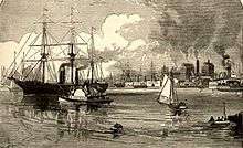
Canal era
.jpg)
At the beginning of the 19th century, transportation away from the US east coast was difficult. Boat travel was still the fastest mode of transportation at the time, as automobiles and rail transportation were still being developed. In order to facilitate boat travel throughout the interior of the United States, numerous canals were constructed between internal bodies of water in the country. These canals would transfer freight throughout the inland US.[45][46]
One of the most significant canals of this era was the Erie Canal. For about a hundred years, various groups had sought to have a canal built between the Great Lakes and the Hudson River. This would link the frontier region of the United States to the Port of New York, a significant seaport during that time period as it is today.[46] Construction of the canal began in 1817 and finished in 1825.[45] Originally called "Clinton's Ditch," after NY Governor DeWitt Clinton,[47] the canal proved to be a success, returning revenues of over $121 million after an initial construction cost of only $7 million.[46] After the canal was built, freight could travel from many frontier cities, such as Pittsburgh, Chicago, and Cleveland, to Lake Erie, then to Buffalo and the entrance to the canal, through the canal to the Hudson River, and then south to New York City.[46] The completion of the canal enhanced the development of the American West, allowing settlers to travel west, then send goods back to market in frontier cities, and then eventually export goods via the Hudson River and New York City. The completion of the canal made New York City one of the most vital ports in the nation, surpassing the Port of Philadelphia and ports in Massachusetts.[46][47][48]
The Erie Canal was not the only canal built that connects to the Hudson River.[48] After the completion of the Erie Canal, smaller canals were built to connect with the new system. The Champlain Canal was built to connect the Hudson River near Troy to the southern end of Lake Champlain. This canal allowed boaters to travel from the St. Lawrence Seaway, and then British cities such as Montreal to the Hudson River and New York City.[48] Another major canal was the Oswego Canal, which connected the Erie Canal to Oswego and Lake Ontario. This canal could be used to bypass Niagara Falls.[48] The Cayuga-Seneca Canal connected the Erie Canal to Cayuga Lake and Seneca Lake.[48] Farther south, the Delaware and Hudson Canal was built between the Delaware River at Honesdale, Pennsylvania, and the Hudson River at Kingston, New York. This canal enabled the transportation of coal, and later other goods as well, between the Delaware and Hudson River watersheds.[49] The combination of these canals made the Hudson River one of the most vital waterways for trade in the nation.[48]
In 1823, Troy's dam and lock were completed; its sloop lock was rebuilt in 1854.[50]
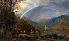
Hudson River School
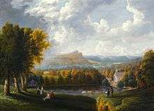
Hudson River School paintings reflect three themes of America in the 19th century: discovery, exploration, and settlement.[51] The paintings also depict the American landscape as a pastoral setting, where human beings and nature coexist peacefully. Hudson River School landscapes are characterized by their realistic, detailed, and sometimes idealized portrayal of nature, often juxtaposing peaceful agriculture and the remaining wilderness, which was fast disappearing from the Hudson Valley just as it was coming to be appreciated for its qualities of ruggedness and sublimity.[52] In general, Hudson River School artists believed that nature in the form of the American landscape was an ineffable manifestation of God,[53] though the artists varied in the depth of their religious conviction. They took as their inspiration such European masters as Claude Lorrain, John Constable and J. M. W. Turner.[54] Their reverence for America's natural beauty was shared with contemporary American writers such as Henry David Thoreau and Ralph Waldo Emerson.[55] The Dusseldorf School of Painting had a direct influence on the Hudson River School.[56]
The school characterizes the artistic body, its New York location, its landscape subject matter, and often its subject, the Hudson River.[57] While the elements of the paintings were rendered realistically, many of the scenes were composed as a synthesis of multiple scenes or natural images observed by the artists. In gathering the visual data for their paintings, the artists would travel to extraordinary and extreme environments, which generally had conditions that would not permit extended painting at the site. During these expeditions, the artists recorded sketches and memories, returning to their studios to paint the finished works later.
The artist Thomas Cole is generally acknowledged as the founder of the Hudson River School.[58] Cole took a steamship up the Hudson in the autumn of 1825, the same year the Erie Canal opened, stopping first at West Point, then at Catskill landing. He hiked west high up into the eastern Catskill Mountains of New York State to paint the first landscapes of the area. The first review of his work appeared in the New York Evening Post on November 22, 1825.[59] At that time, only the English native Cole, born in a landscape where autumnal tints were of browns and yellows, found the brilliant autumn hues of the area to be inspirational.[58] Cole's close friend, Asher Durand, became a prominent figure in the school as well.[60] Painters Frederic Edwin Church and Albert Bierstadt were the most successful painters of the school.[57]
Industrial Revolution
On September 14, 1901, then-US Vice President Theodore Roosevelt was at Lake Tear of the Clouds after returning from a hike to the Mount Marcy summit when he received a message informing him that President William McKinley, who had been shot two weeks earlier but was expected to survive, had taken a turn for the worse. Roosevelt hiked down the mountain to the closest stage station at Long Lake, New York. He then took a 40 miles (64 km) midnight stage coach ride through the Adirondacks to the Adirondack Railway station at North Creek, where he discovered that McKinley had died. Roosevelt took the train to Buffalo, New York, where he was officially sworn in as President.[61] The 40-mile route is now designated the Roosevelt-Marcy Trail.[62]
During the Industrial Revolution, the Hudson River became a major location for production, especially around Albany and Troy. The river allowed for fast and easy transport of goods from the interior of the Northeast to the coast. Hundreds of factories were built around the Hudson, in towns including Poughkeepise, Newburgh, Kingston, and Hudson. The North Tarrytown Assembly (later owned by General Motors), on the river in Sleepy Hollow, was a large and notable example. The River links to the Erie Canal and Great Lakes, allowing manufacturing in the Midwest, including automobiles in Detroit, to use the river for transport.[63](pp71-2) With industrialization came new technologies for transport, including steamboats for faster transport. In 1807, the North River Steamboat (later known as Clermont), became the first commercially successful steamboat.[64] It carried passengers between New York City and Albany along the Hudson River.
Contemporary
In 1965, governor Nelson Rockefeller proposed the Hudson River Expressway, a limited-access highway from the Bronx to Beacon. An 8-mile section was built from Ossining to Peekskill, now part of U.S. Route 9; the rest of the highway was never built due to local opposition.[65]
.jpg)
In 2004, Christopher Swain became the first person to swim the entire length of the Hudson River.[66]
On January 15, 2009, US Airways Flight 1549 made an emergency ditching onto the Hudson River beside lower Manhattan. The flight was a domestic commercial passenger flight with 150 passengers and 5 crew members traveling from LaGuardia Airport in New York City to Charlotte Douglas International Airport in Charlotte. After striking a flock of Canada geese during its initial climb out, the airplane lost engine power and ditched in the Hudson River off Midtown Manhattan with no loss of human life. All 155 occupants safely evacuated the airliner, and were quickly rescued by nearby ferries and other watercraft. The airplane was still virtually intact though partially submerged and slowly sinking. The entire crew of Flight 1549 was later awarded the Master's Medal of the Guild of Air Pilots and Air Navigators.[67] It was described by NTSB board member Kitty Higgins as "the most successful ditching in aviation history."[68]
Geology
The Hudson is sometimes called, in geological terms, a drowned river. The rising sea levels after the retreat of the Wisconsin glaciation, the most recent ice age, have resulted in a marine incursion that drowned the coastal plain and brought salt water well above the mouth of the river. The deeply eroded old riverbed beyond the current shoreline, Hudson Canyon, is a rich fishing area. The former riverbed is clearly delineated beneath the waters of the Atlantic Ocean, extending to the edge of the continental shelf.[69]
The Narrows were most likely formed about 6,000 years ago at the end of the last ice age. Previously, Staten Island and Long Island were connected, preventing the Hudson River from terminating via The Narrows. At that time, the Hudson River emptied into the Atlantic Ocean through a more westerly course through parts of present-day northern New Jersey, along the eastern side of the Watchung Mountains to Bound Brook, New Jersey and then on into the Atlantic Ocean via Raritan Bay. A buildup of water in the Upper New York Bay eventually allowed the Hudson River to break through previous land mass that was connecting Staten Island and Brooklyn to form The Narrows as it exists today. This allowed the Hudson River to find a shorter route to the Atlantic Ocean via its present course between New Jersey and New York City.[70]
Transportation

The Hudson River is navigable for a great distance above mile 0 (at 40°42.1'N., 74°01.5'W.) off Battery Park.[71] The original Erie Canal, opened in 1825 to connect the Hudson with Lake Erie, emptied into the Hudson at the Albany Basin, just 3 miles (4.8 km) south of the Federal Dam in Troy (at mile 134). The canal enabled shipping between cities on the Great Lakes and Europe via the Atlantic Ocean.[69] The New York State Canal System, the successor to the Erie Canal, runs into the Hudson River north of Troy and uses the Federal Dam as the Lock 1 and natural waterways whenever possible. The first railroad in New York, the Mohawk and Hudson Railroad, opened in 1831 between Albany and Schenectady on the Mohawk River, enabling passengers to bypass the slowest part of the Erie Canal.[71]
In northern Troy, the Champlain Canal split from the Erie Canal and continued north along the west side of the Hudson to Thompson, where it crossed to the east side. At Fort Edward the canal left the Hudson, heading northeast to Lake Champlain. A barge canal now splits from the Hudson at that point, taking roughly the same route (also parallel to the Delaware and Hudson Railway's Saratoga and Whitehall Railroad) to Lake Champlain at Whitehall. From Lake Champlain, boats can continue north into Canada to the Saint Lawrence Seaway.
The Hudson Valley also proved attractive for railroads, once technology progressed to the point where it was feasible to construct the required bridges over tributaries. The Troy and Greenbush Railroad was chartered in 1845 and opened that same year, running a short distance on the east side between Troy and Greenbush, now known as East Greenbush (east of Albany). The Hudson River Railroad was chartered the next year as a continuation of the Troy and Greenbush south to New York City, and was completed in 1851. In 1866 the Hudson River Bridge opened over the river between Greenbush and Albany, enabling through traffic between the Hudson River Railroad and the New York Central Railroad west to Buffalo. When the Poughkeepsie Bridge opened in 1889, it became the longest single-span bridge in the world. On October 3, 2009, it re-opened as a pedestrian walkway over the Hudson, as part of the Hudson River Quadricentennial Celebrations and connects over 25 miles of existing pedestrian trails.
The New York, West Shore and Buffalo Railway began at Weehawken Terminal and ran up the west shore of the Hudson as a competitor to the merged New York Central and Hudson River Railroad. Construction was slow, and was finally completed in 1884; the New York Central purchased the line the next year.
The Upper Hudson River Valley was also useful for railroads. Sections of the Rensselaer and Saratoga Railroad, Troy and Boston Railroad and Albany Northern Railroad ran next to the Hudson between Troy and Mechanicville. North of Mechanicville the shore was bare until Glens Falls, where the short Glens Falls Railroad ran along the east shore. At Glens Falls the Hudson turns west to Corinth before continuing north; at Corinth the Adirondack Scenic Railroad begins to run along the Hudson's west bank. The original Adirondack Railway opened by 1871, ending at North Creek along the river. In World War II an extension opened to Tahawus, the site of valuable iron and titanium mines. The extension continued along the Hudson River into Hamilton County, and then continued north where the Hudson makes a turn to the west, crossing the Hudson and running along the west shore of the Boreas River. South of Tahawus the route returned to the east shore of the Hudson the rest of the way to its terminus.
Crossings
The Hudson is crossed at numerous points by bridges, tunnels, and ferries. The width of the Lower Hudson River required major feats of engineering to cross, the results today visible in the George Washington Bridge and the Tappan Zee Bridge, as well as the Lincoln and Holland Tunnels and the PATH and Pennsylvania Railroad tubes. The George Washington Bridge, which carries multiple highways, connects Fort Lee, New Jersey to the Washington Heights neighborhood of Upper Manhattan, and is the world's busiest motor vehicle bridge.[9] The Tappan Zee Bridge is the longest bridge in New York, although the Verrazano–Narrows Bridge has a larger main span. The Troy Union Bridge between Waterford and Troy was the first bridge over the Hudson; built in 1804 and destroyed in 1909;[72] its replacement, the Troy–Waterford Bridge, was built in 1909.[73] The Rensselaer and Saratoga Railroad was chartered in 1832 and opened in 1835, including the Green Island Bridge, the second bridge over the Hudson south of the Federal Dam.[71]
Pollution
The most discussed pollution of the Hudson River is General Electric's contamination of the river with polychlorinated biphenyls (PCBs) between 1947 and 1977.[74] This pollution caused a range of harmful effects to wildlife and people who ate fish from the river or drank the water.[75][76] In response to this contamination, activists protested in various ways. Musician Pete Seeger founded the Hudson River Sloop Clearwater and the Clearwater Festival to draw attention to the problem. The activism led to the site being designated as one of the superfund sites.[77] Other kinds of pollution, including mercury contamination and sewage dumping, have caused problems as well.[78][79]
See also
References
- ↑ "Estimates of monthly and annual net discharge, in cubic feet per second, of Hudson River at New York, N.Y.". United States Geological Survey. October 15, 2010. Retrieved December 30, 2014.
- ↑ "21. The Hudson as Fjord". New York State Department of Environmental Conservation. Retrieved December 30, 2014.
- 1 2 "Feature Detail Report for: Hudson River". United States Geological Survey. Retrieved December 30, 2014.
- 1 2 3 4 5 Freeman, W. O. "National Water Quality Assessment Program - The Hudson River Basin". ny.water.usgs.gov/. United States Geological Survey. Retrieved December 30, 2014.
- ↑ Zahavi, Gerald. "Station 1A: The Source Of The Hudson ~ Lake Tear Of The Clouds". www.albany.edu/. University of Albany. Retrieved December 30, 2014.
- ↑ "Town of Newcomb, Essex County: Historic Tahawus Tract". www.apa.ny.gov/. Adirondack Park Agency. Retrieved December 30, 2014.
- 1 2 3 4 5 6 7 8 Location of the Site in New York (Map). United States Geological Survey. Retrieved December 30, 2014.
- ↑ Winslow, Mike. "On Closing the Champlain Canal". www.lakechamplaincommittee.org. Lake Champlain Committee. Retrieved December 30, 2014.
- 1 2 "George Washington Bridge". The Port Authority of New York and New Jersey. Retrieved December 30, 2014.
- ↑ Rittner, Don (2002). Troy, NY: A Collar City History. Charleston, South Carolina: Arcadia Publishing. ISBN 0-7385-2368-2.
- ↑ "The Hudson River National Historic Landmark District". Hudson River Heritage. Retrieved December 30, 2014.
- ↑ Clinton, William Jefferson (July 30, 1998). "Designation of American Heritage Rivers" (PDF). United States Government Printing Office. Retrieved November 8, 2014.
- ↑ "Hudson River, NY". National Oceanic and Atmospheric Administration. Retrieved February 3, 2015.
- ↑ https://archive.org/stream/aboriginalplacen00beau/aboriginalplacen00beau_djvu.txt
- ↑ http://www.delawaretribe.org/services-and-programs/historic-preservation/states-and-counties-covered-by-dthpo/
- ↑ Gennochio, Benjamin (September 3, 2009). "The River's Meaning to Indians, Before and After Hudson". nytimes.com. The New York Times. Retrieved December 30, 2014.
- 1 2 3 4 5 History of the County of Hudson, Charles H. Winfield, 1874, p. 1-2
- ↑ Ingersoll, Ernest (1893). Rand McNally & Co.'s Illustrated Guide to the Hudson River and Catskill Mountains. Chicago, Illinois: Rand, McNally & Company. p. 19. Retrieved January 6, 2015.
- ↑ Jacobs, Jaap (2005). New Netherland: A Dutch Colony in Seventeenth-Century America. Netherlands: Brill Publishers. p. 11. ISBN 9004129065. OCLC 191935005.
- ↑ Steinhauer, Jennifer (May 15, 1994). "Smell of the Forest". The New York Times. Retrieved December 30, 2014.
- ↑ Stanne, Stephen P.; Panetta, Roger G.; Forist, Brian E. (1996). The Hudson, An Illustrated Guide to the Living River. New Brunswick, New Jersey: Rutgers University Press. ISBN 9780813522715. OCLC 32859161.
- ↑ "The Hudson River: Autumn Peace Broods over America's Rhine". Life. October 2, 1939. p. 57. Retrieved December 31, 2014.
- ↑ "Giovanni Verrazano". timesmachine.nytimes.com. New York Times. September 15, 1909. Retrieved March 28, 2016.
- ↑ Cleveland, Henry R. "Henry Hudson Explores the Hudson River". history-world.org. International World History Project. Retrieved February 3, 2015.
- 1 2 3 4 5 "Dutch Colonies". nps.gov. National Park Service. Retrieved June 26, 2016.
- 1 2 Rink, Oliver A. (1986). Holland on the Hudson: An Economic and Social History of Dutch New York. Ithaca, New York: Cornell University Press. pp. 17–23, 264–266. ISBN 978-0801495854. Retrieved June 26, 2016.
- 1 2 3 Roberts, Sam (August 25, 2014). "350 Years Ago, New Amsterdam Became New York. Don't Expect a Party.". New York Times. Retrieved June 26, 2016.
- ↑ Mansinne, Jr., Major Andrew. "The West Point Chain and Hudson River Obstructions in the Revolutionary War" (PDF). desmondfishlibrary.org. Desmond Fish Library. Retrieved March 8, 2016.
- ↑ Carroll, John Martin; Baxter, Colin F. (August 2006). The American Military Tradition: From Colonial Times to the Present (2nd ed.). Lanham, Maryland: Rowman and Littlefield Publishers, Inc. pp. 14–18. ISBN 9780742544284. Retrieved March 8, 2016.
- ↑ Hevesi, Dennis (August 27, 1993). "A Crucial Battle In the Revolution". New York Times. Retrieved March 8, 2016.
- ↑ "Governor's Island: The Battle of Brooklyn". www.nps.gov. National Park Service. Retrieved March 8, 2016.
- ↑ "The HMS Jersey". www.history.com. History Channel. Retrieved March 8, 2016.
- ↑ Shepherd, Joshua (April 15, 2014). ""Cursedly Thrashed": The Battle Of Harlem Heights". Journal of the American Revolution. Retrieved March 9, 2016.
- ↑ "The Battle of White Plains". www.theamericanrevolution.org. TheAmericanRevolution.org. Retrieved March 9, 2016.
- 1 2 Borkow, Richard (July 2013). "Westchester County, New York and the Revolutionary War: The Battle of White Plains (1776)". Westchester Magazine. Retrieved March 10, 2016.
- 1 2 Ayers, Edward L.; Gould, Lewis L.; Oshinky, David M.; Soderlund, Jean R. (2009). American Passage: A History of the United States (4th ed.). Boston, MA: Wadsworth, Cengage Learning. ISBN 9780547166292.
- 1 2 3 Mark, Steven Paul (November 20, 2013). "Too Little, Too Late: Battle Of The Hudson Highlands". Journal of the American Revolution. Retrieved March 10, 2016.
- ↑ Harrington, Hugh T. (September 25, 2014). "he Great West Point Chain". Journal of the American Revolution. Retrieved March 10, 2016.
- 1 2 3 4 "Battle of Saratoga". www.wpi.edu. Worcester Polytechnic Institute. Retrieved March 10, 2016.
- 1 2 3 Stambach, Abigail; Stambach, Paul. "Victory...Impossible Without Schuyler's Direction". dmna.ny.gov. New York State Military Museum. Retrieved March 10, 2016.
- 1 2 3 4 "History and Culture". www.nps.gov. National Park Service. Retrieved March 10, 2016.
- ↑ Randall, Willard Sterne (1990). Benedict Arnold: Patriot and Traitor. William Morrow and Inc. pp. 522–523. ISBN 1-55710-034-9.
- ↑ Adams, Arthur, The Hudson River Guidebook (Fordham University Press, New York, 1996, pp. 146)
- 1 2 Lossing, Benson John (1852). The Pictorial Field-book of the Revolution. Harper & Brothers.
- 1 2 "Canal History". www.canals.ny.gov. New York State Canal Corporation. Retrieved March 6, 2016.
- 1 2 3 4 5 "Canal Era". www.ushistory.org/. U.S. History. Retrieved March 6, 2016.
- 1 2 "Erie Canalway". www.eriecanalway.org. Erie Canalway. Retrieved March 7, 2016.
- 1 2 3 4 5 6 Finch, Roy G. "The Story of the New York State Canals" (PDF). www.canals.ny.gov. New York State Canals Corporation. Retrieved March 7, 2016.
- ↑ Levine, David (August 2010). "How the Delaware & Hudson Canal Fueled the Valley". Hudson Valley Magazine. Retrieved March 7, 2016.
- ↑ University of Rochester Chronology
- ↑ Kornhauser, Elizabeth Mankin; Ellis, Amy; Miesmer, Maureen (2003). Hudson River School: Masterworks from the Wadsworth Atheneum Museum of Art. Wadsworth Atheneum Museum of Art. p. vii. Retrieved June 26, 2016.
- ↑ "The Panoramic River: the Hudson and the Thames". Hudson River Museum. 2013. p. 188. ISBN 978-0-943651-43-9. Retrieved June 23, 2016.
- ↑ "The Hudson River School: Nationalism, Romanticism, and the Celebration of the American Landscape". Virginia Tech History Department. Retrieved June 26, 2016.
- ↑ Nicholson, Louise (January 19, 2015). "East meets West: The Hudson River School at LACMA". Apollo. Retrieved June 23, 2016.
- ↑ Oelschlaeger, Max. "The Roots of Preservation: Emerson, Thoreau, and the Hudson River School". Nature Transformed. National Humanities Center. Retrieved June 26, 2016.
- ↑ Marter, Joan (2011). The Grove Encyclopedia of American Art. New York, NY: Oxford University Press. pp. 112–113. ISBN 978-0-19-533579-8. Retrieved June 26, 2016.
- 1 2 Avery, Kevin J. (October 2004). "The Hudson River School". Heilbrunn Timeline of Art History. New York: The Metropolitan Museum of Art. Retrieved June 26, 2016.
- 1 2 O'Toole, Judith H. (2005). Different Views in Hudson River School Painting. Columbia University Press. p. 11.
- ↑ Boyle, Alexander. "Thomas Cole (1801-1848) The Dawn of the Hudson River School". Hamilton Auction Galleries. Retrieved 19 December 2012.
- ↑ "Asher B. Durand". Smithsonian American Art Museum: Renwick Gallery. Smithsonian Museum. Retrieved June 26, 2016.
- ↑ "Adirondack Journal — An Adirondack Presidential History". www.adkmuseum.org. Adirondack Museum. Retrieved February 4, 2015.
- ↑ "Roosevelt-Marcy Byway". www.dot.ny.gov. NewState Department of Transportation. Retrieved February 4, 2015.
- ↑ Harmon, Daniel E. (2004). "The Hudson River". Chelsea House Publishers. Retrieved June 23, 2016.
- ↑ Hunter, Louis C. (1985). A History of Industrial Power in the United States, 1730–1930, Vol. 2: Steam Power. Charlottesville, Virginia: University Press of Virginia.
- ↑ "Governor Signs River Road Bill; Overrides Protests Against Hudson Expressway". The New York Times. May 30, 1965. Retrieved June 26, 2016.
- ↑ New York State Museum - "Swim for the River"
- ↑ Turner, Celia. "US Airways Flight 1549 Crew receive prestigious Guild of Air Pilots and Air Navigators Award" (PDF). Guild of Air Pilots and Air Navigators. Archived from the original (PDF) on January 22, 2009. Retrieved April 30, 2014.
- ↑ Olshan, Jeremy; Livingston, Ikumulisa (January 17, 2009). "Quiet Air Hero is Captain America". New York Post. Retrieved February 12, 2009.
- 1 2 Levinton, Jeffrey S.; Waldman, John R. (2006). The Hudson River Estuary (PDF). Cambridge University Press. pp. 1–10. ISBN 0521207983. OCLC 60245415. Retrieved December 30, 2014.
- ↑ John Waldman; Heartbeats in the Muck; ISBN 1-55821-720-7 The Lyons Press; (2000)
- 1 2 3 "The Hudson River Guide". www.offshoreblue.com. Blue Seas. Retrieved March 4, 2016.
- ↑ "Troy Union Bridge Burned". The New York Times. July 11, 1909. Retrieved December 30, 2014.
- ↑ Crowe II, Kenneth C. "Crack closes bridge over Hudson River". www.timesunion.com. timesunion.com. Retrieved February 5, 2015.
- ↑ "Hudson River PCBs — Background and Site Information". United States Environmental Protection Agency. Retrieved December 31, 2007.
- ↑ "Hudson River PCBs". U.S. Environmental Protection Agency. December 31, 2008. Retrieved January 1, 2015.
- ↑ "Ecological Risk Assessment". EPA.
- ↑ Harrington, Gerry (January 31, 2014). "Movement afoot to name bridge after Pete Seeger". United Press International. Retrieved February 3, 2014.
- ↑ Levinton, J.S.; Ochron, S.T.P. (2008). "Temporal and geographic trends in mercury concentrations in muscle tissue in five species of hudson river, USA, fish". Environmental Toxicology and Chemistry. 27 (8): 1691–1697. doi:10.1897/07-438.1. PMID 18266478.
- ↑ New York State Department of Environmental Conservation (NYSDEC). Albany, NY. (2007). "Hudson River Estuary Program: Cleaning the river: Improving water quality" (PDF). p. 24. Archived from the original (PDF) on February 27, 2008. Retrieved December 31, 2007.
External links
- History
- Hudson River Maritime Museum
- Beczak Environmental Education Center
- Tocqueville in Newburgh — a Alexis de Tocqueville Tour segment on Hudson River steamship travel in the 1830s
- Environmental groups
- Scenic Hudson
- Hudson River Foundation
- Riverkeeper
- Hudson River Environmental Society
- Hudson River Watertrail Association
- Hudson River Sloop Clearwater
- Groundwork Hudson Valley