River Batherm
| River Batherm | |
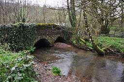 Batherm Bridge near Petton | |
| Country | England |
|---|---|
| Counties | Devon, Somerset |
| Source | Sperry Barton |
| Mouth | River Exe |
| - coordinates | 50°58′33.75″N 3°29′13.9″W / 50.9760417°N 3.487194°WCoordinates: 50°58′33.75″N 3°29′13.9″W / 50.9760417°N 3.487194°W |
 Catchment map of the River Batherm | |
The River Batherm is a river which flows through Somerset and Devon in England. The river rises on high ground near the village of Sperry Barton, between Wimbleball and Clatworthy reservoirs. It flows south through the villages of Blackwell, Petton, and Shillingford before it joins the River Exe just over a mile downstream from Bampton.[1]
References
- ↑ "Water Framework Directive - River Basin Management Plans". What's in your Backyard. Environment Agency. Retrieved 20 November 2015.
This article is issued from Wikipedia - version of the 10/2/2016. The text is available under the Creative Commons Attribution/Share Alike but additional terms may apply for the media files.