Rio Grande City, Texas
| Rio Grande City, Texas | |||||
|---|---|---|---|---|---|
| City | |||||
| City of Rio Grande City | |||||
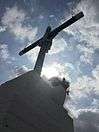
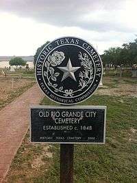
Santa Cruz at Rio Grande City, Texas, Plaque describing the history of Rio Grande City, Texas, Plaque of the Old Rio Grande City Cemetery | |||||
| |||||
| Nickname(s): "RGC" | |||||
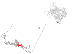
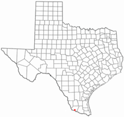 Location of Rio Grande City in the U.S. state of Texas | |||||
 | |||||
| Coordinates: 26°22′50″N 98°49′6″W / 26.38056°N 98.81833°WCoordinates: 26°22′50″N 98°49′6″W / 26.38056°N 98.81833°W | |||||
| Country | United States | ||||
| State | Texas | ||||
| County | Starr | ||||
| Government | |||||
| • Mayor | Joel Villarreal | ||||
| • Police chief | Noe Castillo | ||||
| Area | |||||
| • Total | 7.6 sq mi (19.6 km2) | ||||
| • Land | 7.6 sq mi (19.6 km2) | ||||
| • Water | 0.0 sq mi (0.0 km2) | ||||
| Elevation | 174 ft (53 m) | ||||
| Population (2010) | |||||
| • Total | 13,834 | ||||
| • Density | 1,571.6/sq mi (606.8/km2) | ||||
| Time zone | Central (CST) (UTC-6) | ||||
| • Summer (DST) | CDT (UTC-5) | ||||
| ZIP code | 78582 | ||||
| Area code(s) | 956 | ||||
| FIPS code | 48-62168[1] | ||||
| GNIS feature ID | 1388199[2] | ||||
| Website | http://www.cityofrgc.com/ | ||||


Rio Grande City is a city in and the county seat of Starr County, Texas.[3] The population was 13,834 at the 2010 census. The city is 41 miles west of McAllen. The city also holds the March record high for the United States at 108 degrees Fahrenheit. The city is connected to Camargo, Tamaulipas, via the Rio Grande City-Camargo International Bridge.
History
The area around Rio Grande City was first populated in 1846, when it served as a transfer point for supplies and soldiers supporting General Zachary Taylor’s invasion of Mexico. It was a logical point for trade, as it was the highest point up the Rio Grande (known as the Rio Bravo in Mexico) for reliable steamboat traffic, and intersected a number of overland routes to Saltillo, Monterrey, and Northern Mexico.
During the early stages of the Mexican-American War, one of the soldiers stationed here, Henry Clay Davis, married Hilaria de la Garza Falcon, a resident of Camargo and heiress to the land on which Rio Grande City now sits. At the end of the war, Davis set out to organize this area into a formal city, breaking up the land into plots. At first, the area was referred to as “Rancho Davis” then the name was changed to “Rio Grande City” to encourage investors and settlers. From its founding, in 1848, until the Texas Mexican Railroad opened up in 1883, Rio Grande City was one of the most significant hubs of trade between Texas and Mexico, and was one of the major contemporary contributors to the American romanticized concept of the "wild West".
Famous early residents include: Joshua H. Bean, brother of Judge Roy Bean, and the first mayor of San Diego, CA; Orlando C. Phelps, one of the few surviving members of the Mier Expedition; Edwin R. Rainwater, hero of the Texas Revolution; Edward R. Hord, an influential early South Texas statesman; and John L. Haynes, a native Virginian politician and writer who was an outspoken anti-secessionist and strong proponent of Mexican-American rights.
Many buildings in the Rio Grande City historic district are notable and have historical value. Perhaps the most notable structure is La Borde House, an early 20th-century, two-story brick building that now doubles as a hotel and a restaurant (Che's). Lyndon Baines Johnson's wife, Lady Bird Johnson, once stayed at La Borde House on a visit to see the area's Spring wildflowers.
In the 1970s and into the 1980s, federal law enforcement officials concentrated their anti-drug smuggling efforts on Starr County.[4]
In spite of Rio Grande City's rich architectural heritage, many buildings in the old downtown district are abandoned, dilapidated, or crumbling. While there are a good number of small shops and businesses operating in the district, most new development and commerce takes place in new shopping centers outside of the old downtown neighborhood.
Rio Grande City has seen rapid growth in the past years. In August 2006, an HEB Plus (the regional supermarket chain of south Texas) was opened just east of the historic downtown and Fort Ringgold.
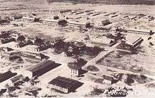
Fort Ringgold
Ringgold Barracks were established at Davis Landing on 26 October 1848 by the 1st US Infantry under the command of Captain J.H. La Motte, in honor of Major Ringgold who was mortally wounded at the Battle of Palo Alto.[5] Troops were withdrawn on 3 March 1859 but reoccupied again on 29 December 1859 during the Cortina War.[5] Abandoned again at the start of the Civil War in 1861, but reoccupied again by US forces in 1865.[5] The fort was active until 1944 when the property was sold to the Rio Grande City public schools system[6]:vii Units stationed here included the 1st Infantry (Mounted Dragoons), 7th and 28th Infantry Regiments, 3rd Texas Volunteers, the 9th, 10th and 12th Cavalry Regiments, the 9th and 10th being composed of Buffalo Soldiers.[6]:13 Besides the parade ground, several post buildings survive as school facilities. These include the sentry and guard houses, barracks, officers quarters, the bakery, hospital and post headquarters,[6] situated along Ringgold Avenue, Lee Circle, 12th Cavalry and F Troop streets.
Geography
Rio Grande City is located at 26°22′50″N 98°49′6″W / 26.38056°N 98.81833°W (26.380667, -98.818364).[7]
According to the United States Census Bureau, the city has a total area of 7.6 square miles (19.7 km²), all land.
Education
Rio Grande City is served by the Rio Grande City Consolidated Independent School District. Immaculate Conception School, founded in 1884 and the only Catholic school in Starr County, provides a faith-based pre-K through eighth-grade education to approximately 250 students each year.
Radio stations
- XAVO 101.5FM
- KFRQ 94.5FM
- KKPS 99.5FM
- KNVO 101.1FM
- KVLY 107.9FM
- WILD 104.1FM
Notable people
- Ricardo Sanchez, lieutenant general and commander of U.S. forces in Iraq, retired from the United States Army, born in Rio Grande City in 1953
Demographics
| Historical population | |||
|---|---|---|---|
| Census | Pop. | %± | |
| 2000 | 11,923 | — | |
| 2010 | 13,834 | 16.0% | |
| Est. 2015 | 14,404 | [8] | 4.1% |
As of the 2010 Census Rio Grande City had a population of 13,834. The median age was 30. The racial makeup of the population was 92.1% white (4.7% claiming to not be Hispanic or Latino), 0.2% Black, 0.3% Native American, 0.8% Asian, 5.5% from some other race and 1.1% from two or more races. 94.3% of the population was Hispanic or Latino of any race with 88.2% of the population describing themselves as ethnically Mexican.[10]
As of the census[1] of 2000, there were 11,923 people, 3,333 households, and 2,796 families residing in the city. The population density was 1,571.6 people per square mile (606.5/km²). There were 3,846 housing units at an average density of 506.9 per square mile (195.6/km²). The racial makeup of the city was 82.97% White, 0.30% African American, 0.44% Native American, 1.11% Asian, 0.01% Pacific Islander, 12.51% from other races, and 2.67% from two or more races. Hispanic or Latino of any race were 95.89% of the population.
There were 3,333 households out of which 47.0% had children under the age of 18 living with them, 60.1% were married couples living together, 19.8% had a female householder with no husband present, and 16.1% were non-families. 14.6% of all households were made up of individuals and 7.5% had someone living alone who was 65 years of age or older. The average household size was 3.47 and the average family size was 3.86.
In the city the population was spread out with 33.1% under the age of 18, 11.4% from 18 to 24, 27.4% from 25 to 44, 17.0% from 45 to 64, and 11.2% who were 65 years of age or older. The median age was 29 years. For every 100 females there were 93.4 males. For every 100 females age 18 and over, there were 88.5 males.
The median income for a household in the city was $19,853, and the median income for a family was $21,363. Males had a median income of $20,245 versus $14,984 for females. The per capita income for the city was $9,684. About 40.4% of families and 44.1% of the population were below the poverty line, including 57.3% of those under age 18 and 33.7% of those age 65 or over.
References
- 1 2 "American FactFinder". United States Census Bureau. Retrieved 2008-01-31.
- ↑ "US Board on Geographic Names". United States Geological Survey. 2007-10-25. Retrieved 2008-01-31.
- ↑ "Find a County". National Association of Counties. Retrieved 2011-06-07.
- ↑ Miller, Tom. On the Border: Portraits of America’s Southwestern Frontier, pp. 27-34.
- 1 2 3 Texas Historical Marker #5061002012
- 1 2 3 Simmons, T.E., 1991, Fort Ringgold: A Brief Tour, Edinburg: The University of Texas-Pan American Press, ISBN 0938738097
- ↑ "US Gazetteer files: 2010, 2000, and 1990". United States Census Bureau. 2011-02-12. Retrieved 2011-04-23.
- ↑ "Annual Estimates of the Resident Population for Incorporated Places: April 1, 2010 to July 1, 2015". Retrieved July 2, 2016.
- ↑ "Census of Population and Housing". Census.gov. Retrieved June 4, 2015.
- ↑ 2010 general profile of population and housing characteristics of Rio Grande City from the United States census
External links
 Media related to Rio Grande City, Texas at Wikimedia Commons
- Rio Grande Discussion
- City of Rio Grande
- Rio Grande City News Blog
- Rio Grande Herald newspaper hosted by the Portal to Texas History.
Municipalities and communities of Starr County, Texas, United States | ||
|---|---|---|
| Cities | 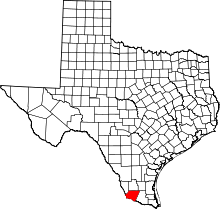 | |
| CDPs |
| |
| Other unincorporated communities | ||
