Rikuchu Kaigan National Park
| Rikuchu Kaigan National Park | |
|---|---|
| 陸中海岸国立公園 | |
|
IUCN category II (national park) | |
|
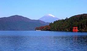
northern coastline of Rikuchu Kaigan NP | |
| Location | Honshū, Japan |
| Coordinates | 39°04′19″N 141°43′01″E / 39.07194°N 141.71694°ECoordinates: 39°04′19″N 141°43′01″E / 39.07194°N 141.71694°E |
| Area | 121.98 km2 |
| Established | May 2, 1955 |
| Governing body | Ministry of the Environment (Japan) |

Rikuchū Kaigan National Park (陸中海岸国立公園 Rikuchū Kaigan Kokuritsu Kōen) is a national park in the Tohoku region of Honshū in northern Japan. The park extends for 180 kilometers from north to south along the coastline of the Pacific Ocean from northern Miyagi prefecture to northern Iwate prefecture. The park was created on May 2, 1955, and covers a land area of 121.98 square kilometres (47.10 sq mi).
The entire coastline is noted for examples of sea erosion, with numerous rock pillars and islands. The northern coast is an example of an uplifted coastline, and is an area which has been subject to several strong earthquakes and tsunami in recent history. The southern coast is an example of a ria coastline of submerged river valleys, with deep inlets and narrow peninsulas, forming many small bays and coves.
Flora includes groves of Japanese red pine, rhododendrons and Rosa rugosa. Fauna includes numerous bird species, including the black-tailed gull and shearwater. In terms of larger animals, there have also been sightings of the kamoshika.
In 2013 the park was incorporated into Sanriku Fukkō National Park.[1][2]
See also
| Wikimedia Commons has media related to Sanriku-Fukko National Park. |
References
- ↑ 基礎情報 [Basic Information] (in Japanese). Ministry of the Environment. Retrieved 22 October 2013.
- ↑ "National park of restoration". The Japan Times. 28 May 2013. Retrieved 22 October 2013.