Ridgway, Pennsylvania
| Ridgway, Pennsylvania | |
|---|---|
| Borough | |
|
Ridgway from Elk County Country Club, April 2010 | |
 Location in Elk County and the state of Pennsylvania. | |
| Coordinates: 41°25′29″N 78°43′47″W / 41.42472°N 78.72972°WCoordinates: 41°25′29″N 78°43′47″W / 41.42472°N 78.72972°W | |
| Country | United States |
| State | Pennsylvania |
| County | Elk |
| Settled | 1824 |
| Incorporated | 1881 |
| Government | |
| • Type | Borough Council |
| • Mayor | Guillermo Udarbe |
| Area | |
| • Total | 2.67 sq mi (6.91 km2) |
| • Land | 2.61 sq mi (6.77 km2) |
| • Water | 0.05 sq mi (0.14 km2) |
| Elevation | 1,381 ft (421 m) |
| Population (2010) | |
| • Total | 4,078 |
| • Density | 1,561/sq mi (602.6/km2) |
| Time zone | Eastern (EST) (UTC-5) |
| • Summer (DST) | EDT (UTC-4) |
| ZIP code | 15853 |
| Area code(s) | 814 |
| Website |
www |

Ridgway is a borough in and the county seat of Elk County, Pennsylvania, United States.[1] As of the 2010 census it had a population of 4,078.[2]
History

Ridgway was founded by Philadelphian shipping merchant Jacob Ridgway and James Gillis. Jacob Ridgway earned substantial wealth both in Philadelphia and abroad in London. He constantly sent sums of money back to be invested in property. In the early 19th century as part of a larger land purchase, Ridgway acquired 40,000 acres (160 km2) that became Elk County. One of Jacob Ridgway's nephews, James Gillis, convinced Ridgway that the area could become a very lucrative spot for a lumber camp due to the proximity of Elk Creek and the Clarion River, a tributary of the Allegheny River. Coal and natural gas abound in the district. In the past, the industrial interests were manufacturing leather, iron, clay, and lumber products, silk goods, railroad snow plows, dynamos, and machine tools. In 1900, the people living here numbered 3,515; in 1910, 5,408; in 1940, 6,253, and in 2010, 4,078.
Many historic structures are located within the boundaries of the Ridgway Historic District, added to the National Register of Historic Places in 2003. The O.B. Grant House and Ridgway Armory are also listed on the National Register of Historic Places.[3]
The lumber industry continued to flourish in Ridgway, to the degree that around the start of the 20th century, the town claimed it had more millionaires per capita than any other town in the U.S.[4]
Geography
Ridgway is located in central Elk County at 41°25′29″N 78°43′47″W / 41.42472°N 78.72972°W (41.424739, -78.729733).[5] It is surrounded by Ridgway Township.
The borough is in the valley of the Clarion River, where it is joined from the east by Elk Creek. U.S. Route 219 passes through the borough center, leading north 44 miles (71 km) to Bradford and south 28 miles (45 km) to DuBois.
According to the United States Census Bureau, the borough has a total area of 2.67 square miles (6.91 km2), of which 2.61 square miles (6.77 km2) is land and 0.054 square miles (0.14 km2), or 2.07%, is water.[2]
Demographics
| Historical population | |||
|---|---|---|---|
| Census | Pop. | %± | |
| 1880 | 1,100 | — | |
| 1890 | 1,903 | 73.0% | |
| 1900 | 3,515 | 84.7% | |
| 1910 | 5,408 | 53.9% | |
| 1920 | 6,037 | 11.6% | |
| 1930 | 6,313 | 4.6% | |
| 1940 | 6,253 | −1.0% | |
| 1950 | 6,244 | −0.1% | |
| 1960 | 6,387 | 2.3% | |
| 1970 | 6,022 | −5.7% | |
| 1980 | 5,604 | −6.9% | |
| 1990 | 4,793 | −14.5% | |
| 2000 | 4,591 | −4.2% | |
| 2010 | 4,078 | −11.2% | |
| Est. 2015 | 3,896 | [6] | −4.5% |
| Sources:[7][8][9] | |||
2010
As of the census[10] of 2010, there were 4,078 people, 1,783 households, and 1,073 families residing in the borough. The population density was 1,568.5 people per square mile (612.7/km²). There were 2,068 housing units at an average density of 795.4 per square mile (310.7/km²). The racial makeup of the borough was 97.7% White, 0.6% African American, 0.1% Native American, 0.6% Asian, 0.1% from other races, and 0.9% from two or more races. Hispanic or Latino of any race were 0.6% of the population.
There were 1,783 households, out of which 26.1% had children under the age of 18 living with them, 45.3% were married couples living together, 9.8% had a female householder with no husband present, and 39.8% were non-families. 35.3% of all households were made up of individuals, and 15.1% had someone living alone who was 65 years of age or older. The average household size was 2.25 and the average family size was 2.91.
In the borough the population was spread out, with 22.8% under the age of 18, 59.9% from 18 to 64, and 17.3% who were 65 years of age or older. The median age was 43 years.
The median income for a household in the borough was $37,917, and the median income for a family was $47,969. Males had a median income of $34,629 versus $28,750 for females. The per capita income for the borough was $22,415. About 17.5% of families and 18.1% of the population were below the poverty line, including 39.3% of those under age 18 and 7.2% of those age 65 or over.
2000
As of the census[8] of 2000, there were 4,591 people, 1,927 households, and 1,233 families residing in the borough. The population density was 1,722.7 people per square mile (663.9/km²). There were 2,089 housing units at an average density of 783.8 per square mile (302.1/km²). The racial makeup of the borough was 98.54% White, 0.17% African American, 0.04% Native American, 0.70% Asian, 0.17% from other races, and 0.37% from two or more races. Hispanic or Latino of any race were 0.52% of the population.
There were 1,927 households, out of which 28.4% had children under the age of 18 living with them, 50.1% were married couples living together, 9.7% had a female householder with no husband present, and 36.0% were non-families. 31.7% of all households were made up of individuals, and 16.8% had someone living alone who was 65 years of age or older. The average household size was 2.33 and the average family size was 2.94.
In the borough the population was spread out, with 22.9% under the age of 18, 8.2% from 18 to 24, 27.8% from 25 to 44, 22.8% from 45 to 64, and 18.3% who were 65 years of age or older. The median age was 40 years. For every 100 females there were 91.2 males. For every 100 females age 18 and over, there were 89.3 males.
The median income for a household in the borough was $33,141, and the median income for a family was $45,224. Males had a median income of $31,855 versus $21,296 for females. The per capita income for the borough was $17,157. About 4.9% of families and 6.1% of the population were below the poverty line, including 8.9% of those under age 18 and 2.3% of those age 65 or over.
Art and culture
Ridgway is home to the Ridgway Chainsaw Carving Rendezvous, the largest chainsaw carving gathering of its kind. In the summer months the Ridgway Volunteer Fire Department host their week-long celebration on their lot off North Broad Street. The Ridgway Heritage Council hosts the Tasting in the Wilds Festival, which is full of art, music, local wine tastings, and hand crafted brews.
Things to do
There are many activities available in Ridgway. As the gateway to the Allegheny National Forest, which provides ATV trails, horseback riding, camping, fishing, and hiking, there are plenty of recreational opportunities for day trips, overnight camping, and touring the area. There are several unique shops, including clothing, gifts, art gallery, sporting goods, food, housewares, hardware, and anything a small town would feature. Ridgway has several bed and breakfasts, the Summit Fireside Lodge and Grill, and the oldest hotel in Elk County, the Royal Inn. The Wild and Scenic Clarion River hosts great trophy trout fishing, an afternoon float, or overnight camping along its banks. The Little Toby-Clarion River Rail Trail trek runs 18 miles (29 km) to Brockway. The trail is great for walking, running, and biking. A stroll within Ridgway's neighborhoods along Main Street will identify the rich history of the Hyde Murphy Company through the Victorian era.
Education
Ridgway houses two school systems in the borough and township. The Ridgway Area School District and St. Leo's Catholic School make up Ridgway's school systems.
Ridgway Area School District
Ridgway Area School District (RASD), has two buildings used to educate. There is an elementary and a middle/high school building.
The Francis S. Grandinetti Elementary School is located on Boot Jack Hill in Ridgway Township. IU9 preschool, kindergarten, 1st grade, 2nd grade, 3rd grade, 4th grade, and 5th grade are the grade levels available for students.
The Ridgway Area Middle/High School is located at 1403 Hill Street in Ridgway. Although one building, the middle school and high school students are separated by two floors. Students at the middle school level, grades six through eight, are on the bottom floor, while students at the high school level, grades nine to twelve, are on the upper floor.
The athletic team is known as the Elkers, in reference to Ridgway being the county seat for Elk County.
St. Leo's Catholic School
St. Leo's Catholic School has two buildings, a building for kindergarten students, and a main building, for children in grades 1-8. The kindergarten building is located just to the right of the main building. The preschool building is located to the left of the main building. The main building at St. Leo's educates children from grades 1-8. After completing 8th grade, students have the choice to transfer to public school (see above) or to transfer to Elk County Catholic High School, in St. Marys.
References
| Wikimedia Commons has media related to Ridgway, Pennsylvania. |
- ↑ "Find a County". National Association of Counties. Archived from the original on May 31, 2011. Retrieved 2011-06-07.
- 1 2 "Geographic Identifiers: 2010 Demographic Profile Data (G001): Ridgway borough, Pennsylvania". American Factfinder. U.S. Census Bureau. Retrieved March 10, 2016.
- ↑ National Park Service (2009-03-13). "National Register Information System". National Register of Historic Places. National Park Service.
- ↑ http://www.forbes.com/forbes/2000/1009/6610068a.html
- ↑ "US Gazetteer files: 2010, 2000, and 1990". United States Census Bureau. 2011-02-12. Retrieved 2011-04-23.
- ↑ "Annual Estimates of the Resident Population for Incorporated Places: April 1, 2010 to July 1, 2015". Retrieved July 2, 2016.
- ↑ "Census of Population and Housing". U.S. Census Bureau. Archived from the original on May 11, 2015. Retrieved 11 December 2013.
- 1 2 "American FactFinder". United States Census Bureau. Archived from the original on September 11, 2013. Retrieved 2008-01-31.
- ↑ "Incorporated Places and Minor Civil Divisions Datasets: Subcounty Resident Population Estimates: April 1, 2010 to July 1, 2012". Population Estimates. U.S. Census Bureau. Archived from the original on June 17, 2013. Retrieved 11 December 2013.
- ↑ "American FactFinder". United States Census Bureau. Archived from the original on September 11, 2013. Retrieved 2011-05-14.
External links
Municipalities and communities of Elk County, Pennsylvania, United States | ||
|---|---|---|
| City | 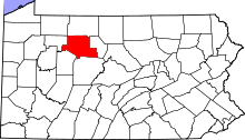 | |
| Boroughs | ||
| Townships | ||
| CDPs | ||
| Unincorporated communities | ||