Rhaetian Alps
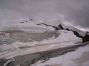
The Rhaetian Alps (Italian: Alpi Retiche; German: Rätischen Alpen) are a mountain range of the Eastern Alps. The SOIUSA classification system divides them into the Western and Eastern Rhaetian Alps, while the Alpine Club classification of the Eastern Alps places most of the Rhaetion subranges within the Western Limestone Alps.
They are located along the Italian–Swiss and Austrian–Swiss borders, in the canton of Graubünden in eastern Switzerland; in the state of Tyrol in Austria; and in the Italian regions of Trentino-Alto Adige and Lombardy.
The name relates to a Roman province and the Rhaetian people subdued under Emperor Augustus in 15 BCE.
Geography
The Rhaetian Alps contain the subranges of:
The highest peak in the range is Piz Bernina at 4,049 metres (13,284 ft), located in Grisons/Graubünden canton, Switzerland, adjacent to the Italian border.
The Swiss National Park is located in the Western Rhaetian Alps.
See also
References
Coordinates: 46°48′N 10°00′E / 46.800°N 10.000°E