Reinsfjellet
| Reinsfjellet | |
|---|---|
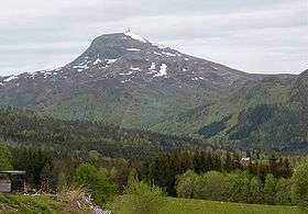 View from Heggem in Osmarka | |
| Highest point | |
| Elevation | 994 m (3,261 ft) |
| Prominence | 823 m (2,700 ft) [1] |
| Coordinates | 62°55′47″N 07°55′35″E / 62.92972°N 7.92639°ECoordinates: 62°55′47″N 07°55′35″E / 62.92972°N 7.92639°E |
| Geography | |
 Reinsfjellet Location in Møre og Romsdal | |
| Location | Gjemnes Municipality, Møre og Romsdal, Norway |
| Climbing | |
| Easiest route | Mountain road to the top |
Reinsfjellet is a mountain in Gjemnes Municipality in Møre og Romsdal county, Norway. The 994-metre (3,261 ft) tall mountain is the third tallest mountain in the municipality. It is located on the Romsdal peninsula about 4 kilometres (2.5 mi) southeast of the village of Torvikbukt and the Batnfjorden. The village of Heggem lies 6.5 kilometres (4.0 mi) to the southwest and Angvika lies 10 kilometres (6.2 mi) to the southeast.[2]
There is a road that goes all the way to the top, where there is a communications tower for radio and television.
References
- ↑ "Reinsfjellet". WestCoastPeaks.com. Retrieved 2010-11-27.
- ↑ Store norske leksikon. "Gjemnes" (in Norwegian). Retrieved 2013-04-28.
This article is issued from Wikipedia - version of the 10/15/2015. The text is available under the Creative Commons Attribution/Share Alike but additional terms may apply for the media files.